Os cookies.
Este site utiliza cookies para lhe proporcionar uma melhor experiência de utilização.
OK, ACEITO
Sobre
Itens da coleção
Refinar a pesquisa
Coleções digitais
Biblioteca Geral
140
Mapas Nabais Conde
121
História da Ciência
21
OG
21
Tipo
Cartografia
Autor
Bode, Johann Elert
20
Walker, J. & C.
19
Vidal, Alexander Thomas Emeric
14
Bedford, George Augustus
8
Justus Perthes (Firma)
5
Ver mais
Data
1841
1836-1840
1810
1801
1800
Ver mais
Local de publicação
Londres
36
Paris
24
[Berlim
18
Lisboa
14
Gota
8
Ver mais
Assunto
Mapa
46
Portugal
42
Constelações
20
Mapas
20
Carta náutica
18
Ver mais
Idioma
Inglês
43
Português
35
Latim
22
Francês
21
Alemão
18
Ver mais
PT
EN
PT
EN
Biblioteca de Fundo Antigo da UC
Almamater
Em destaque
Todos os itens
Sobre
Nesta coleção
Pesquisa avançada
Refinar a pesquisa
Limpar
Coleções digitais
Biblioteca Geral
140
Mapas Nabais Conde
121
História da Ciência
21
OG
21
Tipo
Cartografia
Autor
Bode, Johann Elert
20
Walker, J. & C.
19
Vidal, Alexander Thomas Emeric
14
Bedford, George Augustus
8
Justus Perthes (Firma)
5
Ver mais
Data
1841
1836-1840
1810
1801
1800
Ver mais
Local de publicação
Londres
36
Paris
24
[Berlim
18
Lisboa
14
Gota
8
Ver mais
Assunto
Mapa
46
Portugal
42
Constelações
20
Mapas
20
Carta náutica
18
Ver mais
Idioma
Inglês
43
Português
35
Latim
22
Francês
21
Alemão
18
Ver mais
Itens
142
Ver como
Grelha
Lista
Galeria
Ordenar por
Título (descendente)
Título
Data (de publicação)
Data (descendente)
Páginas
1
2
Limite por página
50
100
250
Cartografia
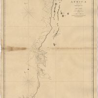
West Coast of Africa : Sheet XVIII : Fernando Po to Cape Lopez
Owen, William Fitzwilliam; Bedford, George Augustus; Vidal, Alexander Thomas Emeric
Cartografia
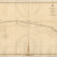
West Coast of Africa : Sheet XVII : Cape Formosa to Fernando Po
Owen, William Fitzwilliam; Bedford, George Augustus; Vidal, Alexander Thomas Emeric; Allen, William
Cartografia
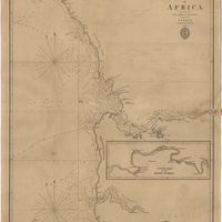
West Coast of Africa : Sheet XIV : Barracoe to Cape St. Paul
Vidal, Alexander Thomas Emeric; Bedford, George Augustus
Cartografia
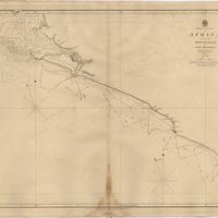
West Coast of Africa : Sheet XIII : Cape Three Points to Barracoe
Vidal, Alexander Thomas Emeric; Bedford, George Augustus
Cartografia
West Coast of Africa : Sheet XII : Grand Lahou to Cape Three Points
Vidal, Alexander Thomas Emeric; Bedford, George Augustus
Cartografia
West Coast of Africa : Sheet XI : Cape Palmas to Grand Lahou
Vidal, Alexander Thomas Emeric; Bedford, George Augustus
Cartografia
West Coast of Africa : Sheet X : Cape Mesurada to Cape Palmas
Bedford, George Augustus; Vidal, Alexander Thomas Emeric
Cartografia
West Coast of Africa : Sheet VII : from Cape Roxo to Isles de Los
Belcher, Edward; Owen, William Fitzwilliam; Arlett, William
Cartografia
West Coast of Africa : Sheet VI : Cape Verde to Cape Roxo including the Gambia
Boteler, T.
Cartografia
West Coast of Africa : Sheet V : Cape Blanco to Cape Verde
Roussin, Albion René, Baron de
Cartografia
West Coast of Africa : Sheet IX : Sherboro Island to Cape Mesurada
Bedford, George Augustus; Vidal, Alexander Thomas Emeric
Cartografia
West Coast of Africa : Sheet IV : Cape Bojador to Cape Blanco
Vidal, Alexander Thomas Emeric; Roussin, Albion René, Baron de
Cartografia
West Coast of Africa : Sheet III : Sta. Cruz to Cape Bojador
Arlett, William
Cartografia
West Coast of Africa : Sheet II : Azamor to Sta. Cruz
Arlett, William
Cartografia
West Coast of Africa : Sheet I : Cape Spartel to Mazighan
Arlett, William
Cartografia
Welt-Karte zur Übersicht der Meeres-Strömungen und des Schnellverkehrs
Berghaus, Hermann
Cartografia
Welt-Karte zur Übersicht der Luft-Strömungen und Niederschläge
Berghaus, Hermann
Cartografia
A topographical chart of the entrance of the river Tagus, describing the coast from Cape Roca to Sacavem ; with the harbour and environs of Lisbon. The nautical part is from a survey taken in 1806 by W. Chapman, Master of the Royal Navy; and approved by the Chart Committee of the Admiralty. The interior and line of the coast are drawn from survays made by officers of the Quarter Master General's Department
Chapman, William
Cartografia
Theatro da guerra em Portugal.
Cartografia
Stockholm ; Lissabon
Meyer, Joseph; Meyer, Joseph
Cartografia
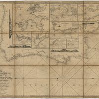
Steel's new and correct chart of the coasts of Spain and Portugal : including plans at the principal harbours on an enlarged scale
Steel & Co.
Cartografia
[Spanien und Portugal in IV Blattern]
Stieler, Adolf
Cartografia
Spanien und Portugal in 4 Blättern
Vogel, Carl
Cartografia
Spanien und Portugal in 4 Blättern
Vogel, Carl
Cartografia
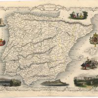
Spain and Portugal
Cartografia
Spain and Portugal
Cartografia
Spain & Portugal
Harvey, William, 1796-1866
Cartografia
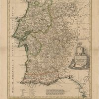
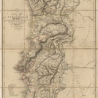
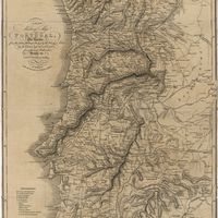
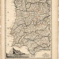
Regni Portugalliae Provincias tres septentrionales Beiram, Trasmontanam & Interamniam
Guessefeld, Franz Ludwig; López de Vargas Machuca, Tomás
Cartografia
Quadros que mostram o estado da barra e porto da Figueira desde 1801 até 1860
Silva, Francisco Maria Pereira da
Cartografia
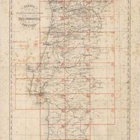
Quadro de juncção das folhas que formam a Carta Chorographica de Portugal
Portugal. Direcção Geral dos Trabalhos Geodésicos do Reino
Cartografia
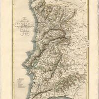
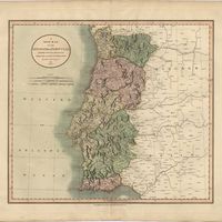
Provincias meridionales Regni Portugalliae, scilicet Extremadura, Transtagana, quibus Regnum Algarbiae adiungitur
Guessefeld, Franz Ludwig; López de Vargas Machuca, Tomás
Cartografia
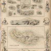
Portuguese Islands in the Atlantic Ocean
Cartografia
Portugal.
Cartografia
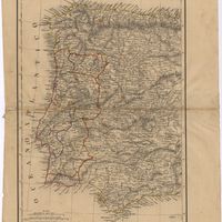
Portugal vor der Neuen Landesaufnahme ; Portugal nach der Neuen Landesaufnahme
Justus Perthes (Firma)
Cartografia
Portugal und die Azoren : 1849
Bibliographisches Institut
Cartografia
Portugal orographico com curvas de nível.
Cartografia
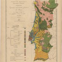
Portugal geologico
Botella y de Hornos, Federico de
Cartografia
Portugal : Nº 4
Cartografia
Portugal : 1132-1789
May, Alfredo Oscar de Azevedo
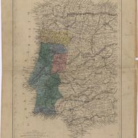
Cartografia
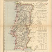
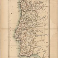
Portugal
Cartografia
Portugal
Society for the Diffusion of Useful Knowledge
Cartografia
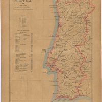
Portugal
Cartografia
Portugal
Baynes, Thomas S.; Smith, William Robertson
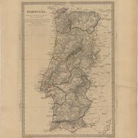
Cartografia
Portugal
Cartografia
Porto : Rio Douro : plano indicando as obras propostas por Sir John Coode entre Forada e S. João da Foz e descriptas no seu relatorio datado de Julho de 1881
Cartografia
Port du Lagos
Roux, Joseph
Cartografia
Planta Geral do Rio Mondego entre a Figueira e a Foz do Dão.
Cartografia
Planta da cidade de Lisboa : com a indicação das zonas e dos reservatórios para a distribuição das aguas
Cartografia
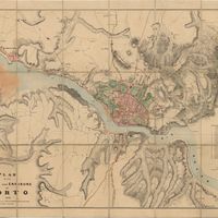
Plan of the town and environs of Porto
Cartografia
Plan du siége d'Almeida par l'Armée Française en 1810
Cartografia
Plan du champ de bataille de Fuentes de Ognoro
Cartografia
Plan du champ de bataille de Busaco
Cartografia
Plan de Lisbonne : son port, ses rades et ses environs avec une petite carte routière du Portugal
Calmet-Beauvoisin, Marie-Antoine
Cartografia
Plan de Lisbonne
Cartografia
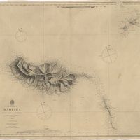
Physical Map of the Island of Madeira
Ziegler, Jakob Melchior
Cartografia
Partie de L'Espagne et Portugal.
Cartografia
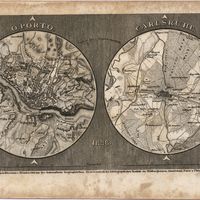
Oporto ; Carlsruhe
Meyer, Joseph
Cartografia
Océan Atlantique : Iles Éparses : Madère, Porto Santo et Desertas ; Baie de Funchal
Vidal, Alexander Thomas Emeric
Cartografia
Océan Atlantique : Iles Éparses : Fayal, Pico et San Jorge (iles Açores)
Vidal, Alexander Thomas Emeric
Cartografia
Obras publicas para melhoramento da Barra e Porto da Figueira : desde o seu principio em Maio de 1857 até ao fim do anno economico de 1859-1860 : atlas
Silva, Francisco Maria Pereira da
Cartografia
Novo atlas universal de historia e geographia antiga, medieval e moderna
May, Alfredo Oscar de Azevedo
Cartografia
Novo atlas das provincias portuguezas : d'alem-mar, na Europa, Africa, Asia e Australasia : conforme as melhores cartas geographicas nacionaes e estrangeiras
Amado, José de Sousa
Cartografia
A new military map of Portugal : the roads from the Carta militar published by the french in Lisbon, the rivers and montains, from the best authorities
Elliott, Wm, Capt.
Cartografia
A new military map of Portugal : the roads from the Carta Militar published by the french in Lisbon : the rivers and mountains from the last Authorities
Elliott, Wm, Capt.
Cartografia
A new military map of Portugal : the roads from the Carta Militar published by the french in Lisbon : the rivers and mountains from the last Authorities
Elliott, Wm, Capt.
Cartografia
A new map of the Kingdom of Portugal divided into its provinces
Cartografia
A new map of Spain and Portugal : exhibiting the chains of mountains with their passes, the principal & cross roads, with other details requisite for the intelligence of Military Operations
Nantiat, Jasper
Cartografia
A new map of Spain and Portugal : exhibiting the chains of mountains with their passes, the principal & cross roads, with other details requisite for the intelligence of Military Operations
Nantiat, Jasper
Cartografia
Neueste Karte von Portugal : nach den neuesten Quellen entw. u. gez.
Radefeld, Carl Christian Franz
Cartografia
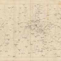
A Military sketch of the country between Lisbon and Vimiero occupied by the British Army under the command of Lieutenant General Viscount Wellington
Cartografia
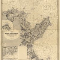
Mediterranean : Tunis : Fratelli Rocks to Mahedia
Richards, G. H.; Boyle, A. J.
Cartografia
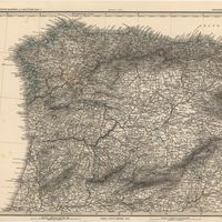
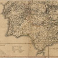
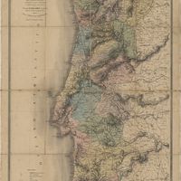
Mappa physico e politico do Reino de Portugal : indicando as novas divisões territoriais por Provincias e Districtos, as estradas de grande communicação, os caminhos de ferro e suas estações, &
Vuillemin, Alexandre Aimé
Cartografia
Mappa geographico da Ilha de S. Miguel
Cartografia
Mappa do Territorio das velhas e novas conquistas no Estado da Índia : 1860
Cartografia
Mappa das estradas e vias militares de Portugal : contendo todas as cidades, villas, e Povoações mais notaveis, marcando as leguas de distancia, e as horas que gasta o Correio de pé
C., F. B. de
Cartografia
[Mapa de Portugal]
H.C.
Cartografia
Mapa de España y Portugal
Cartografia
Mapa civil y militar de España y Portugal con la nueva division en distritos, enriquecido de los planes particulares de 34 ciudades y puertos principales : Dedicado a las Heróicas Naciones Española y Portuguesa por los Editores Dauty y Malo
Donnet, Alexis
Cartografia
Map of the wine district of the Alto-Douro
Forrester, Joseph James
Cartografia
Madrid
Society for the Diffusion of Useful Knowledge
Cartografia
Lissabon = Lisboa ; Neapel = Napoli
Cartografia
Lissabon
Brockhaus, Friedrich Arnold
Cartografia
Lisbon = Lisboa
Society for the Diffusion of Useful Knowledge
Cartografia
Land und Wasser auf de Erde in Globular Projection
Berghaus, Hermann
Cartografia
Das Königreich Portugal
Radefeld, Carl Christian Franz
Cartografia
Karte des theiles von Portugal zwischen dem Duero, Ocean uns Guadiana
Bühler, S
Cartografia
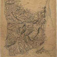
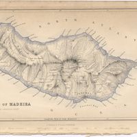
The islands of Madeira, Porto santo and Dezertas
Vidal, Alexander Thomas Emeric
Cartografia
Islands in the Atlantic Ocean : Azores or Western isles (portuguese) : Faeroe Isles : Madeira Isles.
Cartografia
Islands in the Atlantic
Cartografia
The Island of Madeira (Portuguese)
Cartografia
Island of Madeira
Cartografia
Höhen und Tiefen der Erde in Lambert's Zenithal Projection
Berghaus, Hermann
Cartografia
General Karte von Spanien und Portugal
Bühler, S
Cartografia
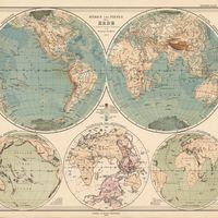
Europe
The Edinburgh Geographical Institute; John Bartholomew & Co.
Cartografia
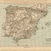
España y Portugal
Vuillemin, Alexandre Aimé
Cartografia
Espagne Occidentale et Portugal
Malte-Brun, Conrad; Lapie, Pierre M.
Cartografia
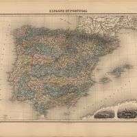
Espagne et Portugal
Cortambert, Eugène
Cartografia
Espagne et Portugal
Migeon, J.
Cartografia
L'Espagne et le Portugal
Hérisson, Eustache
Cartografia
Espagne & Portugal