Os cookies.
Este site utiliza cookies para lhe proporcionar uma melhor experiência de utilização.
OK, ACEITO
Sobre
Itens da coleção
Refinar a pesquisa
Coleções digitais
Biblioteca Geral
48
Mapas Nabais Conde
47
História da Ciência
1
OG
1
Tipo
Cartografia
Autor
Walker, J. & C.
12
Vidal, Alexander Thomas Emeric
11
Bedford, George Augustus
8
Chias y Carbó, Benito
3
Edgell, J. A.
3
Ver mais
Data
1935
Local de publicação
Londres
26
Barcelona
3
Leipzig
2
Nova Iorque
2
Paris
2
Ver mais
Assunto
Mapa
16
Oceano Atlântico
15
Carta náutica
14
Costa Ocidental
13
Portugal
13
Ver mais
Idioma
Inglês
31
Português
7
Alemão
4
Espanhol
3
Francês
2
Ver mais
PT
EN
PT
EN
Biblioteca de Fundo Antigo da UC
Almamater
Em destaque
Todos os itens
Sobre
Nesta coleção
Pesquisa avançada
Refinar a pesquisa
Limpar
Coleções digitais
Biblioteca Geral
48
Mapas Nabais Conde
47
História da Ciência
1
OG
1
Tipo
Cartografia
Autor
Walker, J. & C.
12
Vidal, Alexander Thomas Emeric
11
Bedford, George Augustus
8
Chias y Carbó, Benito
3
Edgell, J. A.
3
Ver mais
Data
1935
Local de publicação
Londres
26
Barcelona
3
Leipzig
2
Nova Iorque
2
Paris
2
Ver mais
Assunto
Mapa
16
Oceano Atlântico
15
Carta náutica
14
Costa Ocidental
13
Portugal
13
Ver mais
Idioma
Inglês
31
Português
7
Alemão
4
Espanhol
3
Francês
2
Ver mais
Itens
48
Ver como
Grelha
Lista
Galeria
Ordenar por
Título (descendente)
Título
Data (de publicação)
Data (descendente)
Limite por página
50
100
250
Cartografia
West coasts of Spain and Portugal : Cabo Villanno to Oporto : from the spanish and portuguese government charts to 1916 : with corrections and additions to 1921
Learmonth, Frederick C.
Cartografia
West coast of Spain and Portugal : Cape Finisterre to Cape St. Vincent : compiled from the latest information in the Hidrographic Office to 1881
Richards, George Henry
Cartografia
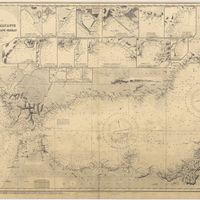
West Coast of Africa : Sheet XVIII : Fernando Po to Cape Lopez
Owen, William Fitzwilliam; Bedford, George Augustus; Vidal, Alexander Thomas Emeric
Cartografia
West Coast of Africa : Sheet XVII : Cape Formosa to Fernando Po
Owen, William Fitzwilliam; Bedford, George Augustus; Vidal, Alexander Thomas Emeric; Allen, William
Cartografia
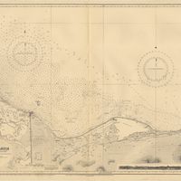
West Coast of Africa : Sheet XIV : Barracoe to Cape St. Paul
Vidal, Alexander Thomas Emeric; Bedford, George Augustus
Cartografia
West Coast of Africa : Sheet XIII : Cape Three Points to Barracoe
Vidal, Alexander Thomas Emeric; Bedford, George Augustus
Cartografia
West Coast of Africa : Sheet XII : Grand Lahou to Cape Three Points
Vidal, Alexander Thomas Emeric; Bedford, George Augustus
Cartografia
West Coast of Africa : Sheet XI : Cape Palmas to Grand Lahou
Vidal, Alexander Thomas Emeric; Bedford, George Augustus
Cartografia
West Coast of Africa : Sheet X : Cape Mesurada to Cape Palmas
Bedford, George Augustus; Vidal, Alexander Thomas Emeric
Cartografia
West Coast of Africa : Sheet V : Cape Blanco to Cape Verde
Roussin, Albion René, Baron de
Cartografia
West Coast of Africa : Sheet IX : Sherboro Island to Cape Mesurada
Bedford, George Augustus; Vidal, Alexander Thomas Emeric
Cartografia
West Coast of Africa : Sheet IV : Cape Bojador to Cape Blanco
Vidal, Alexander Thomas Emeric; Roussin, Albion René, Baron de
Cartografia
West Coast of Africa : Sheet III : Sta. Cruz to Cape Bojador
Arlett, William
Cartografia
West Coast of Africa : Sheet II : Azamor to Sta. Cruz
Arlett, William
Cartografia
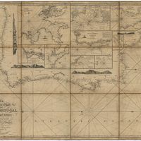
Steel's new and correct chart of the coasts of Spain and Portugal : including plans at the principal harbours on an enlarged scale
Steel & Co.
Cartografia
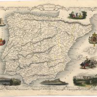
Spain and Portugal
Cartografia
Spain and Portugal
Cartografia
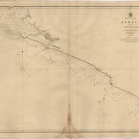
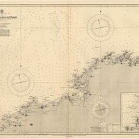
Spain : North Coast : Foz to Camariñas : from the spanish government charts of 1915 to 1920 : with additions and corrections to 1935
Edgell, J. A.
Cartografia
Spain & Portugal
Harvey, William, 1796-1866
Cartografia
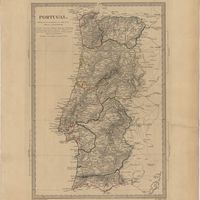
Portugal : 1132-1789
May, Alfredo Oscar de Azevedo
Cartografia
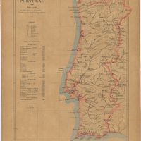
Portugal
Justus Perthes (Firma)
Cartografia
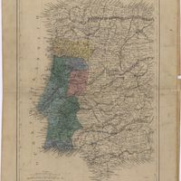
Portugal
Cartografia
Portugal
Society for the Diffusion of Useful Knowledge
Cartografia
Océan Atlantique : Iles Éparses : Madère, Porto Santo et Desertas ; Baie de Funchal
Vidal, Alexander Thomas Emeric
Cartografia
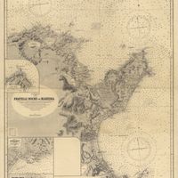
Océan Atlantique : Iles Éparses : Fayal, Pico et San Jorge (iles Açores)
Vidal, Alexander Thomas Emeric
Cartografia
Neueste Karte von Portugal : nach den neuesten Quellen entw. u. gez.
Radefeld, Carl Christian Franz
Cartografia
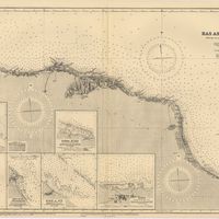
Mediterranean Sea : Libya : Ras Ashdir to Sirte : from the italian Gouvernment charts of 1931-32
Edgell, J. A.
Cartografia
Mediterranean Sea : Europe Gibraltar to Alicante : Africa Cape Spartel to Cape Ferrat : from spanish and french government charts to 1877
Evans, F. J.
Cartografia
Mediterranean Sea : Egypt : Damietta to El Arish
Douglas, H. P.
Cartografia
Mediterranean Sea : Egypt : Alexandria to Port Saïd
Reyne, F. A.; Hill, S. A. G.; Douglas, H. P.
Cartografia
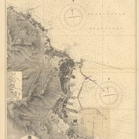
Mediterranean Sea : Algeria : Port d'Alger : from the french government chart of 1911 : with corrections to 1938
Purey-Cust, H. E.
Cartografia
Mediterranean : Tunis : Fratelli Rocks to Mahedia
Richards, G. H.; Boyle, A. J.
Cartografia
Mediterranean : Coast of Palestine : Tyre to El Arish
Edgell, J. A.
Cartografia
Mediterranean : Algeric : approaches to Bone : from french government chart 1889 : with corrections from the french government chart 1929
Wharton, W. J. L.
Cartografia
Mediterranean : Algeria : Tunis : C. Bougaroni to Fratelli Rocks including Galita Channel
Richards, G. H.
Cartografia
Mediterranean : Algeria : Algiers to C. Bougaroni : surveyed by Captain E. Mouchez of the french Navy 1867-9 : with corrections from the french gouvernment charts 1925-1926
Wharton, W. J. L.
Cartografia
Lissabon Innerestadt ; Lissabon mit den Vorstädten ; Umgebung von Lissabon
Cartografia
Das Königreich Portugal
Radefeld, Carl Christian Franz
Cartografia
Islands in the Atlantic
Cartografia
France : West Coast : La Gironde Royan to Bordeaux : from the french government chart of 1914 : with additions and corrections to 1954
Day, Archibald
Cartografia
[Espanha e Portugal]
Petri, Eduard J.; Sokal'skij, Julij Michajlovic
Cartografia
Empresa Insulana de Navegação : Viagem do dia 5 de cada mez : Viagem do dia 20 de cada mez : Os paquetes tocam nos mesmos pontos nas viagens de regresso
Arnaud, W
Cartografia
Douro
Chias y Carbó, Benito
Cartografia
Carta Hydrographica do Golfo de Guiné : Desde o Cabo das Trez Pontas até o Cabo de Lopo Gonçalves comprehendendo as Ilhas de Fernão do Póo, Príncipe, São Thomé, Anno Bom, e a pequena Ilha do Corisco
Cartografia
[Carta das principais triangulações de Portugal]
Cartografia
Carta agrícola e florestal de Portugal na escala de 1:500 000 : coordenada sob a direcção e por ideia e iniciativa de Pedro Romano Folque Coronel d'Engenharia e Engenheiro Chefe de 1ª classe
Folque, Pedro Romano; Portugal. Direcção Geral dos Serviços da Carta Agrícola
Cartografia
Beira Baixa
Chias y Carbó, Benito
Cartografia
Beira Alta
Chias y Carbó, Benito; Ribera, Joaquim