Os cookies.
Este site utiliza cookies para lhe proporcionar uma melhor experiência de utilização.
OK, ACEITO
Sobre
Itens da coleção
Refinar a pesquisa
Coleções digitais
Biblioteca Geral
23
Mapas Nabais Conde
23
Tipo
Cartografia
Autor
Walker, J. & C.
20
Vidal, Alexander Thomas Emeric
13
Owen, William Fitzwilliam
9
Bedford, George Augustus
8
Arlett, William
4
Ver mais
Data
1844
1841
1840
1836
1827
Ver mais
Local de publicação
Londres
15
Paris
1
Assunto
Carta náutica
África
20
Oceano Atlântico
19
Costa Ocidental
18
Mapa
4
Ver mais
Idioma
Inglês
22
Francês
1
PT
EN
PT
EN
Biblioteca de Fundo Antigo da UC
Almamater
Em destaque
Todos os itens
Sobre
Nesta coleção
Pesquisa avançada
Refinar a pesquisa
Limpar
Coleções digitais
Biblioteca Geral
23
Mapas Nabais Conde
23
Tipo
Cartografia
Autor
Walker, J. & C.
20
Vidal, Alexander Thomas Emeric
13
Owen, William Fitzwilliam
9
Bedford, George Augustus
8
Arlett, William
4
Ver mais
Data
1844
1841
1840
1836
1827
Ver mais
Local de publicação
Londres
15
Paris
1
Assunto
Carta náutica
África
20
Oceano Atlântico
19
Costa Ocidental
18
Mapa
4
Ver mais
Idioma
Inglês
22
Francês
1
Itens
23
Ver como
Galeria
Lista
Grelha
Ordenar por
Título (descendente)
Título
Data (de publicação)
Data (descendente)
Limite por página
50
100
250
Cartografia
West Coast of Africa : Sheet XVIII : Fernando Po to Cape Lopez
Cartografia
The West Coast of Africa : Sheet XVII from Banda Point to St. Paul de Loanda including the Congo
Cartografia
West Coast of Africa : Sheet XVII : Cape Formosa to Fernando Po
Cartografia
West Coast of Africa : Sheet XIV : Barracoe to Cape St. Paul
Cartografia
West Coast of Africa : Sheet XIII : Cape Three Points to Barracoe
Cartografia
West Coast of Africa : Sheet XII : Grand Lahou to Cape Three Points
Cartografia
West Coast of Africa : Sheet XI : Cape Palmas to Grand Lahou
Cartografia
West Coast of Africa : Sheet X : Cape Mesurada to Cape Palmas
Cartografia
West Coast of Africa : Sheet VII : from Cape Roxo to Isles de Los
Cartografia
West Coast of Africa : Sheet VI : Cape Verde to Cape Roxo including the Gambia
Cartografia
West Coast of Africa : Sheet V : Cape Blanco to Cape Verde
Cartografia
West Coast of Africa : Sheet IX : Sherboro Island to Cape Mesurada
Cartografia
West Coast of Africa : Sheet IV : Cape Bojador to Cape Blanco
Cartografia
West Coast of Africa : Sheet III : Sta. Cruz to Cape Bojador
Cartografia
West Coast of Africa : Sheet II : Azamor to Sta. Cruz
Cartografia
West Coast of Africa : Sheet I : Cape Spartel to Mazighan
Cartografia
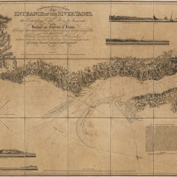
A topographical chart of the entrance of the river Tagus, describing the coast from Cape Roca to Sacavem ; with the harbour and environs of Lisbon. The nautical part is from a survey taken in 1806 by W. Chapman, Master of the Royal Navy; and approved by the Chart Committee of the Admiralty. The interior and line of the coast are drawn from survays made by officers of the Quarter Master General's Department
Cartografia
Océan Atlantique : Iles Éparses : Fayal, Pico et San Jorge (iles Açores)
Cartografia
A chart of the West Coast of Africa : Sheet VIII : the Isles de Los to Sherboro Island
Cartografia
Africa : Sheet V : from Cape Corrientes to Juba Islands including Madagascar, Comoro, Zanzibar, Ids. & c.
Cartografia
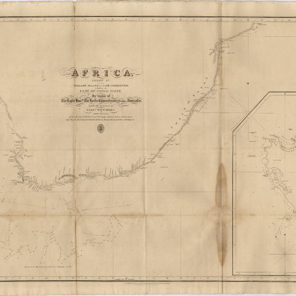
Africa : Sheet IV : from Hollams Island to Cape Corrientes including the Cape of Good Hope
Cartografia
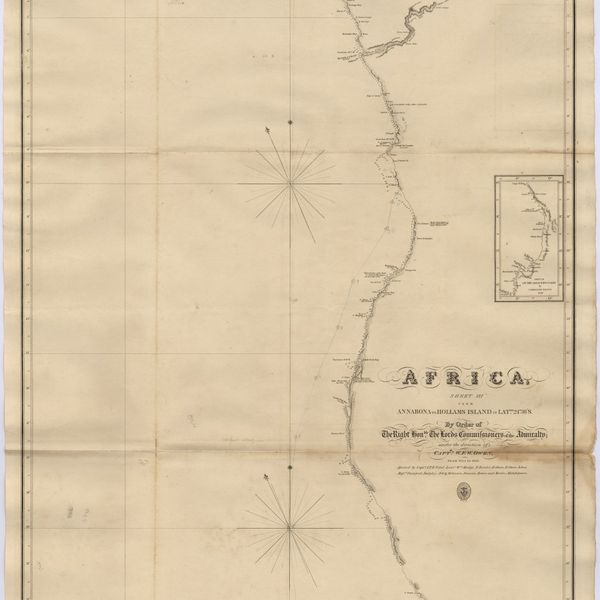
Africa : Sheet III : from Annabona to Hollams Island in Latde. 24º 36' S
Cartografia
Africa : Sheet II : from the River Gambia to cape Lopez and Annabona including the Bight of Biafra