Os cookies.
Este site utiliza cookies para lhe proporcionar uma melhor experiência de utilização.
OK, ACEITO
Sobre
Itens da coleção
Refinar a pesquisa
Coleções digitais
Mapas Nabais Conde
Biblioteca Geral
175
EU
1
Tipo
Cartografia
159
Gravuras e Desenhos
16
Autor
Walker, J. & C.
24
Vidal, Alexander Thomas Emeric
14
Owen, William Fitzwilliam
10
Bedford, George Augustus
8
Edgell, J. A.
8
Ver mais
Data
1953-1954
11
1922-1937
12
1808-1810
10
1761-1787
13
1752-1760
9
Ver mais
Local de publicação
Londres
141
Washington
8
Edimburgo
3
Nova Iorque
2
Chicago
1
Ver mais
Assunto
Mapa
79
Portugal
41
Costa Ocidental
30
Oceano Atlântico
30
Mar Mediterrâneo
28
Ver mais
Idioma
Inglês
PT
EN
PT
EN
Biblioteca de Fundo Antigo da UC
Almamater
Em destaque
Todos os itens
Sobre
Nesta coleção
Pesquisa avançada
Refinar a pesquisa
Limpar
Coleções digitais
Mapas Nabais Conde
Biblioteca Geral
175
EU
1
Tipo
Cartografia
159
Gravuras e Desenhos
16
Autor
Walker, J. & C.
24
Vidal, Alexander Thomas Emeric
14
Owen, William Fitzwilliam
10
Bedford, George Augustus
8
Edgell, J. A.
8
Ver mais
Data
1953-1954
11
1922-1937
12
1808-1810
10
1761-1787
13
1752-1760
9
Ver mais
Local de publicação
Londres
141
Washington
8
Edimburgo
3
Nova Iorque
2
Chicago
1
Ver mais
Assunto
Mapa
79
Portugal
41
Costa Ocidental
30
Oceano Atlântico
30
Mar Mediterrâneo
28
Ver mais
Idioma
Inglês
Itens
175
Ver como
Grelha
Lista
Galeria
Ordenar por
Título
Título (descendente)
Data (de publicação)
Data (descendente)
Páginas
1
2
Limite por página
50
100
250
Cartografia
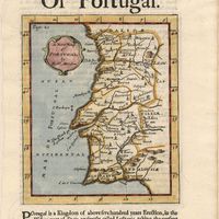
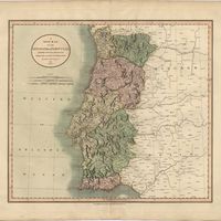
A new map of Portugal
Cartografia
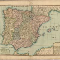
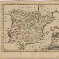
A new map of present Spain & Portugal : shewing their principal divisions, cheif cities, townes, rivers, mountains & c. : Dedicated to His Highness William Duke of Gloucester
Wells, Edward
Cartografia
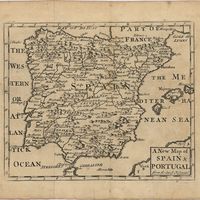
A new map of Spain & Portugal from the latest observatio[ns].
Cartografia
A new map of Spain and Portugal : exhibiting the chains of mountains with their passes, the principal & cross roads, with other details requisite for the intelligence of Military Operations
Nantiat, Jasper
Cartografia
A new map of Spain and Portugal : exhibiting the chains of mountains with their passes, the principal & cross roads, with other details requisite for the intelligence of Military Operations
Nantiat, Jasper
Cartografia
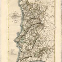
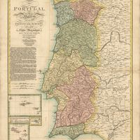
A new map of the Kingdom of Portugal divided into its provinces
Cartografia
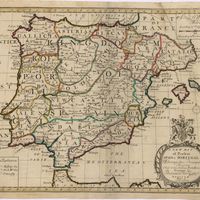
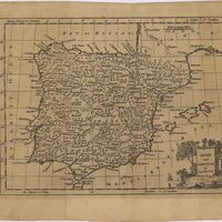
A new map of the kingdoms of Spain and Portugal with their principals divisions.
Cartografia
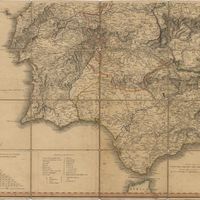
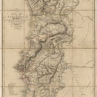
A new military map of Portugal : the roads from the Carta Militar published by the french in Lisbon : the rivers and mountains from the last Authorities
Elliott, Wm, Capt.
Cartografia
A new military map of Portugal : the roads from the Carta militar published by the french in Lisbon, the rivers and montains, from the best authorities
Elliott, Wm, Capt.
Gravuras e Desenhos
Oporto : Ms. C. L. Nº 1319
Cartografia
A plan of the city of Lisbon with the Harbour, Forts, Depth of Water and Country adjacent : for the Lond. Mag.
Cartografia
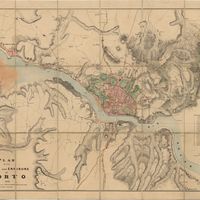
Plan of the town and environs of Porto
Cartografia
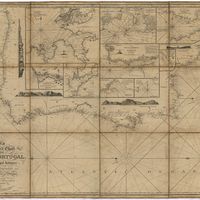
Portsmouth to Canary Islands (Islas Canarias) and the Azores (Açôres) : compiled from the latest information in the hydrographic Department, 1954
Wyatt, A. G. N.
Cartografia
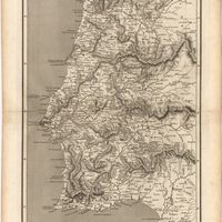
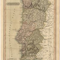
Portugal
Arrowsmith, Aaron
Cartografia
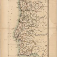
Portugal
Cartografia
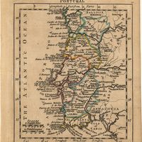
Portugal
Pinnock, William
Cartografia
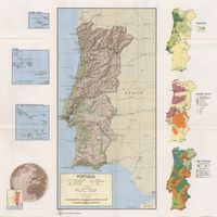
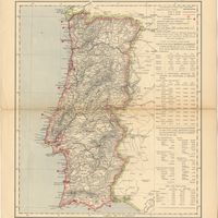
Portugal
Estados Unidos da América. Central Intelligence Agency
Cartografia
Portugal
Cartografia
Portugal
Baynes, Thomas S.; Smith, William Robertson
Cartografia
Portugal
Cartografia
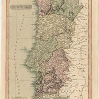
Portugal : agreeable to modern history
Moll, Herman
Cartografia
Portugal : background notes
Estados Unidos da América. Department of State
Cartografia
Portugal : Berlenga to Cabo Espichel including the approaches to Rio Tejo : compiled from portuguese government charts to 1935 : with additions and corrections to 1956
Wharton, W. J. L.
Cartografia
Portugal : Nº 4
Cartografia
Portugal : West Coast : entrance of the River Tagus with the Harbour of Lisbon (Lisboa) : compiled from various Portuguese Government surveys to 1879 : with corrections to 1945
Richards, G. H.
Cartografia
Portugal including Algarve
Tofinõ de San Miguel, Vicente; López de Vargas Machuca, Tomás
Cartografia
Portugal's Magnificent Roads now enable the travellers to make all excursions by car : Map of the international and other first-class roads connecting the principal tourist resorts, as ordered by the Commission of Tourism of the AUTOMOVEL CLUB DE PORTUGAL, Largo do Calhariz 29, Lisbon
Automóvel Club de Portugal. Comissão de turismo
Cartografia
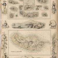
Portuguese Islands in the Atlantic Ocean
Cartografia
The present seat of war in Portugal : with the positions of the French and allied armies.
Gravuras e Desenhos
Ruins of Lisbon after the Earth-Quake on the 1st. Nov.br 1755 : The Opera House
Gravuras e Desenhos
Ruins of Lisbon after the Earthquake in 1755 : engraved for Barlows General History of Europe
Gravuras e Desenhos
Se Velha, or old Cathedral : Coimbra
Holland, T.
Cartografia
The Seat of War
Cartografia
Spain
Estados Unidos da América. Central Intelligence Agency
Cartografia
Spain & Portugal
Harvey, William, 1796-1866
Cartografia
Spain & Portugal. Western Part
Hall, Sidney
Cartografia
Spain : background notes
Estados Unidos da América. Department of State
Cartografia
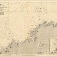
Spain : North Coast : Foz to Camariñas : from the spanish government charts of 1915 to 1920 : with additions and corrections to 1935
Edgell, J. A.
Cartografia
Spain : South Coast : Pta. del Acebuche to Pta. de la Chullera including Gibraltar Bay : from the spanish government charts of 1872-1914
Mostyn, A.
Cartografia
Spain : West Coast : Ria de Vigo : from the spanish government chart of 1912
Parry, J. F.
Cartografia
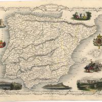
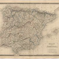
Spain and Portugal
Cartografia
Spain and Portugal
Cartografia
Spain and Portugal
Cartografia
Spain and Portugal
Kitchin, Thomas,
Cartografia
Spain and Portugal
Cartografia
Spain and Portugal
Cartografia
Spain and Portugal. A map of the mouth of the River Tagus or harbour of the city of Lisbon
Cartografia
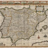
Spaine newly described with many adictions, both in the attires of the people & the setuations of their cheifest cityes
Speed, John
Cartografia
Steel's new and correct chart of the coasts of Spain and Portugal : including plans at the principal harbours on an enlarged scale
Steel & Co.
Cartografia
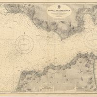
Strait of Gibraltar : from the spanish government charts of 1936 : with corrections to 1953
Edgell, J. A.
Cartografia
The theatre of war in Portugal with the distances of the fortified towns, from Lisbon
Cartografia
A topographical chart of the entrance of the river Tagus, describing the coast from Cape Roca to Sacavem ; with the harbour and environs of Lisbon. The nautical part is from a survey taken in 1806 by W. Chapman, Master of the Royal Navy; and approved by the Chart Committee of the Admiralty. The interior and line of the coast are drawn from survays made by officers of the Quarter Master General's Department
Chapman, William
Cartografia
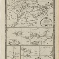
Various charts of islands &c., in the Atlantic & Pacific Oceans
Millar, George Henry
Gravuras e Desenhos
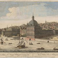
A view of the Palace of the King of Portugal at Lisbone = Vüe de Palais Roi de Portugale à Lisbon
Cartografia
West Coast of Africa : Sheet I : Cape Spartel to Mazighan
Arlett, William
Cartografia
West Coast of Africa : Sheet II : Azamor to Sta. Cruz
Arlett, William
Cartografia
West Coast of Africa : Sheet III : Sta. Cruz to Cape Bojador
Arlett, William
Cartografia
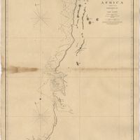
West Coast of Africa : Sheet IV : Cape Bojador to Cape Blanco
Vidal, Alexander Thomas Emeric; Roussin, Albion René, Baron de
Cartografia
West Coast of Africa : Sheet IX : Sherboro Island to Cape Mesurada
Bedford, George Augustus; Vidal, Alexander Thomas Emeric
Cartografia
West Coast of Africa : Sheet V : Cape Blanco to Cape Verde
Roussin, Albion René, Baron de
Cartografia
West Coast of Africa : Sheet VI : Cape Verde to Cape Roxo including the Gambia
Boteler, T.
Cartografia
West Coast of Africa : Sheet VII : from Cape Roxo to Isles de Los
Belcher, Edward; Owen, William Fitzwilliam; Arlett, William
Cartografia
West Coast of Africa : Sheet X : Cape Mesurada to Cape Palmas
Bedford, George Augustus; Vidal, Alexander Thomas Emeric
Cartografia
West Coast of Africa : Sheet XI : Cape Palmas to Grand Lahou
Vidal, Alexander Thomas Emeric; Bedford, George Augustus
Cartografia
West Coast of Africa : Sheet XII : Grand Lahou to Cape Three Points
Vidal, Alexander Thomas Emeric; Bedford, George Augustus
Cartografia
West Coast of Africa : Sheet XIII : Cape Three Points to Barracoe
Vidal, Alexander Thomas Emeric; Bedford, George Augustus
Cartografia
West Coast of Africa : Sheet XIV : Barracoe to Cape St. Paul
Vidal, Alexander Thomas Emeric; Bedford, George Augustus
Cartografia
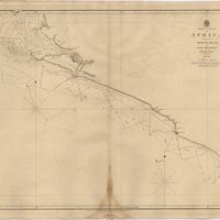
West Coast of Africa : Sheet XVII : Cape Formosa to Fernando Po
Owen, William Fitzwilliam; Bedford, George Augustus; Vidal, Alexander Thomas Emeric; Allen, William
Cartografia
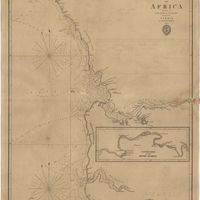
The West Coast of Africa : Sheet XVII from Banda Point to St. Paul de Loanda including the Congo
Owen, William Fitzwilliam; Vidal, Alexander Thomas Emeric
Cartografia
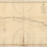
West Coast of Africa : Sheet XVIII : Fernando Po to Cape Lopez
Owen, William Fitzwilliam; Bedford, George Augustus; Vidal, Alexander Thomas Emeric
Cartografia
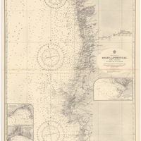
West coast of Spain and Portugal : Cabo Villano to Cabo de S.º Vicente : compiled from the latest information in the Hidrographic Office to 1958
Richards, G. H.
Cartografia
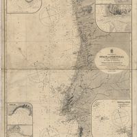
West coast of Spain and Portugal : Cape Finisterre to Cape St. Vincent : compiled from the latest information in the Hidrographic Office to 1881
Richards, George Henry
Cartografia
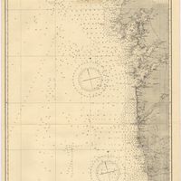
West coasts of Spain and Portugal : Cabo Villanno to Oporto : from the spanish and portuguese government charts to 1916 : with corrections and additions to 1921
Learmonth, Frederick C.
Cartografia
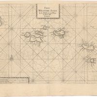
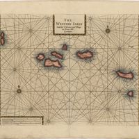
The Western Isles
Cartografia
The Western Isles