Os cookies.
Este site utiliza cookies para lhe proporcionar uma melhor experiência de utilização.
OK, ACEITO
Sobre
Itens da coleção
Refinar a pesquisa
Coleções digitais
Biblioteca Geral
26
Mapas Nabais Conde
26
Tipo
Cartografia
Autor
Bedford, George Augustus
6
Vidal, Alexander Thomas Emeric
6
Walker, J. & C.
6
Edgell, J. A.
3
Rapkin, John
3
Ver mais
Data
1935
1930
1868
1851
1841
Ver mais
Local de publicação
Londres
Nova Iorque
2
Assunto
Mapa
12
Mar Mediterrâneo
10
Oceano Atlântico
9
Carta náutica
7
Costa Ocidental
7
Ver mais
Idioma
Inglês
25
Português
1
PT
EN
PT
EN
Biblioteca de Fundo Antigo da UC
Almamater
Em destaque
Todos os itens
Sobre
Nesta coleção
Pesquisa avançada
Refinar a pesquisa
Limpar
Coleções digitais
Biblioteca Geral
26
Mapas Nabais Conde
26
Tipo
Cartografia
Autor
Bedford, George Augustus
6
Vidal, Alexander Thomas Emeric
6
Walker, J. & C.
6
Edgell, J. A.
3
Rapkin, John
3
Ver mais
Data
1935
1930
1868
1851
1841
Ver mais
Local de publicação
Londres
Nova Iorque
2
Assunto
Mapa
12
Mar Mediterrâneo
10
Oceano Atlântico
9
Carta náutica
7
Costa Ocidental
7
Ver mais
Idioma
Inglês
25
Português
1
Itens
26
Ver como
Grelha
Lista
Galeria
Ordenar por
Título
Título (descendente)
Data (de publicação)
Data (descendente)
Limite por página
50
100
250
Cartografia
France : West Coast : La Gironde Royan to Bordeaux : from the french government chart of 1914 : with additions and corrections to 1954
Day, Archibald
Cartografia
Islands in the Atlantic
Cartografia
Mediterranean : Algeria : Algiers to C. Bougaroni : surveyed by Captain E. Mouchez of the french Navy 1867-9 : with corrections from the french gouvernment charts 1925-1926
Wharton, W. J. L.
Cartografia
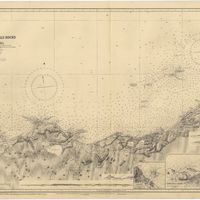
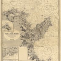
Mediterranean : Algeria : Tunis : C. Bougaroni to Fratelli Rocks including Galita Channel
Richards, G. H.
Cartografia
Mediterranean : Algeric : approaches to Bone : from french government chart 1889 : with corrections from the french government chart 1929
Wharton, W. J. L.
Cartografia
Mediterranean : Coast of Palestine : Tyre to El Arish
Edgell, J. A.
Cartografia
Mediterranean : Tunis : Fratelli Rocks to Mahedia
Richards, G. H.; Boyle, A. J.
Cartografia
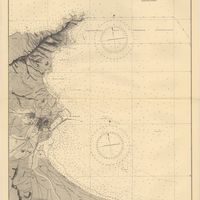
Mediterranean Sea : Algeria : Port d'Alger : from the french government chart of 1911 : with corrections to 1938
Purey-Cust, H. E.
Cartografia
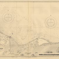
Mediterranean Sea : Egypt : Alexandria to Port Saïd
Reyne, F. A.; Hill, S. A. G.; Douglas, H. P.
Cartografia
Mediterranean Sea : Egypt : Damietta to El Arish
Douglas, H. P.
Cartografia
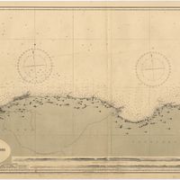
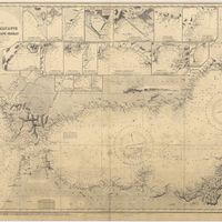
Mediterranean Sea : Europe Gibraltar to Alicante : Africa Cape Spartel to Cape Ferrat : from spanish and french government charts to 1877
Evans, F. J.
Cartografia
Mediterranean Sea : Libya : Ras Ashdir to Sirte : from the italian Gouvernment charts of 1931-32
Edgell, J. A.
Cartografia
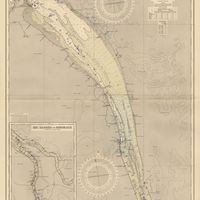
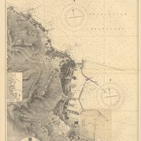
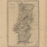
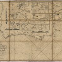
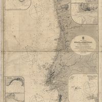
Portugal
Society for the Diffusion of Useful Knowledge
Cartografia
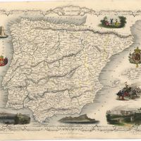
Spain & Portugal
Harvey, William, 1796-1866
Cartografia
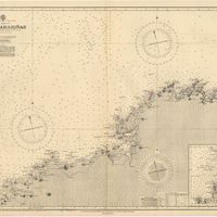
Spain : North Coast : Foz to Camariñas : from the spanish government charts of 1915 to 1920 : with additions and corrections to 1935
Edgell, J. A.
Cartografia
Spain and Portugal
Cartografia
Spain and Portugal
Cartografia
Steel's new and correct chart of the coasts of Spain and Portugal : including plans at the principal harbours on an enlarged scale
Steel & Co.
Cartografia
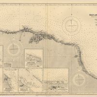
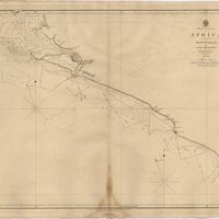
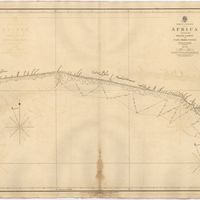
West Coast of Africa : Sheet IX : Sherboro Island to Cape Mesurada
Bedford, George Augustus; Vidal, Alexander Thomas Emeric
Cartografia
West Coast of Africa : Sheet XI : Cape Palmas to Grand Lahou
Vidal, Alexander Thomas Emeric; Bedford, George Augustus
Cartografia
West Coast of Africa : Sheet XII : Grand Lahou to Cape Three Points
Vidal, Alexander Thomas Emeric; Bedford, George Augustus
Cartografia
West Coast of Africa : Sheet XIV : Barracoe to Cape St. Paul
Vidal, Alexander Thomas Emeric; Bedford, George Augustus
Cartografia
West Coast of Africa : Sheet XVII : Cape Formosa to Fernando Po
Owen, William Fitzwilliam; Bedford, George Augustus; Vidal, Alexander Thomas Emeric; Allen, William
Cartografia
West Coast of Africa : Sheet XVIII : Fernando Po to Cape Lopez
Owen, William Fitzwilliam; Bedford, George Augustus; Vidal, Alexander Thomas Emeric
Cartografia
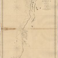
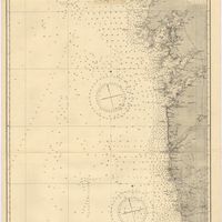
West coast of Spain and Portugal : Cape Finisterre to Cape St. Vincent : compiled from the latest information in the Hidrographic Office to 1881
Richards, George Henry
Cartografia
West coasts of Spain and Portugal : Cabo Villanno to Oporto : from the spanish and portuguese government charts to 1916 : with corrections and additions to 1921
Learmonth, Frederick C.