Os cookies.
Este site utiliza cookies para lhe proporcionar uma melhor experiência de utilização.
OK, ACEITO
Sobre
Itens da coleção
Refinar a pesquisa
Coleções digitais
Biblioteca Geral
39
Mapas Nabais Conde
38
Botânica
7
Tipo
Cartografia
31
Gravuras e Desenhos
7
Manuscrito
5
Livro Moderno
3
Autor
Walker, J. & C.
14
Vidal, Alexander Thomas Emeric
10
Bedford, George Augustus
7
Owen, William Fitzwilliam
6
Rapkin, John
3
Ver mais
Data
1876
1851
1841
1827
1800
Ver mais
Local de publicação
Londres
34
London
3
Edimburgo
2
Nova Iorque
2
Dublin
1
Ver mais
Assunto
África
13
Carta náutica
12
Costa Ocidental
11
Oceano Atlântico
11
Mapa
9
Ver mais
Idioma
Inglês
PT
EN
PT
EN
Biblioteca de Fundo Antigo da UC
Almamater
Em destaque
Todos os itens
Sobre
Nesta coleção
Pesquisa avançada
Refinar a pesquisa
Limpar
Coleções digitais
Biblioteca Geral
39
Mapas Nabais Conde
38
Botânica
7
Tipo
Cartografia
31
Gravuras e Desenhos
7
Manuscrito
5
Livro Moderno
3
Autor
Walker, J. & C.
14
Vidal, Alexander Thomas Emeric
10
Bedford, George Augustus
7
Owen, William Fitzwilliam
6
Rapkin, John
3
Ver mais
Data
1876
1851
1841
1827
1800
Ver mais
Local de publicação
Londres
34
London
3
Edimburgo
2
Nova Iorque
2
Dublin
1
Ver mais
Assunto
África
13
Carta náutica
12
Costa Ocidental
11
Oceano Atlântico
11
Mapa
9
Ver mais
Idioma
Inglês
Itens
46
Ver como
Grelha
Lista
Galeria
Ordenar por
Título
Título (descendente)
Data (de publicação)
Data (descendente)
Limite por página
50
100
250
Cartografia
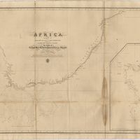
Africa : Sheet III : from Annabona to Hollams Island in Latde. 24º 36' S
Owen, William Fitzwilliam
Cartografia
Africa : Sheet IV : from Hollams Island to Cape Corrientes including the Cape of Good Hope
Owen, William Fitzwilliam
Cartografia
Africa : Sheet VI : from the Juba Islands to Muscat : with the Entrance to the Red Sea
Owen, William Fitzwilliam
Cartografia
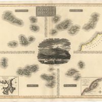
Atlantic islands
Thomson, John
Cartografia
Azores : San Miguel
Vidal, Alexander Thomas Emeric
Gravuras e Desenhos
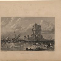
Belem castle, Lisbon
Stanfield, William Clarkson
Gravuras e Desenhos
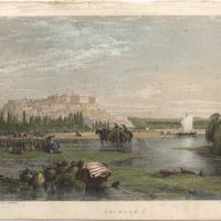
Coimbra
Holland, James
Gravuras e Desenhos
Coimbra : Fig. 197
Gravuras e Desenhos
Coimbra in Portugal
Holland, James
Gravuras e Desenhos
Cossart, Gordon & Cº. : Madeira : established 1745
Cartografia
Europe
The Edinburgh Geographical Institute; John Bartholomew & Co.
Cartografia
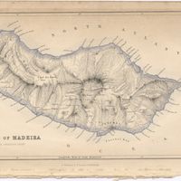
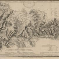
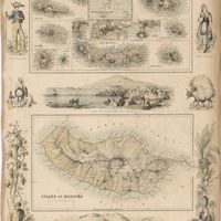
Island of Madeira
Cartografia
The Island of Madeira (Portuguese)
Cartografia
Islands in the Atlantic
Cartografia
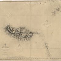
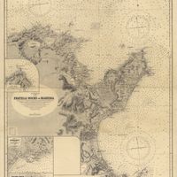
The islands of Madeira, Porto santo and Dezertas
Vidal, Alexander Thomas Emeric
Manuscrito
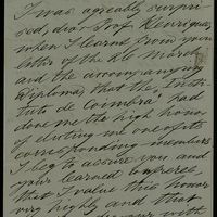
[Letter], 1873 June 13, Melbourne, [to Júlio Henriques], Coimbra
Mueller, Ferdinand Jakob Heinrich von
Manuscrito
[Letter], 1876 Aug. 31, [Kew, to] Sir [Júlio Henriques, Coimbra]
Thiselton-Dyer, William Turner
Manuscrito
[Letter], 1876 Nov. 30, Kew, [to] Sir [Júlio Henriques, Coimbra]
Thiselton-Dyer, William Turner
Manuscrito
[Letter], 1876 Oct. 3, [Kew, to] Sir [Júlio Henriques, Coimbra]
Thiselton-Dyer, William Turner
Manuscrito
[Letter], 1876 Sept. 21, Kew, [to Júlio Henriques, Coimbra]
Baker, John Gilbert
Cartografia
Lisbon = Lisboa
Society for the Diffusion of Useful Knowledge
Gravuras e Desenhos
[Lisbon].
Livro Moderno
A manual flora of Madeira and the adjacent islands of Porto Santo and the Dezertas. Part I. Thalamiflorae, ranunculaceae, pittosporaceae / by Richard Thomas Lowe
Lowe, Richard Thomas
Cartografia
Map of the wine district of the Alto-Douro
Forrester, Joseph James
Cartografia
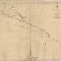
Mediterranean : Tunis : Fratelli Rocks to Mahedia
Richards, G. H.; Boyle, A. J.
Cartografia
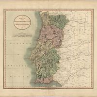
A new map of the Kingdom of Portugal divided into its provinces
Cartografia
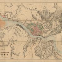
Plan of the town and environs of Porto
Cartografia
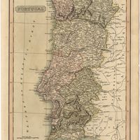
Portugal
Cartografia
Portuguese Islands in the Atlantic Ocean
Livro Moderno
Primitae et Novitiae Faunae et Florae Maderae et Portus Sancti. : two Memoirs on the Ferns, Flowering Plants, and Land Shells of Madeira and Porto Santo : with an appendix
Lowe, Richard Thomas
Gravuras e Desenhos
Se Velha, or old Cathedral : Coimbra
Holland, T.
Cartografia
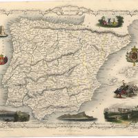
Spain & Portugal
Harvey, William, 1796-1866
Cartografia
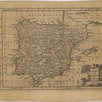
Spain and Portugal
Cartografia
Spain and Portugal
Cartografia
Spain and Portugal
Kitchin, Thomas,
Livro Moderno
Views in Egypt, from the original drawings in the possession of Sir Robert Ainslie, taken during his embassy to Constantinople by Luigi Mayer
Mayer, Luigi
Cartografia
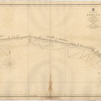
West Coast of Africa : Sheet IX : Sherboro Island to Cape Mesurada
Bedford, George Augustus; Vidal, Alexander Thomas Emeric
Cartografia
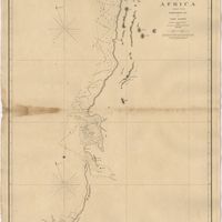
West Coast of Africa : Sheet VI : Cape Verde to Cape Roxo including the Gambia
Boteler, T.
Cartografia
West Coast of Africa : Sheet VII : from Cape Roxo to Isles de Los
Belcher, Edward; Owen, William Fitzwilliam; Arlett, William
Cartografia
West Coast of Africa : Sheet X : Cape Mesurada to Cape Palmas
Bedford, George Augustus; Vidal, Alexander Thomas Emeric
Cartografia
West Coast of Africa : Sheet XI : Cape Palmas to Grand Lahou
Vidal, Alexander Thomas Emeric; Bedford, George Augustus
Cartografia
West Coast of Africa : Sheet XII : Grand Lahou to Cape Three Points
Vidal, Alexander Thomas Emeric; Bedford, George Augustus
Cartografia
West Coast of Africa : Sheet XIII : Cape Three Points to Barracoe
Vidal, Alexander Thomas Emeric; Bedford, George Augustus
Cartografia
West Coast of Africa : Sheet XIV : Barracoe to Cape St. Paul
Vidal, Alexander Thomas Emeric; Bedford, George Augustus
Cartografia
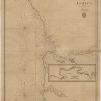
The West Coast of Africa : Sheet XVII from Banda Point to St. Paul de Loanda including the Congo
Owen, William Fitzwilliam; Vidal, Alexander Thomas Emeric
Cartografia
West Coast of Africa : Sheet XVIII : Fernando Po to Cape Lopez
Owen, William Fitzwilliam; Bedford, George Augustus; Vidal, Alexander Thomas Emeric