Os cookies.
Este site utiliza cookies para lhe proporcionar uma melhor experiência de utilização.
OK, ACEITO
Sobre
Itens da coleção
Refinar a pesquisa
Coleções digitais
Mapas Nabais Conde
Biblioteca Geral
148
EU
1
Tipo
Cartografia
137
Gravuras e Desenhos
11
Autor
Walker, J. & C.
17
Vidal, Alexander Thomas Emeric
11
Owen, William Fitzwilliam
10
Edgell, J. A.
8
Wharton, W. J. L.
8
Ver mais
Data
1876-1926
9
1832-1840
10
1790-1809
10
1740-1757
9
1626-1732
10
Ver mais
Local de publicação
Londres
Nova Iorque
2
Dublin
1
Edimburgo
1
Assunto
Mapa
76
Portugal
37
Mar Mediterrâneo
28
Costa Ocidental
23
Oceano Atlântico
23
Ver mais
Idioma
Inglês
141
Português
6
Latim
1
PT
EN
PT
EN
Biblioteca de Fundo Antigo da UC
Almamater
Em destaque
Todos os itens
Sobre
Nesta coleção
Pesquisa avançada
Refinar a pesquisa
Limpar
Coleções digitais
Mapas Nabais Conde
Biblioteca Geral
148
EU
1
Tipo
Cartografia
137
Gravuras e Desenhos
11
Autor
Walker, J. & C.
17
Vidal, Alexander Thomas Emeric
11
Owen, William Fitzwilliam
10
Edgell, J. A.
8
Wharton, W. J. L.
8
Ver mais
Data
1876-1926
9
1832-1840
10
1790-1809
10
1740-1757
9
1626-1732
10
Ver mais
Local de publicação
Londres
Nova Iorque
2
Dublin
1
Edimburgo
1
Assunto
Mapa
76
Portugal
37
Mar Mediterrâneo
28
Costa Ocidental
23
Oceano Atlântico
23
Ver mais
Idioma
Inglês
141
Português
6
Latim
1
Itens
148
Ver como
Galeria
Lista
Grelha
Ordenar por
Data (descendente)
Título
Título (descendente)
Data (de publicação)
Páginas
1
2
Limite por página
50
100
250
Cartografia
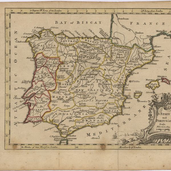
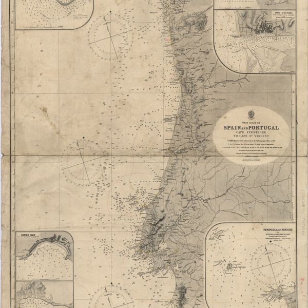
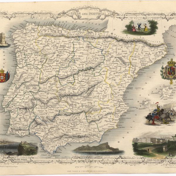
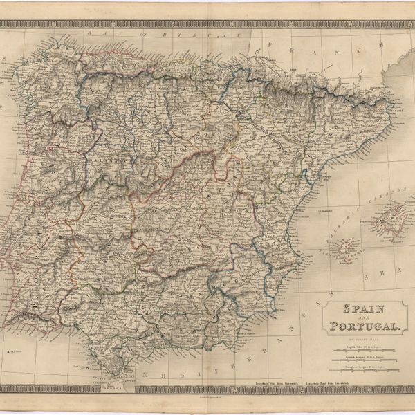
Spain and Portugal
Cartografia
Mediterranean Sea : Tunisia : East Coast : Kélibia to Tripoli : principally from french and italian Gouvernment charts to 1954
Cartografia
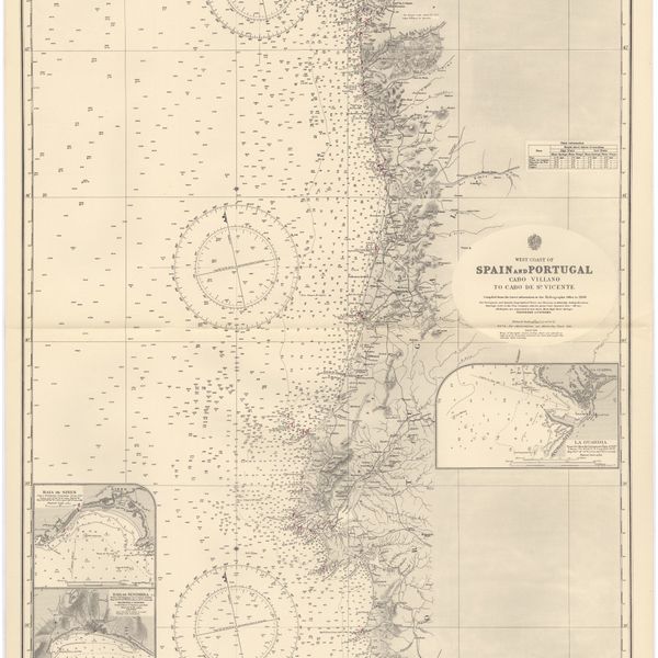
West coast of Spain and Portugal : Cabo Villano to Cabo de S.º Vicente : compiled from the latest information in the Hidrographic Office to 1958
Cartografia
Spain : West Coast : Ria de Vigo : from the spanish government chart of 1912
Cartografia
Mediterranean : Tunisia : North Coast : Lac de Bizerte and Entrance : from french government charts to 1948 : with corrections to 1957
Cartografia
Mediterranean Sea : Tunisia : East Coast : approaches to Sfax : from the french Gouvernment charts to 1952 : with corrections to 1953
Cartografia
Mediterranean Sea : Marocco : Bahia de Ceuta : from the Spanish Gouvernment Chart of 1926 : with corrections to 1956
Cartografia
Mediterranean Sea : Egypt : Alexandria Harbour
Cartografia
Portugal : Berlenga to Cabo Espichel including the approaches to Rio Tejo : compiled from portuguese government charts to 1935 : with additions and corrections to 1956
Cartografia
Mediterranean : Tunisia : Baie de Tunis : from the french Gouvernment charts of 1893 : with corrections to 1953
Cartografia
Mediterranean : Libya : Porto di Tripoli
Cartografia
Portsmouth to Canary Islands (Islas Canarias) and the Azores (Açôres) : compiled from the latest information in the hydrographic Department, 1954
Cartografia
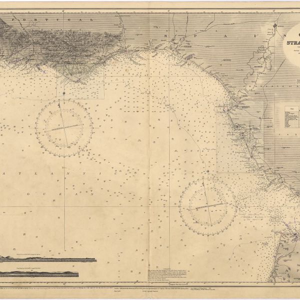
Strait of Gibraltar : from the spanish government charts of 1936 : with corrections to 1953
Cartografia
France : West Coast : Entrance to La Gironde : from the french government charts of 1887 : with additions and corrections to 1955
Cartografia
Mediterranean Sea : Egypt : approaches to Port Said ; Port Said
Cartografia
Mediterranean Sea : plans of the Coast of Libya : Rada and Porto di Tripoli : from the italian Gouvernment chart of 1930
Cartografia
Spain : South Coast : Pta. del Acebuche to Pta. de la Chullera including Gibraltar Bay : from the spanish government charts of 1872-1914
Cartografia
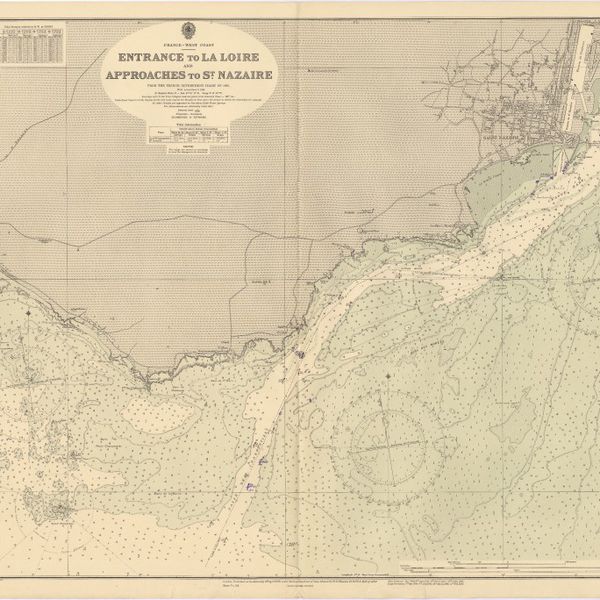
France West Coast : entrance to La Loire and approaches to St. Nazaire : from the French Government Charts of 1893 : with corrections to 1954
Cartografia
Mediterranean Sea : Algérie : C. Ferrat to C. Bougaroni : from the french government surveys of 1868-74 : the coast of Spain from spanish authorities
Cartografia
Mediterranean : Algérie : C. Ivi to Alger : from the french government charts of 1867-1870 : with additions and corrections to 1951
Cartografia
Mediterranean : Gibraltar : surveyed by Capt. R. M. Southern R. N. and officers of H. M. Surveying ship "Challenger" : 1947-1948
Cartografia
Bay of Biscay : from the latest information in the hydrographic Dept. to 1953
Cartografia
France West Coast : La Loire St. Nazaire to Nantes : from French Government Charts to 1948 : with corrections to 1948
Cartografia
France : West Coast : Pertuis d'Antioche with the approaches to La Rochelle and Rochefort : from the latest french government charts to 1950 : with additions and corrections to 1953
Cartografia
Mediterranean : Algeria : Ports d'Oran and Mers-el-Kébir : from the french government chart of 1876 : with corrections to 1953
Cartografia
Mediterranean : Africa : C. Tres Forcas to C. Ivi : surveyed by Captain E. Mouchez of the french Navy 1870-73
Cartografia
Cape St. Vincent to the Strait of Gibraltar : compiled from the latest government charts
Cartografia
Mediterranean : Israel : Bay of Acre ; Acre Anchorage ; Haifa Harbour
Cartografia
France West Coast Sheet V : Bourgneuf to I. de Groix : from the Pilote Francais with corrections from French Government Charts to 1949
Cartografia
Portugal : West Coast : entrance of the River Tagus with the Harbour of Lisbon (Lisboa) : compiled from various Portuguese Government surveys to 1879 : with corrections to 1945
Cartografia
France West Coast Sheet III : Pte. de la Coubre to les Sables d'Olonne : from the French Government Charts to 1940
Cartografia
Mediterranean Sea : Algeria : approaches to Alger : from the french government charts to 1932 : with corrections to 1950
Cartografia
France West Coast : Ile d'Ouessant to St. Nazaire : from the French Government Charts to 1939
Cartografia
Mediterranean Sea : Algeria : Port d'Alger : from the french government chart of 1911 : with corrections to 1938
Cartografia
Mediterranean Sea : Libya : Ras Ashdir to Sirte : from the italian Gouvernment charts of 1931-32
Cartografia
Mediterranean : Coast of Palestine : Tyre to El Arish
Cartografia
Spain : North Coast : Foz to Camariñas : from the spanish government charts of 1915 to 1920 : with additions and corrections to 1935
Cartografia
France : West Coast : La Gironde Royan to Bordeaux : from the french government chart of 1914 : with additions and corrections to 1954
Cartografia
France West Coast Sheet VI : I. de Groix to Raz de Sein : from the French Government Charts of 1828 : with corrections to 1933
Cartografia
Mediterranean : Algeria : Algiers to C. Bougaroni : surveyed by Captain E. Mouchez of the french Navy 1867-9 : with corrections from the french gouvernment charts 1925-1926
Cartografia
Mediterranean : Algeria : Tunis : C. Bougaroni to Fratelli Rocks including Galita Channel
Cartografia
Mediterranean Sea : Egypt : Damietta to El Arish
Cartografia
Mediterranean : Algeric : approaches to Bone : from french government chart 1889 : with corrections from the french government chart 1929
Cartografia
France West Coast Sheet IV : Les Sables d'Olonne to Bourgneuf : from the Pilote Francais with corrections from French Government Charts to 1924
Cartografia
Mediterranean Sea : Egypt : Alexandria to Port Saïd
Cartografia
West coasts of Spain and Portugal : Cabo Villanno to Oporto : from the spanish and portuguese government charts to 1916 : with corrections and additions to 1921
Cartografia
France North Coast : Sheet VIII : Ushant to Plateau des Roches Douvres : from the pilote français 1823 : with additions and corrections to 1911
Cartografia
France-North West Coast : Sheet VII : Raz de Sein to Goulven including Brest and Ushant : from French Government Charts to 1919
Cartografia
Mediterranean Sea : Europe Gibraltar to Alicante : Africa Cape Spartel to Cape Ferrat : from spanish and french government charts to 1877
Cartografia
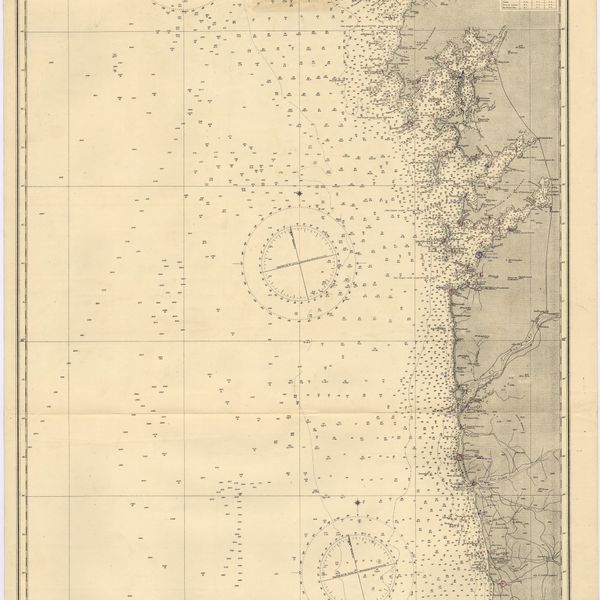
West coast of Spain and Portugal : Cape Finisterre to Cape St. Vincent : compiled from the latest information in the Hidrographic Office to 1881
Cartografia
Portugal : Nº 4
Gravuras e Desenhos
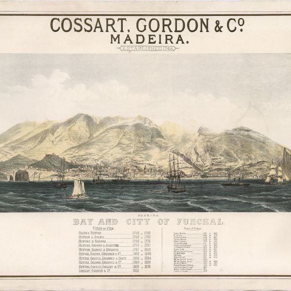
Cossart, Gordon & Cº. : Madeira : established 1745
Cartografia
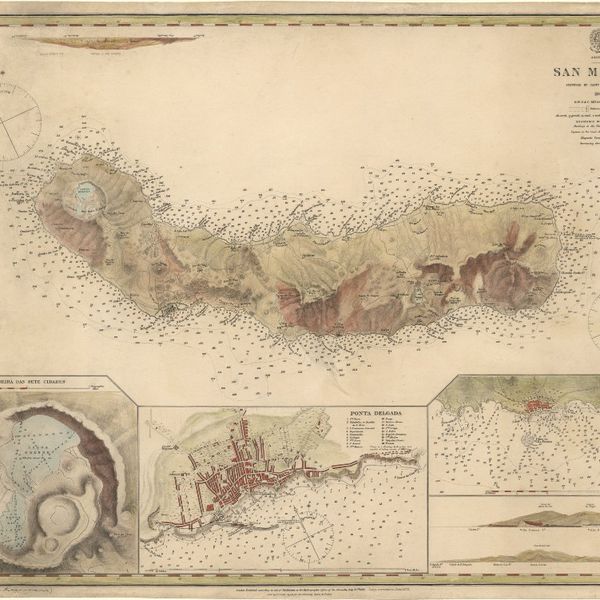
Azores : San Miguel
Cartografia
The islands of Madeira, Porto santo and Dezertas
Cartografia
Mediterranean : Tunis : Fratelli Rocks to Mahedia
Cartografia
Spain & Portugal
Cartografia
Portuguese Islands in the Atlantic Ocean
Cartografia
The Island of Madeira (Portuguese)
Cartografia
Island of Madeira
Cartografia
Map of the wine district of the Alto-Douro
Cartografia
Lisbon = Lisboa
Cartografia
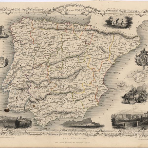
Spain and Portugal
Cartografia
Spain and Portugal
Cartografia
Islands in the Atlantic
Cartografia
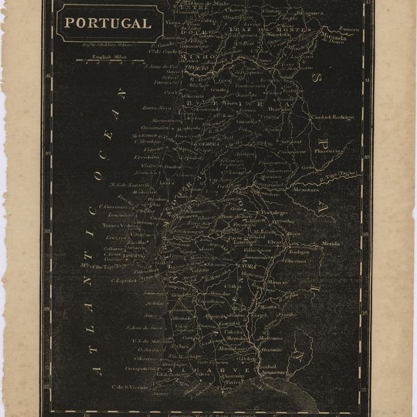
Portugal
Cartografia
Steel's new and correct chart of the coasts of Spain and Portugal : including plans at the principal harbours on an enlarged scale
Cartografia
West Coast of Africa : Sheet XVII : Cape Formosa to Fernando Po
Cartografia
West Coast of Africa : Sheet XI : Cape Palmas to Grand Lahou
Cartografia
West Coast of Africa : Sheet IX : Sherboro Island to Cape Mesurada
Cartografia
West Coast of Africa : Sheet XII : Grand Lahou to Cape Three Points
Cartografia
West Coast of Africa : Sheet XVIII : Fernando Po to Cape Lopez
Cartografia
West Coast of Africa : Sheet XIV : Barracoe to Cape St. Paul
Cartografia
A chart of the West Coast of Africa : Sheet VIII : the Isles de Los to Sherboro Island
Gravuras e Desenhos
[Coimbra]
Gravuras e Desenhos
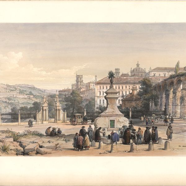
Coimbra from the east
Cartografia
The Delta of the River Kowara or Quorra, the ancient Niger
Gravuras e Desenhos
Se Velha, or old Cathedral : Coimbra
Gravuras e Desenhos
Coimbra
Cartografia
West Coast of Africa : Sheet VI : Cape Verde to Cape Roxo including the Gambia
Cartografia
West Coast of Africa : Sheet VII : from Cape Roxo to Isles de Los
Gravuras e Desenhos
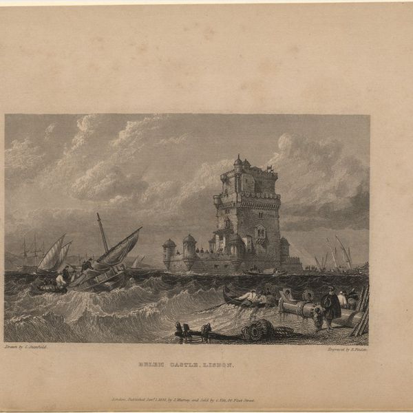
Belem castle, Lisbon
Cartografia
Plan of the town and environs of Porto
Cartografia
Madrid
Cartografia
Africa : Sheet II : from the River Gambia to cape Lopez and Annabona including the Bight of Biafra
Cartografia
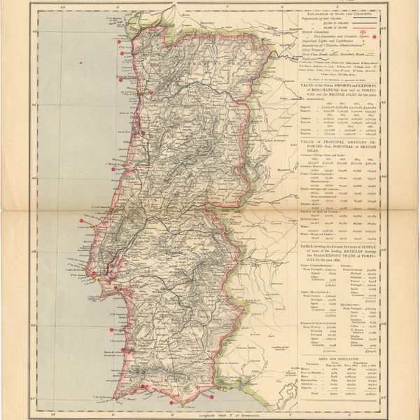
Portugal
Cartografia
Map of Portugal
Cartografia
Africa : Sheet V : from Cape Corrientes to Juba Islands including Madagascar, Comoro, Zanzibar, Ids. & c.
Cartografia
Spain and Portugal
Cartografia
The West Coast of Africa : Sheet XVII from Banda Point to St. Paul de Loanda including the Congo
Cartografia
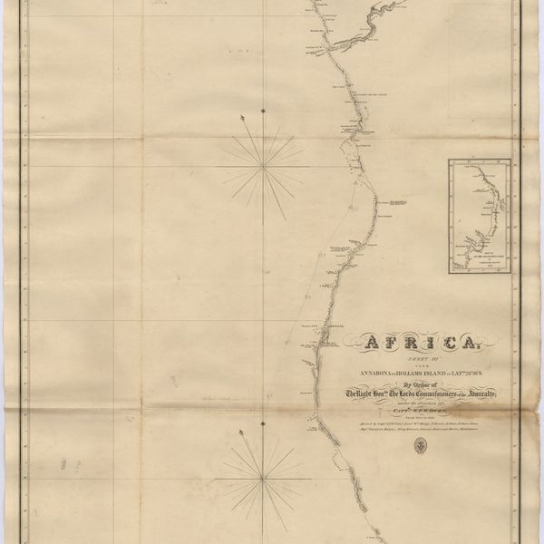
Africa : Sheet III : from Annabona to Hollams Island in Latde. 24º 36' S
Cartografia
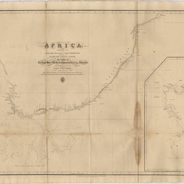
Africa : Sheet IV : from Hollams Island to Cape Corrientes including the Cape of Good Hope
Cartografia
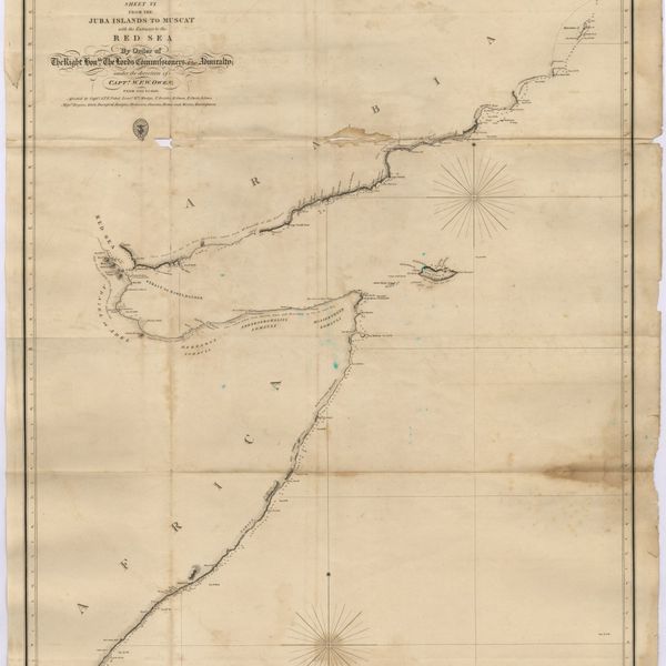
Africa : Sheet VI : from the Juba Islands to Muscat : with the Entrance to the Red Sea
Cartografia
Portugal
Cartografia
A new map of the kingdoms of Spain and Portugal with their principals divisions.
Cartografia
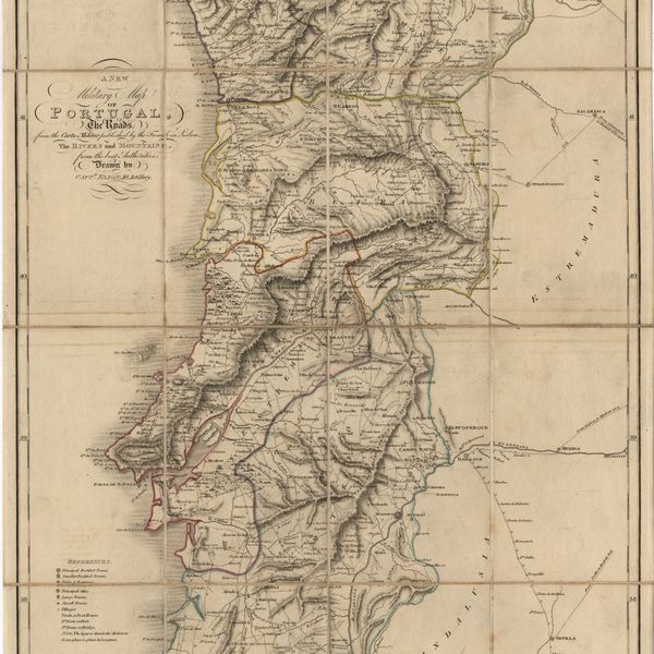
A new military map of Portugal : the roads from the Carta Militar published by the french in Lisbon : the rivers and mountains from the last Authorities
Cartografia
A new military map of Portugal : the roads from the Carta militar published by the french in Lisbon, the rivers and montains, from the best authorities
Cartografia
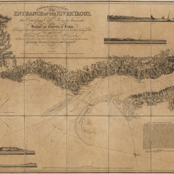
A topographical chart of the entrance of the river Tagus, describing the coast from Cape Roca to Sacavem ; with the harbour and environs of Lisbon. The nautical part is from a survey taken in 1806 by W. Chapman, Master of the Royal Navy; and approved by the Chart Committee of the Admiralty. The interior and line of the coast are drawn from survays made by officers of the Quarter Master General's Department
Cartografia
A new military map of Portugal : the roads from the Carta Militar published by the french in Lisbon : the rivers and mountains from the last Authorities
Cartografia
A new map of Spain and Portugal : exhibiting the chains of mountains with their passes, the principal & cross roads, with other details requisite for the intelligence of Military Operations
Cartografia
A new map of Spain and Portugal : exhibiting the chains of mountains with their passes, the principal & cross roads, with other details requisite for the intelligence of Military Operations