Os cookies.
Este site utiliza cookies para lhe proporcionar uma melhor experiência de utilização.
OK, ACEITO
Sobre
Itens da coleção
Refinar a pesquisa
Coleções digitais
Biblioteca Geral
Mapas Nabais Conde
680
História da Ciência
54
OG
54
EU
1
Ver mais
Tipo
Cartografia
Autor
Portugal. Comissão Nacional do Ambiente
39
Flamsteed, John
26
Walker, J. & C.
24
Dudley, Robert
19
Bode, Johann Elert
18
Ver mais
Data
1900-1952
49
1860-1897
46
1800-1812
52
1755-1775
47
1590-1630
49
Ver mais
Local de publicação
Londres
137
Paris
100
Lisboa
91
Amesterdão
81
[Londres
26
Ver mais
Assunto
Mapa
378
Portugal
298
Carta náutica
59
Espanha
55
Costa
53
Ver mais
Idioma
Latim
164
Inglês
159
Português
133
Francês
126
Alemão
44
Ver mais
PT
EN
PT
EN
Biblioteca de Fundo Antigo da UC
Almamater
Em destaque
Todos os itens
Sobre
Nesta coleção
Pesquisa avançada
Refinar a pesquisa
Limpar
Coleções digitais
Biblioteca Geral
Mapas Nabais Conde
680
História da Ciência
54
OG
54
EU
1
Ver mais
Tipo
Cartografia
Autor
Portugal. Comissão Nacional do Ambiente
39
Flamsteed, John
26
Walker, J. & C.
24
Dudley, Robert
19
Bode, Johann Elert
18
Ver mais
Data
1900-1952
49
1860-1897
46
1800-1812
52
1755-1775
47
1590-1630
49
Ver mais
Local de publicação
Londres
137
Paris
100
Lisboa
91
Amesterdão
81
[Londres
26
Ver mais
Assunto
Mapa
378
Portugal
298
Carta náutica
59
Espanha
55
Costa
53
Ver mais
Idioma
Latim
164
Inglês
159
Português
133
Francês
126
Alemão
44
Ver mais
Itens
735
Ver como
Grelha
Lista
Galeria
Ordenar por
Título
Título (descendente)
Data (de publicação)
Data (descendente)
Páginas
1
...
6
7
8
9
10
11
12
...
15
Limite por página
50
100
250
Cartografia
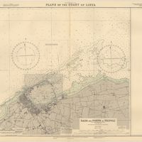
Mediterranean Sea : plans of the Coast of Libya : Rada and Porto di Tripoli : from the italian Gouvernment chart of 1930
Parry, J. F.
Cartografia
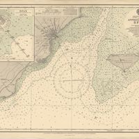
Mediterranean Sea : Tunisia : East Coast : approaches to Sfax : from the french Gouvernment charts to 1952 : with corrections to 1953
Collins, K. St. B.
Cartografia
Mediterranean Sea : Tunisia : East Coast : Kélibia to Tripoli : principally from french and italian Gouvernment charts to 1954
Collins, K. St. B.
Cartografia
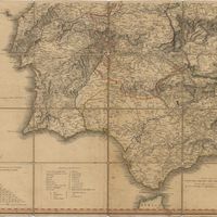
A Military sketch of the country between Lisbon and Vimiero occupied by the British Army under the command of Lieutenant General Viscount Wellington
Cartografia
Mozambique (Portugal)
Cartografia
Mozambique : background notes
United States. Department of State. Bureau of African Affairs
Cartografia
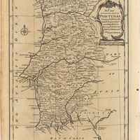
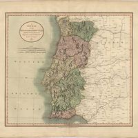
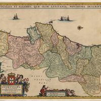
Neueste Generalkarte von Portugal und Spanien
López de Vargas Machuca, Tomás; Votésky, Michael
Cartografia
Neueste Karte von Portugal : nach den neuesten Quellen entw. u. gez.
Radefeld, Carl Christian Franz
Cartografia
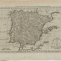
A new and accurate map of Portugal : composed from the latest improvem.ts and adjusted by the most authentic astron. observats.
Cartografia
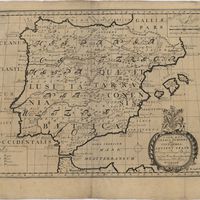
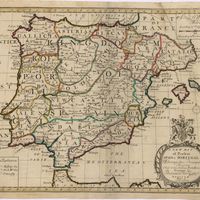
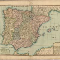
A new and accurate map of Spain and Portugal : drawn from the best Authorities
Bowen, Thomas
Cartografia
A new and correct chart of the coast of Portugal from Cape Stan to Cape Montego ; A new and correct chart of the coast of Portugal from Cape Montego to Pont de Faro
Cartografia
A new map of Iberia Europaea alias Celtiberia, or Ancient Spain : shewing its principal divisions, cheif cities, townes, rivers, mountains & c[?]. Dedicated to His Highness William Duke of Gloucester
Wells, Edward
Cartografia
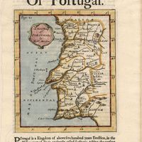
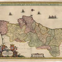
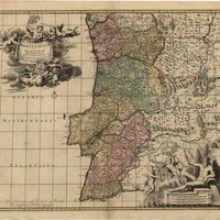
A new map of Portugal
Cartografia
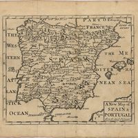
A new map of present Spain & Portugal : shewing their principal divisions, cheif cities, townes, rivers, mountains & c. : Dedicated to His Highness William Duke of Gloucester
Wells, Edward
Cartografia
A new map of Spain & Portugal from the latest observatio[ns].
Cartografia
A new map of Spain and Portugal : exhibiting the chains of mountains with their passes, the principal & cross roads, with other details requisite for the intelligence of Military Operations
Nantiat, Jasper
Cartografia
A new map of Spain and Portugal : exhibiting the chains of mountains with their passes, the principal & cross roads, with other details requisite for the intelligence of Military Operations
Nantiat, Jasper
Cartografia
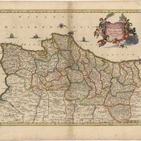
A new map of the Kingdom of Portugal divided into its provinces
Cartografia
A new map of the kingdoms of Spain and Portugal with their principals divisions.
Cartografia
A new military map of Portugal : the roads from the Carta Militar published by the french in Lisbon : the rivers and mountains from the last Authorities
Elliott, Wm, Capt.
Cartografia
A new military map of Portugal : the roads from the Carta Militar published by the french in Lisbon : the rivers and mountains from the last Authorities
Elliott, Wm, Capt.
Cartografia
A new military map of Portugal : the roads from the Carta militar published by the french in Lisbon, the rivers and montains, from the best authorities
Elliott, Wm, Capt.
Cartografia
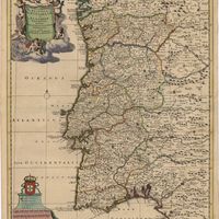
Nieuwe en nauwkeurige Kaart van Portugal, zaamgesteld uit de nieuwste berigten, en verbeterd volgens de geloofwaardigste sterrekundige waarnemingen door Eman. Bowen
Bachiene, W. A.; Bowen, Emanuel
Cartografia
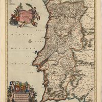
Nieuwe ende perfecte Caerte van het Coningryck Portugael ende Algarve ende nabuirige Getrocken uyt de beste Auctoors Geographi ende Ingeniuers deses tydts Door
Allard, Hugo
Cartografia
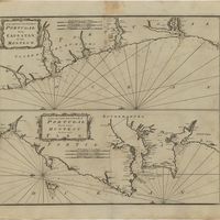
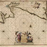
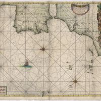
Nieuwe Generale Paskaart van de Cust van Portugal : tuschen C: de Finissterre en C: St. Vincente
Keulen, Johannes van
Cartografia
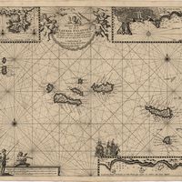
Nieuwe Pascaert van alle de Vlaemse Eylanden : Met hinne diepten en drooghten, Waer in oock te sien is hoe haer de Kust vertoont uyter zee sÿnde noÿt voor desen soo int Licht geweest
Keulen, Johannes van
Cartografia
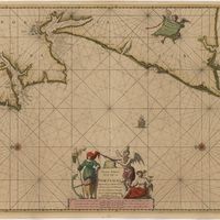
Nieuwe Paskaart van de Kust van Portugal : Beginnende 3 a 4 Myl Benoorde C. Roxent, tot aen C. d S. Vincente. Met al zyn Diepte, en Drooghre, dus ver naaukeurigh Opgesoght. Met Priviligie voor 15 Iaar
Keulen, Johannes van
Cartografia
Nieuwe Paskaart van de Kust van Portugal : Beginnende 3 a 4 Myl Benoorde C. Roxent, tot aen C. d S. Vincente. Met al zyn Diepte, en Drooghre, dus ver naaukeurigh Opgesoght. Met Priviligie voor 15 Iaar
Keulen, Johannes van
Cartografia
Nieuwe Paskaart van de Kust van Portugal : beginnende 3 a 4 Myl Benoorde C. Roxent, tot aen C.deS.Vicente met al zyn Diepte, en Drooghte dus ver naaukeurigh Opsesoght
Vooght, Claes Jansz
Cartografia
Nieuwe Paskaart van de Kust van Portugal : Beginnende van Zurara tot 7 a 8 Myl Besuyde de Barlenges met al zyn Diepte en Drooghte dus ver Naaukeurigh opgesoght
Keulen, Johannes van
Cartografia
Nieuwe Paskaart van de Kust van Portugal : Beginnende van Zurara tot 7 a 8 Myl Besuyde de Barlenges met al zyn Diepte en Drooghte dus ver Naaukeurigh opgesoght
Keulen, Johannes van
Cartografia
Nieuwe Paskaart van de Spaanse-Zee Tusschen Yrland en C:Blanco Behelsende de Kusten van Engelant Vranckrÿk Spanÿen Barbarÿa Maroco Zanhaga Gualata en Arguÿn als mede de Vlaamse en Carnarife Eÿlanden
Keulen, Johannes van
Cartografia
Nieuwe Perfecte Caert van't Coningrijk Poortugael en Algarve met de naburige Grenzen, getrocken uit de beste Auctoors ende Ingenieus deses tyts
Cartografia
Noua Bracarae avgvste descriptio
Cartografia
Noua Bracarae avgvste descriptio
Cartografia
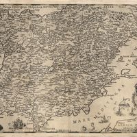
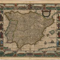
Noua descriptio Hispaniae
Ligorio, Pirro
Cartografia
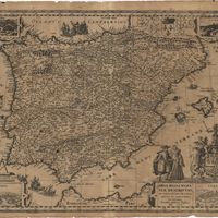
Noua totius Hispaniae descriptio
Ligorio, Pirro
Cartografia
Nouvelle Carte de Portugal, pour servir a l'Histoire de ce Royaume.
Fortia D'Urban, Marquês de; Mielle, J.F.
Cartografia
Nouvelle carte du Portugal : dressee sur les derniers remarques des plus habiles geographes d'Espagne et de Portugal = Nova Portugalliae Tabula : juxta recentiores Hispaniae et Portugalliae Geographus delineata
Sanson, Nicolas
Cartografia
Nova et accurata tabula Hispaniae praecipuis urbib., vestitu, insignib. et antiquitatibus exornata.
Cartografia
Nova et accurata tabula Hispaniae precipuis urbibus, vetitu, insignibus et antiquitatibus exornata
Cartografia
Nova Hispaniae Descriptio.
Cartografia
Nova regni Hispaniae descriptio de novo multis in locis aucta et emendata
Cartografia
Nova regni Portugalliae et Algarbiae descriptio
Ram, Johannes de
Cartografia
Nova Regni Portugalliae et Algarbiae descriptio multis in locis
Cartografia
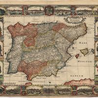
Novissima et accuratissima tabula qua Gallaeciae et Legionis Regna, Asturiarum Principatum, Portugalliae Tractus Septentrionalis, ut et Utriusque Castellae Extremadurae et Bisciae partes confines exactissime ostenduniur ; Perfectissima Geographica delineatio Tegnorum Vandalitiae, Granatae, et Algarbiae; Tractuum meridionalium Portugalliae Extremadurae ac Castellae Novae
Cartografia
Novissima et accuratissima tabula, quâ Gallaeciae et Legionis regna, Asturiarum Principatus. Portugalliae tractus septentrionalis, ut et utriusque Castellae, Extremadurae et Biscajae partes confines exactissime ostenduntur
Cartografia
Novissima regnorum Portugalliae et Algarbiae descriptio
Cartografia
Novissima regnorum Portugalliae et Algarbiae descriptio
Cartografia
Novissima Regnorum Portugalliae et Algarbiae descriptio
Wit, Frederick de