Os cookies.
Este site utiliza cookies para lhe proporcionar uma melhor experiência de utilização.
OK, ACEITO
Sobre
Itens da coleção
Refinar a pesquisa
Coleções digitais
Mapas Nabais Conde
Biblioteca Geral
243
EU
1
Tipo
Cartografia
Autor
Walker, J. & C.
24
Vidal, Alexander Thomas Emeric
16
Bellin, Jacques Nicolas
10
Owen, William Fitzwilliam
10
Bedford, George Augustus
8
Ver mais
Data
1861-1868
1791-1799
1764-1775
1762
1753-1761
Ver mais
Local de publicação
Londres
73
Paris
51
Lisboa
11
Madrid
11
Veneza
8
Ver mais
Assunto
Mapa
103
Portugal
91
Carta náutica
35
Açores
23
Oceano Atlântico
23
Ver mais
Idioma
Inglês
79
Francês
67
Português
29
Alemão
28
Espanhol
22
Ver mais
PT
EN
PT
EN
Biblioteca de Fundo Antigo da UC
Almamater
Em destaque
Todos os itens
Sobre
Nesta coleção
Pesquisa avançada
Refinar a pesquisa
Limpar
Coleções digitais
Mapas Nabais Conde
Biblioteca Geral
243
EU
1
Tipo
Cartografia
Autor
Walker, J. & C.
24
Vidal, Alexander Thomas Emeric
16
Bellin, Jacques Nicolas
10
Owen, William Fitzwilliam
10
Bedford, George Augustus
8
Ver mais
Data
1861-1868
1791-1799
1764-1775
1762
1753-1761
Ver mais
Local de publicação
Londres
73
Paris
51
Lisboa
11
Madrid
11
Veneza
8
Ver mais
Assunto
Mapa
103
Portugal
91
Carta náutica
35
Açores
23
Oceano Atlântico
23
Ver mais
Idioma
Inglês
79
Francês
67
Português
29
Alemão
28
Espanhol
22
Ver mais
Itens
243
Ver como
Grelha
Lista
Galeria
Ordenar por
Título
Título (descendente)
Data (de publicação)
Data (descendente)
Páginas
1
2
3
Limite por página
50
100
250
Cartografia
Les Royaumes de Portugal et des Algarves divisées en ses principales Provinces suivant les nouvelles observations et les memoires les plus réscents.
Cartografia
Schlachten der neurn Zeit 155.tes Blatt : Schlacht bei OṔorto den 29ten. März 1809 = Batailles de L'Age Moderne 155me. feuille : Bataille d'O'Porto de 29 mars 1809.
Cartografia
La Spagna divisa in Regni
Borghi, Bartolomeo
Cartografia
Spain & Portugal
Harvey, William, 1796-1866
Cartografia
Spain & Portugal. Western Part
Hall, Sidney
Cartografia
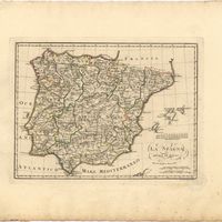
Spain and Portugal
Cartografia
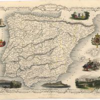
Spain and Portugal
Cartografia
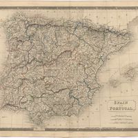
Spain and Portugal
Kitchin, Thomas,
Cartografia
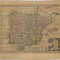
Spain and Portugal
Cartografia
Spain and Portugal. A map of the mouth of the River Tagus or harbour of the city of Lisbon
Cartografia
Spanien und Portugal
Weiland, Carl Ferdinand
Cartografia
Spanien und Portugal in 4 Blättern
Vogel, Carl
Cartografia
Spanien und Portugal in 4 Blättern
Vogel, Carl
Cartografia
[Spanien und Portugal in IV Blattern]
Stieler, Adolf
Cartografia
Steel's new and correct chart of the coasts of Spain and Portugal : including plans at the principal harbours on an enlarged scale
Steel & Co.
Cartografia
Stockholm ; Lissabon
Meyer, Joseph; Meyer, Joseph
Cartografia
Tentativa de huma Carta Critica de Portugal, que comprehende As Cidades, Comarcas, Alguns Lugares mais principaes destes Reynos = Essay d'une Carte Critique du Portugal, Comprenant Les Cités, Comarques, et quelques autres Lieux principaux de ce Royaume
Cartografia
The theatre of war in Portugal with the distances of the fortified towns, from Lisbon
Cartografia
Theatro da guerra em Portugal.
Cartografia
Theâtre de la Guerre en Portugal : tiré de Texaira et autres
Cartografia
Theâtre de la Guerre en Portugal : tiré de Texaira et autres
Cartografia
A topographical chart of the entrance of the river Tagus, describing the coast from Cape Roca to Sacavem ; with the harbour and environs of Lisbon. The nautical part is from a survey taken in 1806 by W. Chapman, Master of the Royal Navy; and approved by the Chart Committee of the Admiralty. The interior and line of the coast are drawn from survays made by officers of the Quarter Master General's Department
Chapman, William
Cartografia
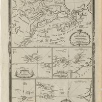
Various charts of islands &c., in the Atlantic & Pacific Oceans
Millar, George Henry
Cartografia
Welt-Karte zur Übersicht der Luft-Strömungen und Niederschläge
Berghaus, Hermann
Cartografia
Welt-Karte zur Übersicht der Meeres-Strömungen und des Schnellverkehrs
Berghaus, Hermann
Cartografia
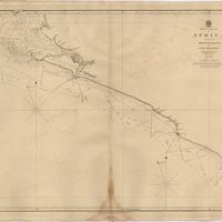
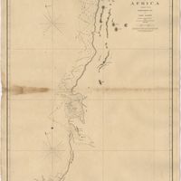
West Coast of Africa : Sheet I : Cape Spartel to Mazighan
Arlett, William
Cartografia
West Coast of Africa : Sheet II : Azamor to Sta. Cruz
Arlett, William
Cartografia
West Coast of Africa : Sheet III : Sta. Cruz to Cape Bojador
Arlett, William
Cartografia
West Coast of Africa : Sheet IV : Cape Bojador to Cape Blanco
Vidal, Alexander Thomas Emeric; Roussin, Albion René, Baron de
Cartografia
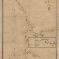
West Coast of Africa : Sheet IX : Sherboro Island to Cape Mesurada
Bedford, George Augustus; Vidal, Alexander Thomas Emeric
Cartografia
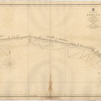
West Coast of Africa : Sheet V : Cape Blanco to Cape Verde
Roussin, Albion René, Baron de
Cartografia
West Coast of Africa : Sheet VI : Cape Verde to Cape Roxo including the Gambia
Boteler, T.
Cartografia
West Coast of Africa : Sheet VII : from Cape Roxo to Isles de Los
Belcher, Edward; Owen, William Fitzwilliam; Arlett, William
Cartografia
West Coast of Africa : Sheet X : Cape Mesurada to Cape Palmas
Bedford, George Augustus; Vidal, Alexander Thomas Emeric
Cartografia
West Coast of Africa : Sheet XI : Cape Palmas to Grand Lahou
Vidal, Alexander Thomas Emeric; Bedford, George Augustus
Cartografia
West Coast of Africa : Sheet XII : Grand Lahou to Cape Three Points
Vidal, Alexander Thomas Emeric; Bedford, George Augustus
Cartografia
West Coast of Africa : Sheet XIII : Cape Three Points to Barracoe
Vidal, Alexander Thomas Emeric; Bedford, George Augustus
Cartografia
West Coast of Africa : Sheet XIV : Barracoe to Cape St. Paul
Vidal, Alexander Thomas Emeric; Bedford, George Augustus
Cartografia
West Coast of Africa : Sheet XVII : Cape Formosa to Fernando Po
Owen, William Fitzwilliam; Bedford, George Augustus; Vidal, Alexander Thomas Emeric; Allen, William
Cartografia
The West Coast of Africa : Sheet XVII from Banda Point to St. Paul de Loanda including the Congo
Owen, William Fitzwilliam; Vidal, Alexander Thomas Emeric
Cartografia
West Coast of Africa : Sheet XVIII : Fernando Po to Cape Lopez
Owen, William Fitzwilliam; Bedford, George Augustus; Vidal, Alexander Thomas Emeric
Cartografia
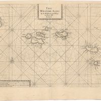
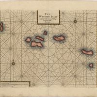
The Western Isles
Cartografia
The Western Isles