Os cookies.
Este site utiliza cookies para lhe proporcionar uma melhor experiência de utilização.
OK, ACEITO
Sobre
Itens da coleção
Refinar a pesquisa
Coleções digitais
Mapas Nabais Conde
Biblioteca Geral
73
Tipo
Cartografia
Autor
Edgell, J. A.
8
Wharton, W. J. L.
7
Walker, J. & C.
6
Day, A.
4
Douglas, H. P.
4
Ver mais
Data
1954
6
1953
5
1810
4
1780-1809
5
1764-1777
4
Ver mais
Local de publicação
Londres
Dublin
1
Edimburgo
1
Assunto
Mapa
Mar Mediterrâneo
28
Portugal
13
Costa Ocidental
12
França
12
Ver mais
Idioma
Inglês
PT
EN
PT
EN
Biblioteca de Fundo Antigo da UC
Almamater
Em destaque
Todos os itens
Sobre
Nesta coleção
Pesquisa avançada
Refinar a pesquisa
Limpar
Coleções digitais
Mapas Nabais Conde
Biblioteca Geral
73
Tipo
Cartografia
Autor
Edgell, J. A.
8
Wharton, W. J. L.
7
Walker, J. & C.
6
Day, A.
4
Douglas, H. P.
4
Ver mais
Data
1954
6
1953
5
1810
4
1780-1809
5
1764-1777
4
Ver mais
Local de publicação
Londres
Dublin
1
Edimburgo
1
Assunto
Mapa
Mar Mediterrâneo
28
Portugal
13
Costa Ocidental
12
França
12
Ver mais
Idioma
Inglês
Itens
73
Ver como
Grelha
Lista
Galeria
Ordenar por
Título
Título (descendente)
Data (de publicação)
Data (descendente)
Páginas
1
2
Limite por página
50
100
250
Cartografia
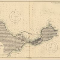
Mediterranean Sea : Marocco : Bahia de Ceuta : from the Spanish Gouvernment Chart of 1926 : with corrections to 1956
Douglas, H. P.
Cartografia
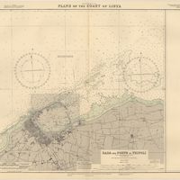
Mediterranean Sea : plans of the Coast of Libya : Rada and Porto di Tripoli : from the italian Gouvernment chart of 1930
Parry, J. F.
Cartografia
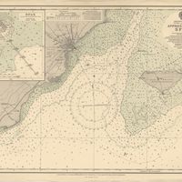
Mediterranean Sea : Tunisia : East Coast : approaches to Sfax : from the french Gouvernment charts to 1952 : with corrections to 1953
Collins, K. St. B.
Cartografia
Mediterranean Sea : Tunisia : East Coast : Kélibia to Tripoli : principally from french and italian Gouvernment charts to 1954
Collins, K. St. B.
Cartografia
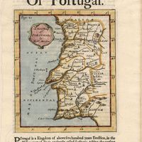
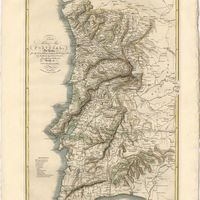
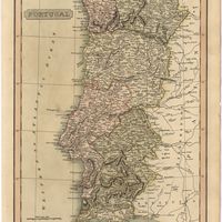
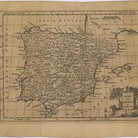
A new map of Portugal
Cartografia
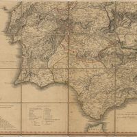
A new map of Spain and Portugal : exhibiting the chains of mountains with their passes, the principal & cross roads, with other details requisite for the intelligence of Military Operations
Nantiat, Jasper
Cartografia
A new map of Spain and Portugal : exhibiting the chains of mountains with their passes, the principal & cross roads, with other details requisite for the intelligence of Military Operations
Nantiat, Jasper
Cartografia
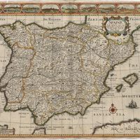
A new map of the kingdoms of Spain and Portugal with their principals divisions.
Cartografia
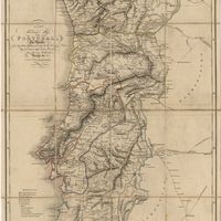
A new military map of Portugal : the roads from the Carta Militar published by the french in Lisbon : the rivers and mountains from the last Authorities
Elliott, Wm, Capt.
Cartografia
A new military map of Portugal : the roads from the Carta militar published by the french in Lisbon, the rivers and montains, from the best authorities
Elliott, Wm, Capt.
Cartografia
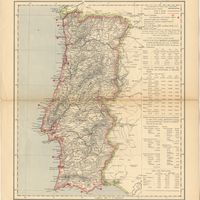
Portugal
Cartografia
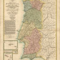
Portugal : Nº 4
Cartografia
Portugal including Algarve
Tofinõ de San Miguel, Vicente; López de Vargas Machuca, Tomás
Cartografia
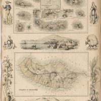
Portuguese Islands in the Atlantic Ocean
Cartografia
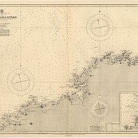
Spain : North Coast : Foz to Camariñas : from the spanish government charts of 1915 to 1920 : with additions and corrections to 1935
Edgell, J. A.
Cartografia
Spain : South Coast : Pta. del Acebuche to Pta. de la Chullera including Gibraltar Bay : from the spanish government charts of 1872-1914
Mostyn, A.
Cartografia
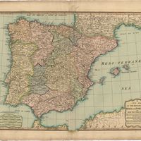
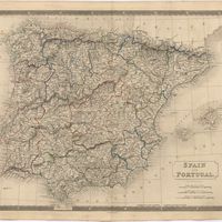
Spain and Portugal
Kitchin, Thomas,
Cartografia
Spain and Portugal
Cartografia
Spaine newly described with many adictions, both in the attires of the people & the setuations of their cheifest cityes
Speed, John
Cartografia
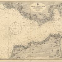
Strait of Gibraltar : from the spanish government charts of 1936 : with corrections to 1953
Edgell, J. A.
Cartografia
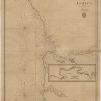
West Coast of Africa : Sheet VI : Cape Verde to Cape Roxo including the Gambia
Boteler, T.
Cartografia
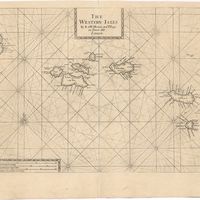
The Western Isles
Cartografia
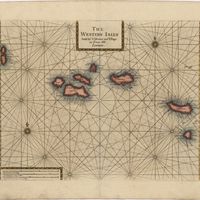
The Western Isles