Os cookies.
Este site utiliza cookies para lhe proporcionar uma melhor experiência de utilização.
OK, ACEITO
Sobre
Itens da coleção
Refinar a pesquisa
Coleções digitais
Biblioteca Geral
Mapas Nabais Conde
EU
1
Tipo
Cartografia
137
Gravuras e Desenhos
11
Autor
Walker, J. & C.
17
Vidal, Alexander Thomas Emeric
11
Owen, William Fitzwilliam
10
Edgell, J. A.
8
Wharton, W. J. L.
8
Ver mais
Data
1876-1926
9
1832-1840
10
1790-1809
10
1740-1757
9
1626-1732
10
Ver mais
Local de publicação
Londres
Nova Iorque
2
Dublin
1
Edimburgo
1
Assunto
Mapa
76
Portugal
37
Mar Mediterrâneo
28
Costa Ocidental
23
Oceano Atlântico
23
Ver mais
Idioma
Inglês
141
Português
6
Latim
1
PT
EN
PT
EN
Biblioteca de Fundo Antigo da UC
Almamater
Em destaque
Todos os itens
Sobre
Nesta coleção
Pesquisa avançada
Refinar a pesquisa
Limpar
Coleções digitais
Biblioteca Geral
Mapas Nabais Conde
EU
1
Tipo
Cartografia
137
Gravuras e Desenhos
11
Autor
Walker, J. & C.
17
Vidal, Alexander Thomas Emeric
11
Owen, William Fitzwilliam
10
Edgell, J. A.
8
Wharton, W. J. L.
8
Ver mais
Data
1876-1926
9
1832-1840
10
1790-1809
10
1740-1757
9
1626-1732
10
Ver mais
Local de publicação
Londres
Nova Iorque
2
Dublin
1
Edimburgo
1
Assunto
Mapa
76
Portugal
37
Mar Mediterrâneo
28
Costa Ocidental
23
Oceano Atlântico
23
Ver mais
Idioma
Inglês
141
Português
6
Latim
1
Itens
148
Ver como
Galeria
Lista
Grelha
Ordenar por
Data (de publicação)
Título
Título (descendente)
Data (descendente)
Páginas
1
2
Limite por página
50
100
250
Cartografia
Spaine newly described with many adictions, both in the attires of the people & the setuations of their cheifest cityes
Cartografia
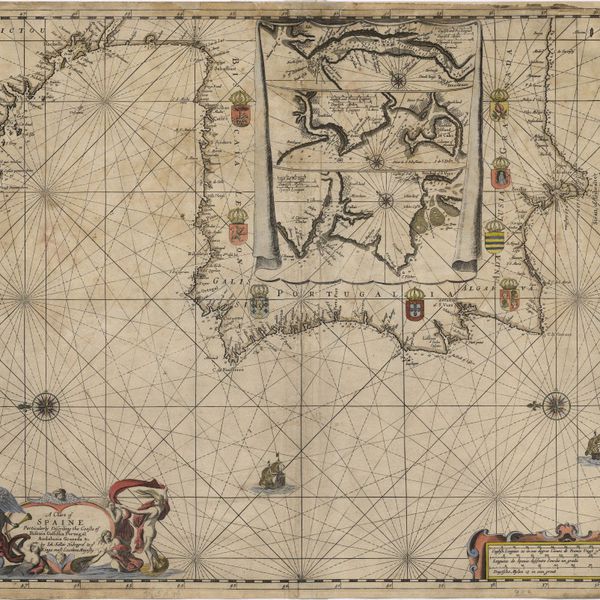
A chart of Spaine : perticulerly discribing the coasts of Biscaia Gallissia Portugal Andaluzia Granada Ec
Gravuras e Desenhos
Illustrissima Catharina Mag: Brit: Fran: & Hiber Regina
Cartografia
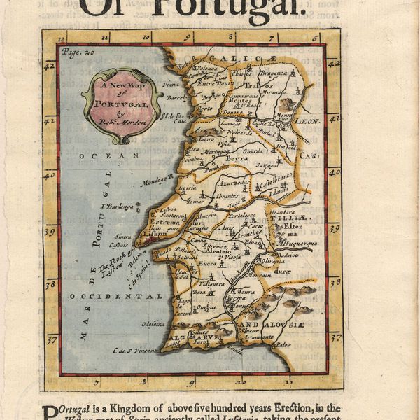
A new map of Portugal
Cartografia
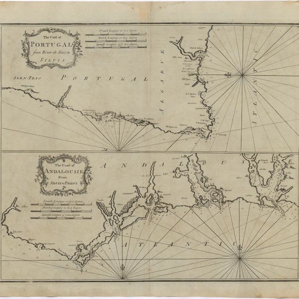
The Coast of Portugal from River de Sinis to Siluis ; The coast of Andalousie from Siluis to Pallos.
Cartografia
A new map of Iberia Europaea alias Celtiberia, or Ancient Spain : shewing its principal divisions, cheif cities, townes, rivers, mountains & c[?]. Dedicated to His Highness William Duke of Gloucester
Cartografia
A new map of present Spain & Portugal : shewing their principal divisions, cheif cities, townes, rivers, mountains & c. : Dedicated to His Highness William Duke of Gloucester
Cartografia
A correct map of Spain & Portugal : according to the newest observations and discoveries comunicated to the Royal Society at London and the Royal Academy at Paris is humbly dedicated to the Right Honorable Iohn Ld. Somers Baron of Evesham
Cartografia
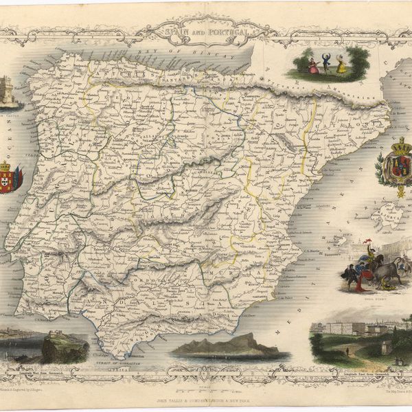
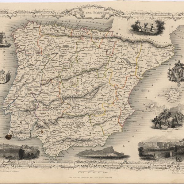
Spain and Portugal
Cartografia
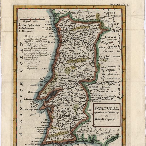
Portugal : agreeable to modern history
Cartografia
A new and accurate map of Spain and Portugal : drawn from the best Authorities
Cartografia
A new and accurate map of Portugal : composed from the latest improvem.ts and adjusted by the most authentic astron. observats.
Cartografia
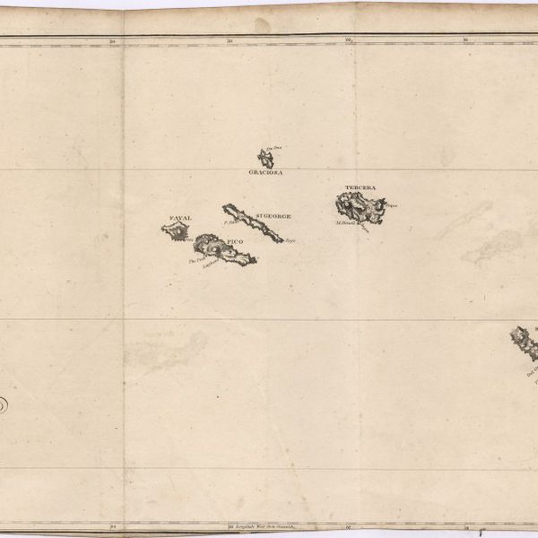
Azores
Cartografia
Island of Madera ; The Dragon Tree
Gravuras e Desenhos
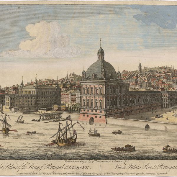
A view of the Palace of the King of Portugal at Lisbone = Vüe de Palais Roi de Portugale à Lisbon
Cartografia
A Chart of the Açores (Hawks) Islands, called also Flemish and Western Islands from Mr. D'Anviille with several additions.
Cartografia
A plan of the city of Lisbon with the Harbour, Forts, Depth of Water and Country adjacent : for the Lond. Mag.
Cartografia
Spain and Portugal. A map of the mouth of the River Tagus or harbour of the city of Lisbon
Gravuras e Desenhos
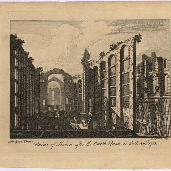
Ruins of Lisbon after the Earth-Quake on the 1st. Nov.br 1755 : The Opera House
Cartografia
A Map of the River Tale to Lisbon Done from a New Survey
Cartografia
A chart of the sea coasts of Algrave [sic] and Andalusia between cape St. Vincent and the strait of Gibralter and c. Spartel
Gravuras e Desenhos
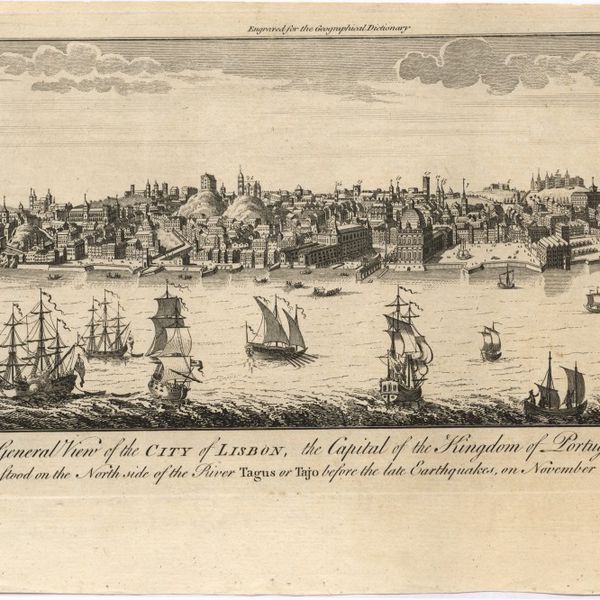
A general view of the city of Lisbon, the capital of the Kingdom of Portugal as it stood on the North side of the river Tagus or Tajo before the late earthquakes, on November 1.st & 8.th 1755
Cartografia
The theatre of war in Portugal with the distances of the fortified towns, from Lisbon
Cartografia
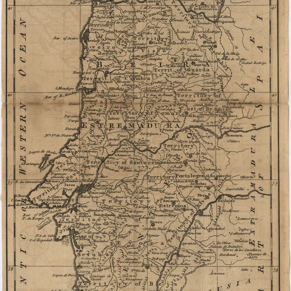
Portugal
Cartografia
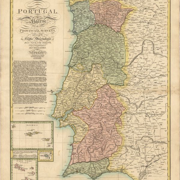
Mappa ou carta geographica dos reinos de Portugal e Algarve
Cartografia
A map of the Kingdom of Portugal
Cartografia
The Western Isles
Cartografia
The Western Isles
Cartografia
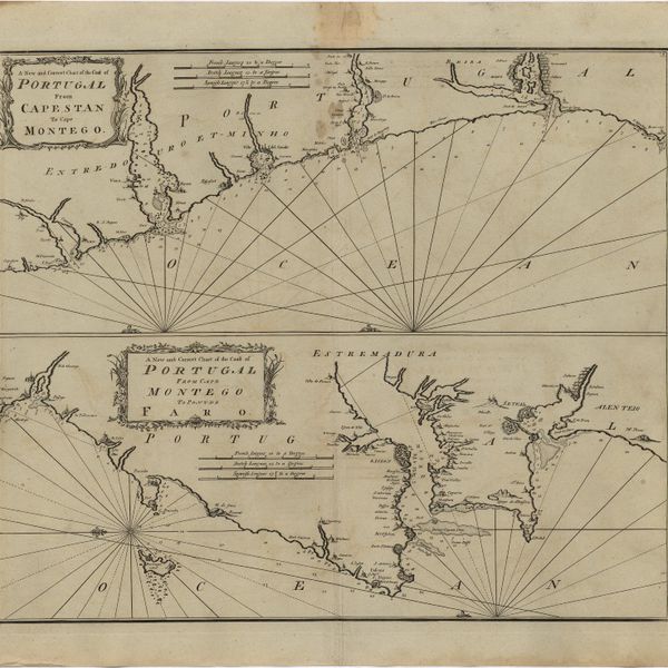
A new and correct chart of the coast of Portugal from Cape Stan to Cape Montego ; A new and correct chart of the coast of Portugal from Cape Montego to Pont de Faro
Cartografia
Spain and Portugal
Cartografia
Chart of the Açores (Hawks) Islands, called also Flemish and Western Islands.
Cartografia
A Chart of the Maderas and Canary Islands : from the Draughts and Memoirs of Captn. George Glas : Regulated and Ascertained by Astronomical Observations.
Cartografia
Map of South America : For the Ver. Dr. Robertson's History of America
Cartografia
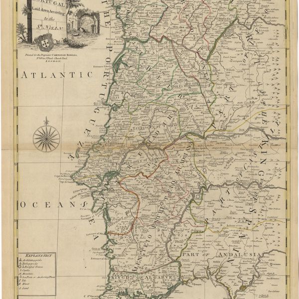
Bowles's new pocket map of Portugal
Gravuras e Desenhos
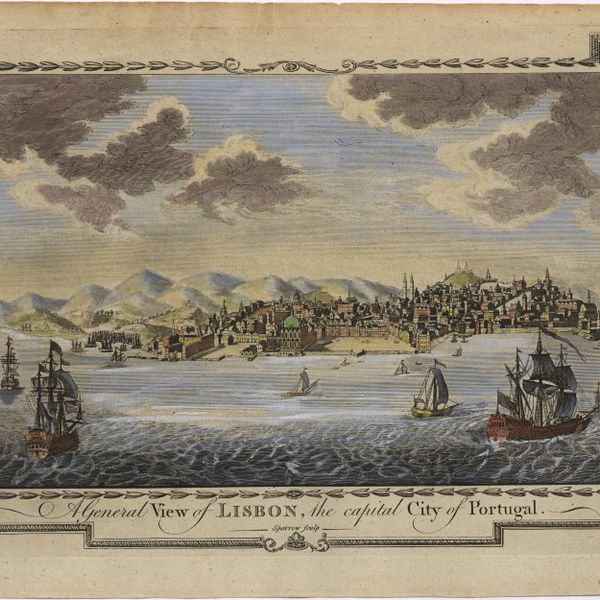
A general view of Lisbon, the capital city of Portugal
Cartografia
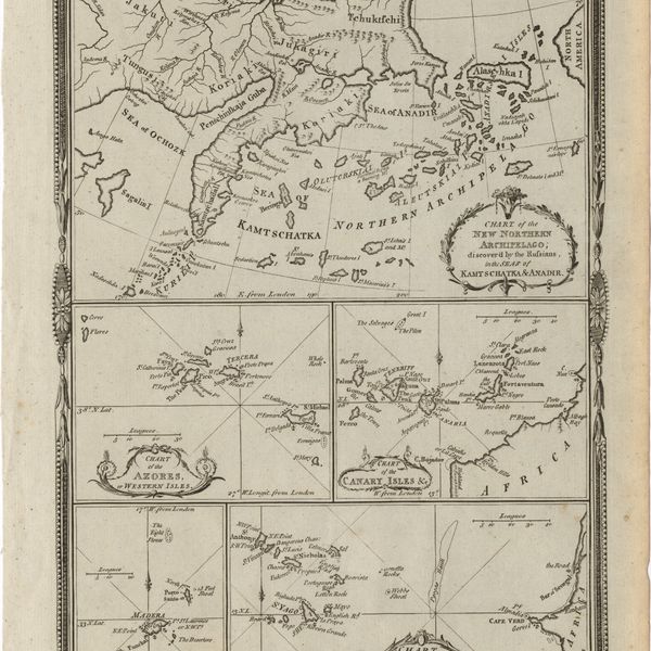
Various charts of islands &c., in the Atlantic & Pacific Oceans
Cartografia
The Kingdoms of Portugal and Algarve from Zannonïs Map
Cartografia
Mappa ou carta geographica dos reinos de Portugal e Algarve
Cartografia
The Kingdoms of Portugal and Algarve from Zannonïs Map
Cartografia
Chart of the Açores (Hawks) Islands, called also Flemish and Western Islands.
Cartografia
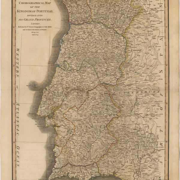
Chorographical map of the kingdom of Portugal divided into its grand provincies = Mappa corografico do Reino de Portugal
Cartografia
Physical Map of the Island of Madeira
Cartografia
A new map of the Kingdom of Portugal divided into its provinces
Cartografia
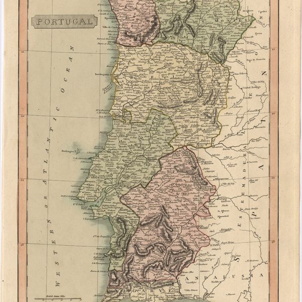
Portugal
Cartografia
Portugal
Cartografia
Chart of the Island of St. Michael
Cartografia
Portugal including Algarve
Cartografia
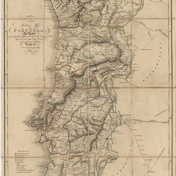
A new military map of Portugal : the roads from the Carta Militar published by the french in Lisbon : the rivers and mountains from the last Authorities
Cartografia
A new military map of Portugal : the roads from the Carta militar published by the french in Lisbon, the rivers and montains, from the best authorities
Cartografia
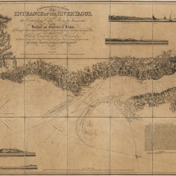
A topographical chart of the entrance of the river Tagus, describing the coast from Cape Roca to Sacavem ; with the harbour and environs of Lisbon. The nautical part is from a survey taken in 1806 by W. Chapman, Master of the Royal Navy; and approved by the Chart Committee of the Admiralty. The interior and line of the coast are drawn from survays made by officers of the Quarter Master General's Department
Cartografia
A new military map of Portugal : the roads from the Carta Militar published by the french in Lisbon : the rivers and mountains from the last Authorities
Cartografia
A new map of Spain and Portugal : exhibiting the chains of mountains with their passes, the principal & cross roads, with other details requisite for the intelligence of Military Operations
Cartografia
A new map of Spain and Portugal : exhibiting the chains of mountains with their passes, the principal & cross roads, with other details requisite for the intelligence of Military Operations
Cartografia
A Military sketch of the country between Lisbon and Vimiero occupied by the British Army under the command of Lieutenant General Viscount Wellington
Cartografia
A new map of the kingdoms of Spain and Portugal with their principals divisions.
Cartografia
Portugal
Cartografia
The West Coast of Africa : Sheet XVII from Banda Point to St. Paul de Loanda including the Congo
Cartografia
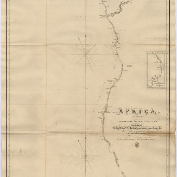
Africa : Sheet III : from Annabona to Hollams Island in Latde. 24º 36' S
Cartografia
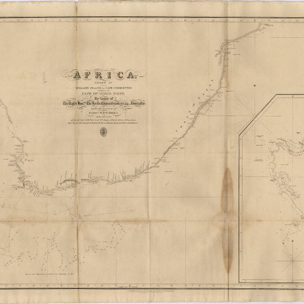
Africa : Sheet IV : from Hollams Island to Cape Corrientes including the Cape of Good Hope
Cartografia
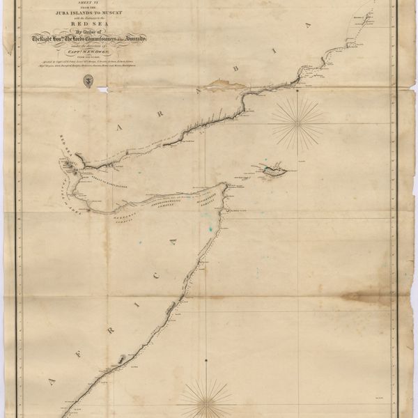
Africa : Sheet VI : from the Juba Islands to Muscat : with the Entrance to the Red Sea
Cartografia
Map of Portugal
Cartografia
Africa : Sheet V : from Cape Corrientes to Juba Islands including Madagascar, Comoro, Zanzibar, Ids. & c.
Cartografia
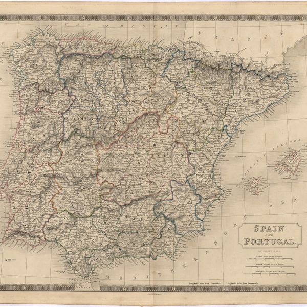
Spain and Portugal
Cartografia
Africa : Sheet II : from the River Gambia to cape Lopez and Annabona including the Bight of Biafra
Cartografia
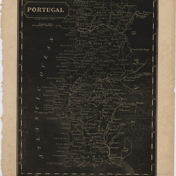
Portugal
Cartografia
Madrid
Gravuras e Desenhos
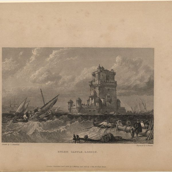
Belem castle, Lisbon
Cartografia
Plan of the town and environs of Porto
Cartografia
West Coast of Africa : Sheet VI : Cape Verde to Cape Roxo including the Gambia
Cartografia
West Coast of Africa : Sheet VII : from Cape Roxo to Isles de Los
Gravuras e Desenhos
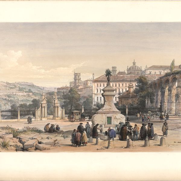
Se Velha, or old Cathedral : Coimbra
Gravuras e Desenhos
Coimbra
Gravuras e Desenhos
[Coimbra]
Gravuras e Desenhos
Coimbra from the east
Cartografia
The Delta of the River Kowara or Quorra, the ancient Niger
Cartografia
A chart of the West Coast of Africa : Sheet VIII : the Isles de Los to Sherboro Island
Cartografia
West Coast of Africa : Sheet XI : Cape Palmas to Grand Lahou
Cartografia
West Coast of Africa : Sheet IX : Sherboro Island to Cape Mesurada
Cartografia
West Coast of Africa : Sheet XII : Grand Lahou to Cape Three Points
Cartografia
West Coast of Africa : Sheet XVIII : Fernando Po to Cape Lopez
Cartografia
West Coast of Africa : Sheet XIV : Barracoe to Cape St. Paul
Cartografia
West Coast of Africa : Sheet XVII : Cape Formosa to Fernando Po
Cartografia
Steel's new and correct chart of the coasts of Spain and Portugal : including plans at the principal harbours on an enlarged scale
Cartografia
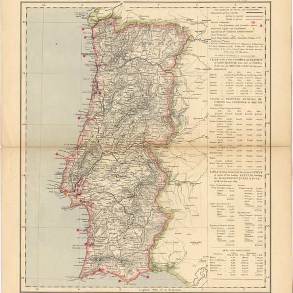
Portugal
Cartografia
Spain and Portugal
Cartografia
Spain and Portugal
Cartografia
Islands in the Atlantic
Cartografia
Lisbon = Lisboa
Cartografia
Map of the wine district of the Alto-Douro
Cartografia
The Island of Madeira (Portuguese)
Cartografia
Island of Madeira
Cartografia
Portuguese Islands in the Atlantic Ocean
Cartografia
Mediterranean : Tunis : Fratelli Rocks to Mahedia
Cartografia
Spain & Portugal
Cartografia
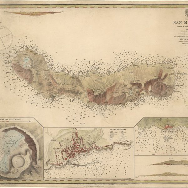
Azores : San Miguel
Cartografia
The islands of Madeira, Porto santo and Dezertas
Gravuras e Desenhos
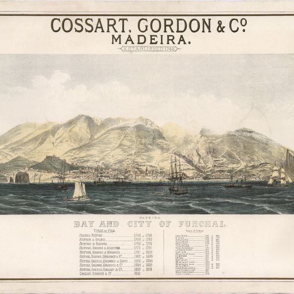
Cossart, Gordon & Cº. : Madeira : established 1745
Cartografia
Portugal : Nº 4
Cartografia
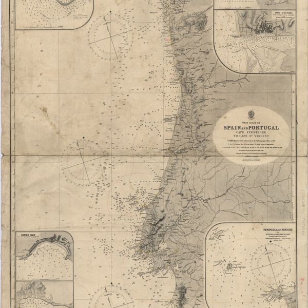
West coast of Spain and Portugal : Cape Finisterre to Cape St. Vincent : compiled from the latest information in the Hidrographic Office to 1881
Cartografia
Mediterranean Sea : Europe Gibraltar to Alicante : Africa Cape Spartel to Cape Ferrat : from spanish and french government charts to 1877