Os cookies.
Este site utiliza cookies para lhe proporcionar uma melhor experiência de utilização.
OK, ACEITO
Sobre
Itens da coleção
Refinar a pesquisa
Coleções digitais
Biblioteca Geral
143
Mapas Nabais Conde
141
Botânica
38
500 Anos da Biblioteca
1
EU
1
Tipo
Cartografia
131
Manuscrito
36
Gravuras e Desenhos
10
Livro Antigo
2
Livro Moderno
1
Ver mais
Autor
Thiselton-Dyer, William Turner
18
Walker, J. & C.
17
Vidal, Alexander Thomas Emeric
11
Owen, William Fitzwilliam
10
Edgell, J. A.
8
Ver mais
Data
1954-1955
11
1922-1934
11
1868-1877
11
1842-1865
10
1626-1747
12
Ver mais
Local de publicação
Londres
Kew
2
Nova Iorque
2
Dublin
1
Edimburgo
1
Assunto
Mapa
73
Portugal
35
Mar Mediterrâneo
28
Costa Ocidental
23
Oceano Atlântico
23
Ver mais
Idioma
Inglês
PT
EN
PT
EN
Biblioteca de Fundo Antigo da UC
Almamater
Em destaque
Todos os itens
Sobre
Nesta coleção
Pesquisa avançada
Refinar a pesquisa
Limpar
Coleções digitais
Biblioteca Geral
143
Mapas Nabais Conde
141
Botânica
38
500 Anos da Biblioteca
1
EU
1
Tipo
Cartografia
131
Manuscrito
36
Gravuras e Desenhos
10
Livro Antigo
2
Livro Moderno
1
Ver mais
Autor
Thiselton-Dyer, William Turner
18
Walker, J. & C.
17
Vidal, Alexander Thomas Emeric
11
Owen, William Fitzwilliam
10
Edgell, J. A.
8
Ver mais
Data
1954-1955
11
1922-1934
11
1868-1877
11
1842-1865
10
1626-1747
12
Ver mais
Local de publicação
Londres
Kew
2
Nova Iorque
2
Dublin
1
Edimburgo
1
Assunto
Mapa
73
Portugal
35
Mar Mediterrâneo
28
Costa Ocidental
23
Oceano Atlântico
23
Ver mais
Idioma
Inglês
Itens
181
Ver como
Grelha
Lista
Galeria
Ordenar por
Data (descendente)
Título
Título (descendente)
Data (de publicação)
Limite por página
50
100
250
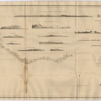
Cartografia
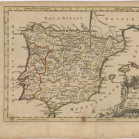
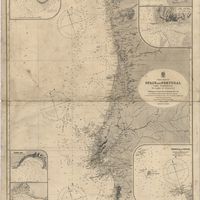
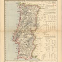
Spain and Portugal
Cartografia
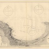
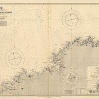
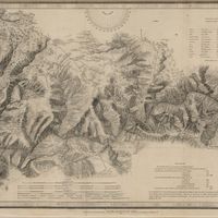
Mediterranean Sea : Tunisia : East Coast : Kélibia to Tripoli : principally from french and italian Gouvernment charts to 1954
Collins, K. St. B.
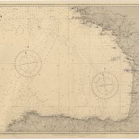
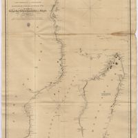
Cartografia
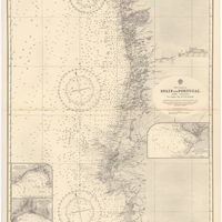
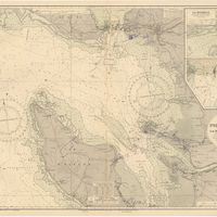
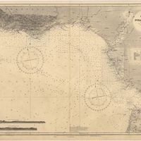
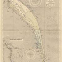
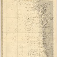
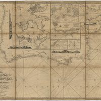
West coast of Spain and Portugal : Cabo Villano to Cabo de S.º Vicente : compiled from the latest information in the Hidrographic Office to 1958
Richards, G. H.
Cartografia
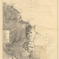
Spain : West Coast : Ria de Vigo : from the spanish government chart of 1912
Parry, J. F.
Cartografia
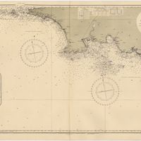
Mediterranean : Tunisia : North Coast : Lac de Bizerte and Entrance : from french government charts to 1948 : with corrections to 1957
Edgell, J. A.
Cartografia
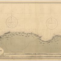
Mediterranean Sea : Tunisia : East Coast : approaches to Sfax : from the french Gouvernment charts to 1952 : with corrections to 1953
Collins, K. St. B.
Cartografia
Mediterranean Sea : Marocco : Bahia de Ceuta : from the Spanish Gouvernment Chart of 1926 : with corrections to 1956
Douglas, H. P.
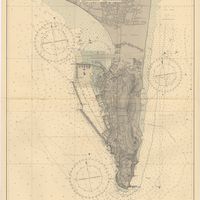
Cartografia
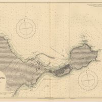
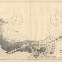
Mediterranean Sea : Egypt : Alexandria Harbour
Hardy, N. A. C.; Day, A.; Edgell, J. A.
Cartografia
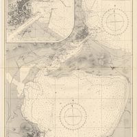
Portugal : Berlenga to Cabo Espichel including the approaches to Rio Tejo : compiled from portuguese government charts to 1935 : with additions and corrections to 1956
Wharton, W. J. L.
Cartografia
Mediterranean : Tunisia : Baie de Tunis : from the french Gouvernment charts of 1893 : with corrections to 1953
Day, A.
Cartografia
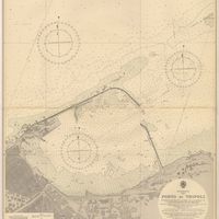
Mediterranean : Libya : Porto di Tripoli
Wyatt, Guy
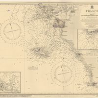
Cartografia
Portsmouth to Canary Islands (Islas Canarias) and the Azores (Açôres) : compiled from the latest information in the hydrographic Department, 1954
Wyatt, A. G. N.
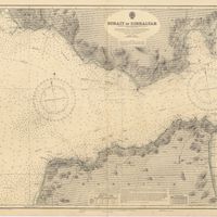
Cartografia
Strait of Gibraltar : from the spanish government charts of 1936 : with corrections to 1953
Edgell, J. A.
Cartografia
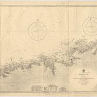
France : West Coast : Entrance to La Gironde : from the french government charts of 1887 : with additions and corrections to 1955
Wharton, W. J. L.
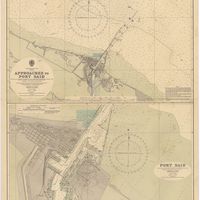
Cartografia
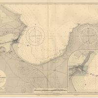
Mediterranean Sea : Egypt : approaches to Port Said ; Port Said
Day, Archibald
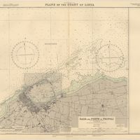
Cartografia
Mediterranean Sea : plans of the Coast of Libya : Rada and Porto di Tripoli : from the italian Gouvernment chart of 1930
Parry, J. F.
Cartografia
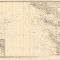
Spain : South Coast : Pta. del Acebuche to Pta. de la Chullera including Gibraltar Bay : from the spanish government charts of 1872-1914
Mostyn, A.
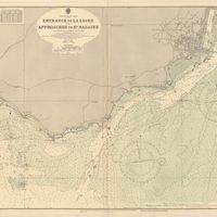
Cartografia
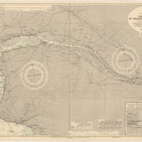
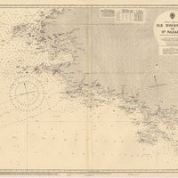
France West Coast : entrance to La Loire and approaches to St. Nazaire : from the French Government Charts of 1893 : with corrections to 1954
Wharton, W. J. L.
Cartografia
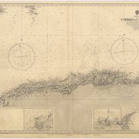
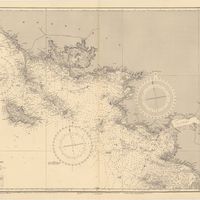
Mediterranean Sea : Algérie : C. Ferrat to C. Bougaroni : from the french government surveys of 1868-74 : the coast of Spain from spanish authorities
Richards, G. H.
Cartografia
Mediterranean : Algérie : C. Ivi to Alger : from the french government charts of 1867-1870 : with additions and corrections to 1951
Wharton, W. J. L.
Cartografia
Mediterranean : Gibraltar : surveyed by Capt. R. M. Southern R. N. and officers of H. M. Surveying ship "Challenger" : 1947-1948
Day, A.
Cartografia
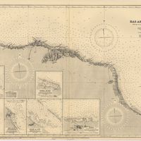
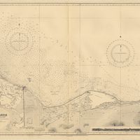
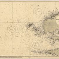
Bay of Biscay : from the latest information in the hydrographic Dept. to 1953
Day, A.
Cartografia
France West Coast : La Loire St. Nazaire to Nantes : from French Government Charts to 1948 : with corrections to 1948
Day. A.
Cartografia
France : West Coast : Pertuis d'Antioche with the approaches to La Rochelle and Rochefort : from the latest french government charts to 1950 : with additions and corrections to 1953
Day. A.
Cartografia
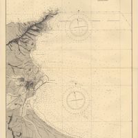
Mediterranean : Algeria : Ports d'Oran and Mers-el-Kébir : from the french government chart of 1876 : with corrections to 1953
Edgell, J. A.
Cartografia
Mediterranean : Africa : C. Tres Forcas to C. Ivi : surveyed by Captain E. Mouchez of the french Navy 1870-73
Wharton, W. J. L.
Cartografia
Cape St. Vincent to the Strait of Gibraltar : compiled from the latest government charts
Mostyn, A.
Cartografia
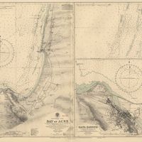
Mediterranean : Israel : Bay of Acre ; Acre Anchorage ; Haifa Harbour
Douglas, H. P.; Edgell, J. A.
Cartografia
France West Coast Sheet V : Bourgneuf to I. de Groix : from the Pilote Francais with corrections from French Government Charts to 1949
Washington, Capitão
Cartografia
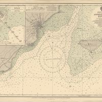
Portugal : West Coast : entrance of the River Tagus with the Harbour of Lisbon (Lisboa) : compiled from various Portuguese Government surveys to 1879 : with corrections to 1945
Richards, G. H.
Cartografia
France West Coast Sheet III : Pte. de la Coubre to les Sables d'Olonne : from the French Government Charts to 1940
Edgell, John
Cartografia
Mediterranean Sea : Algeria : approaches to Alger : from the french government charts to 1932 : with corrections to 1950
Edgell, John
Cartografia
France West Coast : Ile d'Ouessant to St. Nazaire : from the French Government Charts to 1939
Edgell, John
Cartografia
Mediterranean Sea : Algeria : Port d'Alger : from the french government chart of 1911 : with corrections to 1938
Purey-Cust, H. E.
Cartografia
Mediterranean Sea : Libya : Ras Ashdir to Sirte : from the italian Gouvernment charts of 1931-32
Edgell, J. A.
Cartografia
Mediterranean : Coast of Palestine : Tyre to El Arish
Edgell, J. A.
Cartografia
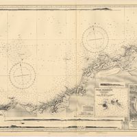
Spain : North Coast : Foz to Camariñas : from the spanish government charts of 1915 to 1920 : with additions and corrections to 1935
Edgell, J. A.
Cartografia
France : West Coast : La Gironde Royan to Bordeaux : from the french government chart of 1914 : with additions and corrections to 1954
Day, Archibald
Manuscrito
[Letter], 1934 Mar. 27, London, [to] Professor A. Quintanilha, Coimbra
British Museum (Natural History); Ramsbottom, J
Correspondência
[Letter], 1934 Mar. 27, London, [to] Professor A. Quintanilha, Coimbra
British Museum (Natural History)
Cartografia
France West Coast Sheet VI : I. de Groix to Raz de Sein : from the French Government Charts of 1828 : with corrections to 1933
Washington, Capitão
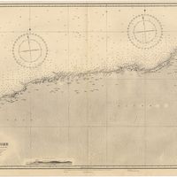
Cartografia
Mediterranean : Algeria : Algiers to C. Bougaroni : surveyed by Captain E. Mouchez of the french Navy 1867-9 : with corrections from the french gouvernment charts 1925-1926
Wharton, W. J. L.
Cartografia
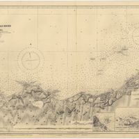
Mediterranean : Algeria : Tunis : C. Bougaroni to Fratelli Rocks including Galita Channel
Richards, G. H.
Cartografia
Mediterranean Sea : Egypt : Damietta to El Arish
Douglas, H. P.
Cartografia
Mediterranean : Algeric : approaches to Bone : from french government chart 1889 : with corrections from the french government chart 1929
Wharton, W. J. L.
Manuscrito
[Letter], 1929 Jan. 26, London, [to] Dr. Carrisso, [Coimbra]
Rendle, Alfred Barton
Cartografia
France West Coast Sheet IV : Les Sables d'Olonne to Bourgneuf : from the Pilote Francais with corrections from French Government Charts to 1924
Washington, Capitão
Cartografia
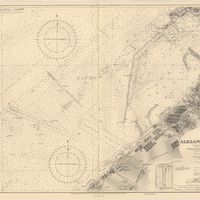
Mediterranean Sea : Egypt : Alexandria to Port Saïd
Reyne, F. A.; Hill, S. A. G.; Douglas, H. P.
Cartografia
West coasts of Spain and Portugal : Cabo Villanno to Oporto : from the spanish and portuguese government charts to 1916 : with corrections and additions to 1921
Learmonth, Frederick C.
Manuscrito
[Letter], 1921 Mar. 01, The Herbarium, Royal Botanic Gardens, Kew, Surrey, [to Júlio Henriques, Coimbra]
Stapf, Otto
Cartografia
France North Coast : Sheet VIII : Ushant to Plateau des Roches Douvres : from the pilote français 1823 : with additions and corrections to 1911
Wharton, W. J. L.
Cartografia
France-North West Coast : Sheet VII : Raz de Sein to Goulven including Brest and Ushant : from French Government Charts to 1919
Washington, Capitão
Manuscrito
[Letter], 1916 Oct. 25, Kew, [to] Monsieur le Prof. J. Henriques, Coimbra
Royal Botanic Gardens, Kew
Manuscrito
[Letter], 1915 Jan. 4, Kew, [to] Prof. J. A. Henriques, Coimbra
Royal Botanic Gardens, Kew
Manuscrito
[Letter], 1912 Oct. 3, Kew, [to] Prof. J. A. Henriques, Coimbra
Royal Botanic Gardens, Kew
Manuscrito
[Letter], 1911 Mar. 11, Kew, [to] Dr. J. A. Henriques, Coimbra
Royal Botanic Gardens, Kew
Cartografia
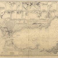
Mediterranean Sea : Europe Gibraltar to Alicante : Africa Cape Spartel to Cape Ferrat : from spanish and french government charts to 1877
Evans, F. J.
Manuscrito
[Letter], 1906 Dec. 28, London, [to] Dr. J. A. Henriques, Coimbra
R. & J. Beck
Cartografia
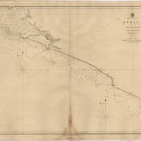
West coast of Spain and Portugal : Cape Finisterre to Cape St. Vincent : compiled from the latest information in the Hidrographic Office to 1881
Richards, George Henry
Manuscrito
[Letter], 1903 May 08, The Herbarium, [Kew], [to Júlio] Henriques, [Coimbra]
Stapf, Otto
Manuscrito
[Letter], 1900 July 2, London, [to] Dr. J. A. Henriques, Coimbra
Hiern, William Philip
Manuscrito
[Letter], 1898 Oct. 20, London, [to] Mr. J. A. Henriques, Coimbra
Gossweiler, John
Manuscrito
[Letter], 1898 Nov. 30, London, [to] Dr. J. Henriques, Coimbra
Gossweiler, John
Manuscrito
[Letter], 1895 Oct. 12, Londres, [to Júlio Henriques, Coimbra]
Baker, Edmund Gilbert
Manuscrito
[Letter], 1895 Oct. 28, Londres, [to Júlio Henriques, Coimbra]
Baker, Edmund Gilbert
Manuscrito
[Letter], 1894 Nov. 20, London, [to Júlio Henriques, Coimbra]
Thiselton-Dyer, William Turner
Manuscrito
[Letter], 1893 July 6, London, [to Júlio Henriques, Coimbra]
Henslow, George
Manuscrito
[Letter], 1888 July 28, London, [to] Professor J. A. Henriques, Coimbra
Morris, Daniel
Manuscrito
[Letter], 1888 Mar. 19, [Kew, to] Dr [Júlio] Henriques, [Coimbra]
Baker, John Gilbert
Manuscrito
[Letter], 1887 Aug. 2, [Kew, to] Dr. [Júlio] Henriques, [Coimbra]
Baker, John Gilbert
Manuscrito
[Letter], 1885 Oct. 24, Kew, [to Júlio Henriques, Coimbra]
Thiselton-Dyer, William Turner
Manuscrito
[Letter], 1884 June 6, Kew, [to Júlio Henriques, Coimbra]
Thiselton-Dyer, William Turner
Manuscrito
[Letter], 1884 May 20, Kew, [to Júlio Henriques, Coimbra]
Thiselton-Dyer, William Turner
Cartografia
Portugal : Nº 4
Manuscrito
[Letter], 1883 July 16, Kew, [to Júlio Henriques, Coimbra]
Thiselton-Dyer, William Turner
Manuscrito
[Letter], 1883 Oct. 25, Kew, [to Júlio Henriques, Coimbra]
Thiselton-Dyer, William Turner
Manuscrito
[Letter], 1881 June 27, [Kew, to Júlio Henriques, Coimbra]
Thiselton-Dyer, William Turner
Manuscrito
[Letter], 1879 July 2, [Kew, to Júlio Henriques, Coimbra]
Thiselton-Dyer, William Turner
Manuscrito
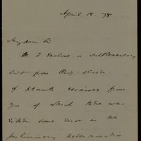
[Letter], 1878 Mar. 21, [Kew, to] Sir [Júlio Henriques, Coimbra]
Thiselton-Dyer, William Turner
Manuscrito
[Letter], 1878 Mar. 26, [Kew, to] Sir [Júlio Henriques, Coimbra]
Thiselton-Dyer, William Turner
Manuscrito
[Letter], 1878 May 1, [Kew, to] Sir [Júlio Henriques, Coimbra]
Thiselton-Dyer, William Turner
Manuscrito
[Letter], 1878 Apr. 18, [Kew, to] Sir [Júlio Henriques, Coimbra]
Thiselton-Dyer, William Turner
Manuscrito
[Letter], 1878 May 18, [Kew, to Júlio Henriques, Coimbra]
Thiselton-Dyer, William Turner
Manuscrito
[Letter], 1877 Feb. 8, [Kew, to] Sir [Júlio Henriques, Coimbra]
Thiselton-Dyer, William Turner
Manuscrito
[Letter], 1877 Aug. 13, [Kew, to] Sir [Júlio Henriques, Coimbra]
Thiselton-Dyer, William Turner
Manuscrito
[Letter], 1876 Oct. 3, [Kew, to] Sir [Júlio Henriques, Coimbra]
Thiselton-Dyer, William Turner
Manuscrito
[Letter], 1876 Nov. 30, Kew, [to] Sir [Júlio Henriques, Coimbra]
Thiselton-Dyer, William Turner
Manuscrito
[Letter], 1876 Aug. 31, [Kew, to] Sir [Júlio Henriques, Coimbra]
Thiselton-Dyer, William Turner
Gravuras e Desenhos
Cossart, Gordon & Cº. : Madeira : established 1745
Cartografia
Azores : San Miguel
Vidal, Alexander Thomas Emeric
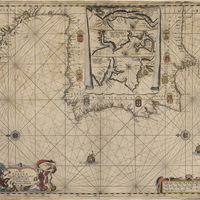
Cartografia
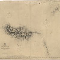
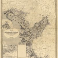
The islands of Madeira, Porto santo and Dezertas
Vidal, Alexander Thomas Emeric
Livro Moderno
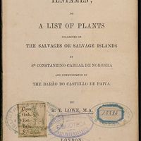
Florulae Salvagicae Tentamen or a list of plants collected in the Salvages or Salvage Islands by Sr Constantino Cabral de Noronha and communicated by The Barão do Castello de Paiva
Lowe, Richard Thomas
Cartografia
Mediterranean : Tunis : Fratelli Rocks to Mahedia
Richards, G. H.; Boyle, A. J.
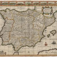
Cartografia
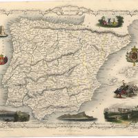
Spain & Portugal
Harvey, William, 1796-1866
Cartografia
Portuguese Islands in the Atlantic Ocean
Cartografia
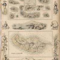
The Island of Madeira (Portuguese)
Cartografia
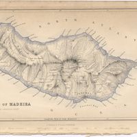
Island of Madeira
Cartografia
Map of the wine district of the Alto-Douro
Forrester, Joseph James
Cartografia
Lisbon = Lisboa
Society for the Diffusion of Useful Knowledge
Cartografia
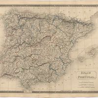
Spain and Portugal
Cartografia
Spain and Portugal
Cartografia
Islands in the Atlantic
Cartografia
Steel's new and correct chart of the coasts of Spain and Portugal : including plans at the principal harbours on an enlarged scale
Steel & Co.
Cartografia
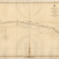
West Coast of Africa : Sheet XVII : Cape Formosa to Fernando Po
Owen, William Fitzwilliam; Bedford, George Augustus; Vidal, Alexander Thomas Emeric; Allen, William
Cartografia
West Coast of Africa : Sheet XI : Cape Palmas to Grand Lahou
Vidal, Alexander Thomas Emeric; Bedford, George Augustus
Cartografia
West Coast of Africa : Sheet IX : Sherboro Island to Cape Mesurada
Bedford, George Augustus; Vidal, Alexander Thomas Emeric
Cartografia
West Coast of Africa : Sheet XII : Grand Lahou to Cape Three Points
Vidal, Alexander Thomas Emeric; Bedford, George Augustus
Cartografia
West Coast of Africa : Sheet XVIII : Fernando Po to Cape Lopez
Owen, William Fitzwilliam; Bedford, George Augustus; Vidal, Alexander Thomas Emeric
Cartografia
West Coast of Africa : Sheet XIV : Barracoe to Cape St. Paul
Vidal, Alexander Thomas Emeric; Bedford, George Augustus
Cartografia
A chart of the West Coast of Africa : Sheet VIII : the Isles de Los to Sherboro Island
Owen, William Fitzwilliam; Boteler, T.; Vidal, Alexander Thomas Emeric
Gravuras e Desenhos
[Coimbra]
Vivian, George
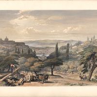
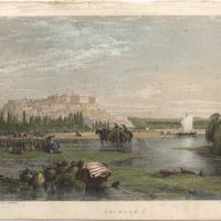
Gravuras e Desenhos
Coimbra from the east
Vivian, George
Cartografia
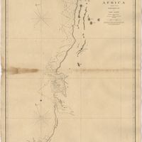
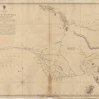
The Delta of the River Kowara or Quorra, the ancient Niger
McQueen, James
Gravuras e Desenhos
Se Velha, or old Cathedral : Coimbra
Holland, T.
Gravuras e Desenhos
Coimbra
Holland, James
Cartografia
West Coast of Africa : Sheet VI : Cape Verde to Cape Roxo including the Gambia
Boteler, T.
Cartografia
West Coast of Africa : Sheet VII : from Cape Roxo to Isles de Los
Belcher, Edward; Owen, William Fitzwilliam; Arlett, William
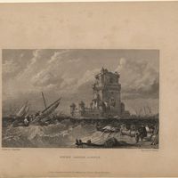
Gravuras e Desenhos
Belem castle, Lisbon
Stanfield, William Clarkson
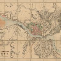
Cartografia
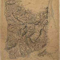
Plan of the town and environs of Porto
Cartografia
Madrid
Society for the Diffusion of Useful Knowledge
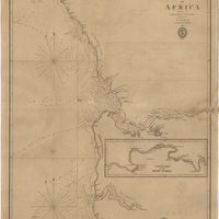
Cartografia
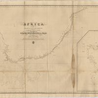
Africa : Sheet II : from the River Gambia to cape Lopez and Annabona including the Bight of Biafra
De Mayne, Anthony; Owen, William Fitzwilliam; Vidal, Alexander Thomas Emeric
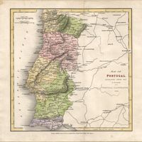
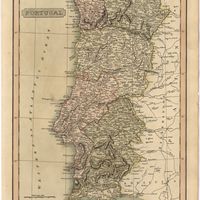
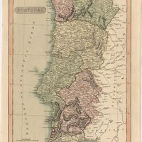
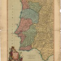
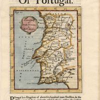
Cartografia
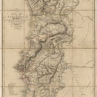
Portugal
Pinnock, William
Cartografia
Map of Portugal
Arrowsmith, Aaron
Cartografia
Africa : Sheet V : from Cape Corrientes to Juba Islands including Madagascar, Comoro, Zanzibar, Ids. & c.
Owen, William Fitzwilliam
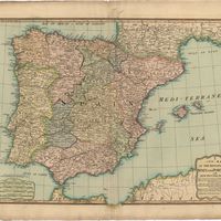
Cartografia
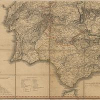
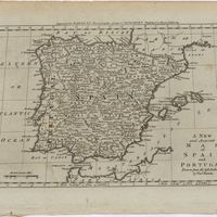
Spain and Portugal
Cartografia
The West Coast of Africa : Sheet XVII from Banda Point to St. Paul de Loanda including the Congo
Owen, William Fitzwilliam; Vidal, Alexander Thomas Emeric
Cartografia
Africa : Sheet III : from Annabona to Hollams Island in Latde. 24º 36' S
Owen, William Fitzwilliam
Cartografia
Africa : Sheet IV : from Hollams Island to Cape Corrientes including the Cape of Good Hope
Owen, William Fitzwilliam
Cartografia
Africa : Sheet VI : from the Juba Islands to Muscat : with the Entrance to the Red Sea
Owen, William Fitzwilliam
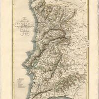
Cartografia
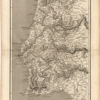
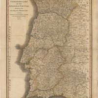
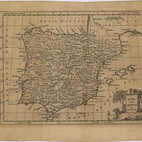
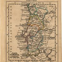
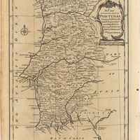
Portugal
Cartografia
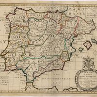
A new map of the kingdoms of Spain and Portugal with their principals divisions.
Cartografia
A new military map of Portugal : the roads from the Carta Militar published by the french in Lisbon : the rivers and mountains from the last Authorities
Elliott, Wm, Capt.
Cartografia
A new military map of Portugal : the roads from the Carta militar published by the french in Lisbon, the rivers and montains, from the best authorities
Elliott, Wm, Capt.
Cartografia
A topographical chart of the entrance of the river Tagus, describing the coast from Cape Roca to Sacavem ; with the harbour and environs of Lisbon. The nautical part is from a survey taken in 1806 by W. Chapman, Master of the Royal Navy; and approved by the Chart Committee of the Admiralty. The interior and line of the coast are drawn from survays made by officers of the Quarter Master General's Department
Chapman, William
Cartografia
A new map of Spain and Portugal : exhibiting the chains of mountains with their passes, the principal & cross roads, with other details requisite for the intelligence of Military Operations
Nantiat, Jasper
Cartografia
A new map of Spain and Portugal : exhibiting the chains of mountains with their passes, the principal & cross roads, with other details requisite for the intelligence of Military Operations
Nantiat, Jasper
Cartografia
A Military sketch of the country between Lisbon and Vimiero occupied by the British Army under the command of Lieutenant General Viscount Wellington
Cartografia
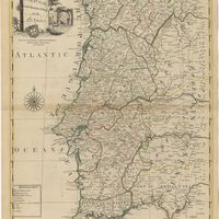
Portugal including Algarve
Tofinõ de San Miguel, Vicente; López de Vargas Machuca, Tomás
Cartografia
Portugal
Arrowsmith, Aaron
Cartografia
Portugal
Cartografia
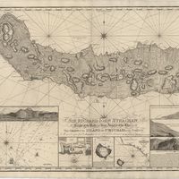
Chart of the Island of St. Michael
Read, W. Harding
Cartografia
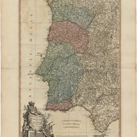
A new map of the Kingdom of Portugal divided into its provinces
Cartografia
Chart of the Açores (Hawks) Islands, called also Flemish and Western Islands.
Cartografia
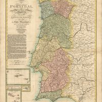
Chorographical map of the kingdom of Portugal divided into its grand provincies = Mappa corografico do Reino de Portugal
Faden, William
Cartografia
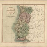
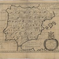
The Kingdoms of Portugal and Algarve from Zannonïs Map
Rizzi-Zannoni,Giovanni Antonio
Cartografia
The Kingdoms of Portugal and Algarve from Zannonïs Map
Rizzi-Zannoni,Giovanni Antonio
Cartografia
Various charts of islands &c., in the Atlantic & Pacific Oceans
Millar, George Henry
Gravuras e Desenhos
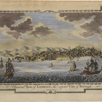
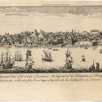
A general view of Lisbon, the capital city of Portugal
Cartografia
Bowles's new pocket map of Portugal
Nolin, Jean Baptiste
Cartografia
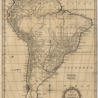
Map of South America : For the Ver. Dr. Robertson's History of America
Cartografia
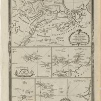
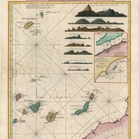
A Chart of the Maderas and Canary Islands : from the Draughts and Memoirs of Captn. George Glas : Regulated and Ascertained by Astronomical Observations.
Cartografia
Chart of the Açores (Hawks) Islands, called also Flemish and Western Islands.
Cartografia
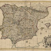
Spain and Portugal
Kitchin, Thomas,
Livro Antigo
The mourning bride : a tragedy
Congreve, William
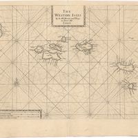
Cartografia
The Western Isles
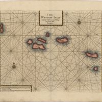
Cartografia
The Western Isles
Cartografia
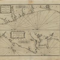
A new and correct chart of the coast of Portugal from Cape Stan to Cape Montego ; A new and correct chart of the coast of Portugal from Cape Montego to Pont de Faro
Cartografia
A map of the Kingdom of Portugal
Cartografia
Portugal
Gravuras e Desenhos
A general view of the city of Lisbon, the capital of the Kingdom of Portugal as it stood on the North side of the river Tagus or Tajo before the late earthquakes, on November 1.st & 8.th 1755
Cartografia
The theatre of war in Portugal with the distances of the fortified towns, from Lisbon
Cartografia
A Map of the River Tale to Lisbon Done from a New Survey
Cartografia
A chart of the sea coasts of Algrave [sic] and Andalusia between cape St. Vincent and the strait of Gibralter and c. Spartel
Gravuras e Desenhos
Ruins of Lisbon after the Earth-Quake on the 1st. Nov.br 1755 : The Opera House
Cartografia
A plan of the city of Lisbon with the Harbour, Forts, Depth of Water and Country adjacent : for the Lond. Mag.
Cartografia
Spain and Portugal. A map of the mouth of the River Tagus or harbour of the city of Lisbon
Cartografia
A Chart of the Açores (Hawks) Islands, called also Flemish and Western Islands from Mr. D'Anviille with several additions.
Gravuras e Desenhos
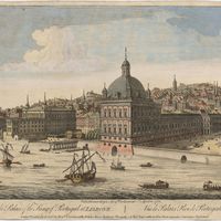
A view of the Palace of the King of Portugal at Lisbone = Vüe de Palais Roi de Portugale à Lisbon
Cartografia
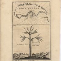
Island of Madera ; The Dragon Tree
Livro Antigo
Micrographia illustrata, or, The knowledge of the microscope explain'd together with an account of a New Invented Universal, single or double, Microscope, either of which is capable of being applied to an Improv'd Solar Apparatus. This Treatise contains a Description of the Nature, Uses, and Magnifysing Powers of Microscopes in general; together with full Directions how to prepare, apply, and examine, as well as preserve, all Sorts of minute Objects also an account of The principal Microcopical Discoveries, that have hirherto been mentioned by the most celebrated Authors, togeher with a great Variety of new Experiments and Observations. The whole being, as it were, A Natural History of a Multitude of Aerial, Terrestrial, and Aquatick Animals, Seeds, Plants, Etc. To which is added, A Translation of Mr. Joblott's Observations on the Animalcula, that are found in many different Sorts of Infusions and a very particular Account of the surprising Phaenomenon, The Fresh Water Polype, translated from the French Treatise of Mr. Trembley. This Work is compiled for the Assistance of those, who are desirous of surveyng the extensive Beauties of the minute Creation and is illustreted with 65 Copper-plates, curiously engrav'd, wich contain above 560 Pictures of Microscopic Objets
Adams, George; Trembley, Abraham
Cartografia
A new and accurate map of Portugal : composed from the latest improvem.ts and adjusted by the most authentic astron. observats.
Cartografia
A new and accurate map of Spain and Portugal : drawn from the best Authorities
Bowen, Thomas
Cartografia
Spain and Portugal
Cartografia
Portugal : agreeable to modern history
Moll, Herman
Cartografia
A correct map of Spain & Portugal : according to the newest observations and discoveries comunicated to the Royal Society at London and the Royal Academy at Paris is humbly dedicated to the Right Honorable Iohn Ld. Somers Baron of Evesham
Cartografia
The Coast of Portugal from River de Sinis to Siluis ; The coast of Andalousie from Siluis to Pallos.
Cartografia
A new map of Iberia Europaea alias Celtiberia, or Ancient Spain : shewing its principal divisions, cheif cities, townes, rivers, mountains & c[?]. Dedicated to His Highness William Duke of Gloucester
Wells, Edward
Cartografia
A new map of present Spain & Portugal : shewing their principal divisions, cheif cities, townes, rivers, mountains & c. : Dedicated to His Highness William Duke of Gloucester
Wells, Edward
Cartografia
A new map of Portugal
Cartografia
A chart of Spaine : perticulerly discribing the coasts of Biscaia Gallissia Portugal Andaluzia Granada Ec
Seller, John
Cartografia
Spaine newly described with many adictions, both in the attires of the people & the setuations of their cheifest cityes
Speed, John