Os cookies.
Este site utiliza cookies para lhe proporcionar uma melhor experiência de utilização.
OK, ACEITO
Sobre
Itens da coleção
Refinar a pesquisa
Coleções digitais
Mapas Nabais Conde
Biblioteca Geral
159
EU
1
Tipo
Cartografia
Autor
Walker, J. & C.
24
Vidal, Alexander Thomas Emeric
14
Owen, William Fitzwilliam
10
Bedford, George Augustus
8
Edgell, J. A.
8
Ver mais
Data
1939-1952
9
1830-1840
10
1810-1824
10
1756-1764
10
1710-1755
9
Ver mais
Local de publicação
Londres
131
Washington
8
Edimburgo
3
Nova Iorque
2
Chicago
1
Ver mais
Assunto
Mapa
79
Portugal
41
Costa Ocidental
30
Oceano Atlântico
30
Mar Mediterrâneo
28
Ver mais
Idioma
Inglês
PT
EN
PT
EN
Biblioteca de Fundo Antigo da UC
Almamater
Em destaque
Todos os itens
Sobre
Nesta coleção
Pesquisa avançada
Refinar a pesquisa
Limpar
Coleções digitais
Mapas Nabais Conde
Biblioteca Geral
159
EU
1
Tipo
Cartografia
Autor
Walker, J. & C.
24
Vidal, Alexander Thomas Emeric
14
Owen, William Fitzwilliam
10
Bedford, George Augustus
8
Edgell, J. A.
8
Ver mais
Data
1939-1952
9
1830-1840
10
1810-1824
10
1756-1764
10
1710-1755
9
Ver mais
Local de publicação
Londres
131
Washington
8
Edimburgo
3
Nova Iorque
2
Chicago
1
Ver mais
Assunto
Mapa
79
Portugal
41
Costa Ocidental
30
Oceano Atlântico
30
Mar Mediterrâneo
28
Ver mais
Idioma
Inglês
Itens
159
Ver como
Galeria
Lista
Grelha
Ordenar por
Data (descendente)
Título
Título (descendente)
Data (de publicação)
Páginas
1
2
Limite por página
50
100
250
Cartografia
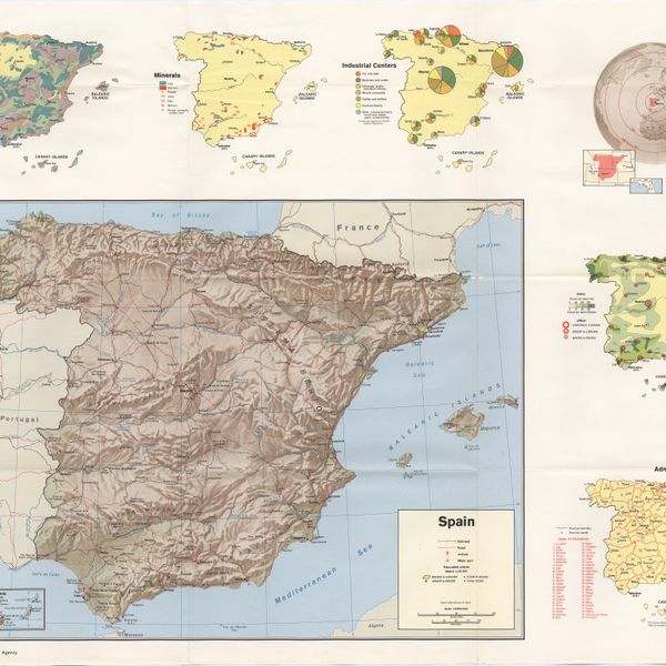
Spain
Cartografia
Iceland : background notes
Cartografia
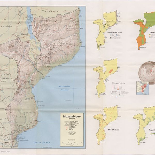
Mozambique (Portugal)
Cartografia
Iceland
Cartografia
Mozambique : background notes
Cartografia
Angola : background notes
Cartografia
Spain : background notes
Cartografia
Portugal : background notes
Cartografia
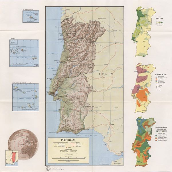
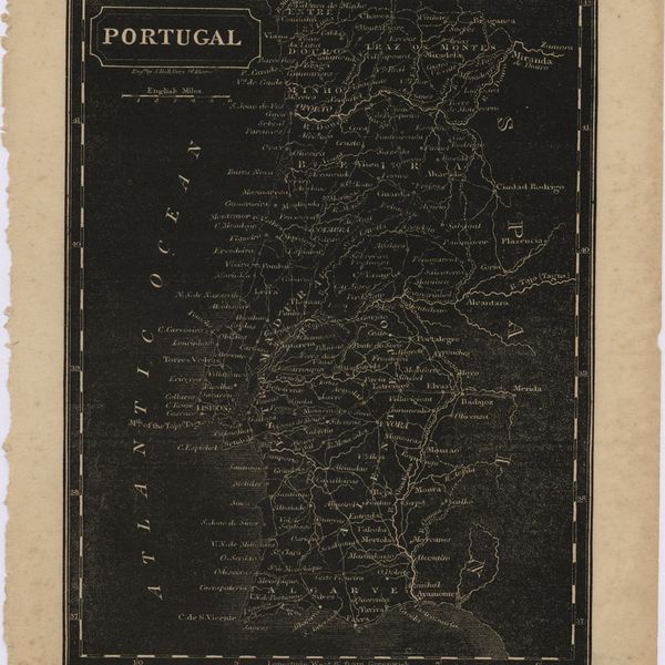
Portugal
Cartografia
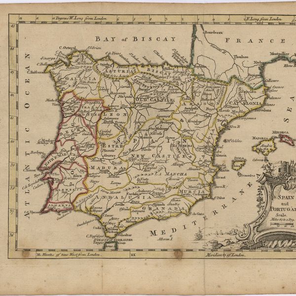
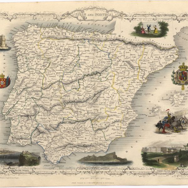
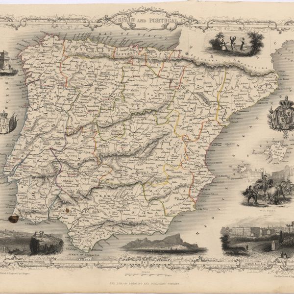
Spain and Portugal
Cartografia
The Seat of War
Cartografia
The Kingdoms of spain and Portugal & Ca.
Cartografia
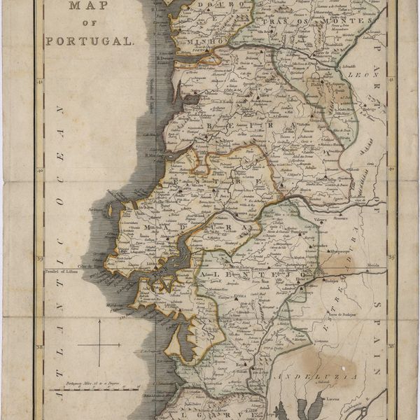
A map of Portugal
Cartografia
Mediterranean Sea : Tunisia : East Coast : Kélibia to Tripoli : principally from french and italian Gouvernment charts to 1954
Cartografia
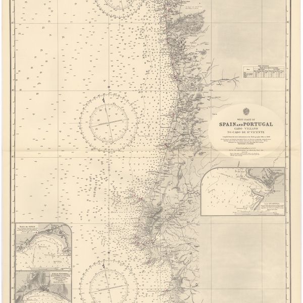
West coast of Spain and Portugal : Cabo Villano to Cabo de S.º Vicente : compiled from the latest information in the Hidrographic Office to 1958
Cartografia
Spain : West Coast : Ria de Vigo : from the spanish government chart of 1912
Cartografia
Mediterranean : Tunisia : North Coast : Lac de Bizerte and Entrance : from french government charts to 1948 : with corrections to 1957
Cartografia
Mediterranean Sea : Tunisia : East Coast : approaches to Sfax : from the french Gouvernment charts to 1952 : with corrections to 1953
Cartografia
Mediterranean Sea : Marocco : Bahia de Ceuta : from the Spanish Gouvernment Chart of 1926 : with corrections to 1956
Cartografia
Mediterranean Sea : Egypt : Alexandria Harbour
Cartografia
Portugal : Berlenga to Cabo Espichel including the approaches to Rio Tejo : compiled from portuguese government charts to 1935 : with additions and corrections to 1956
Cartografia
Mediterranean : Tunisia : Baie de Tunis : from the french Gouvernment charts of 1893 : with corrections to 1953
Cartografia
Mediterranean : Libya : Porto di Tripoli
Cartografia
Portsmouth to Canary Islands (Islas Canarias) and the Azores (Açôres) : compiled from the latest information in the hydrographic Department, 1954
Cartografia
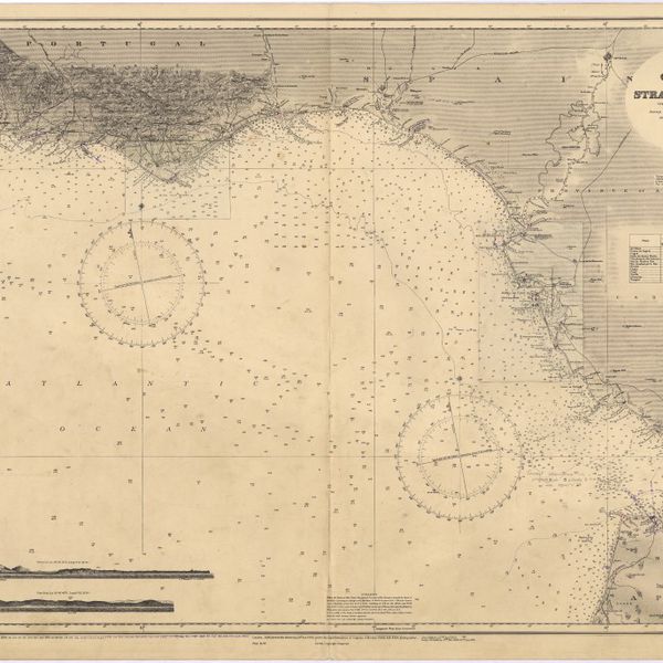
Strait of Gibraltar : from the spanish government charts of 1936 : with corrections to 1953
Cartografia
France : West Coast : Entrance to La Gironde : from the french government charts of 1887 : with additions and corrections to 1955
Cartografia
Mediterranean Sea : Egypt : approaches to Port Said ; Port Said
Cartografia
Mediterranean Sea : plans of the Coast of Libya : Rada and Porto di Tripoli : from the italian Gouvernment chart of 1930
Cartografia
Spain : South Coast : Pta. del Acebuche to Pta. de la Chullera including Gibraltar Bay : from the spanish government charts of 1872-1914
Cartografia
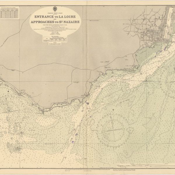
France West Coast : entrance to La Loire and approaches to St. Nazaire : from the French Government Charts of 1893 : with corrections to 1954
Cartografia
Mediterranean Sea : Algérie : C. Ferrat to C. Bougaroni : from the french government surveys of 1868-74 : the coast of Spain from spanish authorities
Cartografia
Mediterranean : Algérie : C. Ivi to Alger : from the french government charts of 1867-1870 : with additions and corrections to 1951
Cartografia
Mediterranean : Gibraltar : surveyed by Capt. R. M. Southern R. N. and officers of H. M. Surveying ship "Challenger" : 1947-1948
Cartografia
Bay of Biscay : from the latest information in the hydrographic Dept. to 1953
Cartografia
France West Coast : La Loire St. Nazaire to Nantes : from French Government Charts to 1948 : with corrections to 1948
Cartografia
France : West Coast : Pertuis d'Antioche with the approaches to La Rochelle and Rochefort : from the latest french government charts to 1950 : with additions and corrections to 1953
Cartografia
Mediterranean : Algeria : Ports d'Oran and Mers-el-Kébir : from the french government chart of 1876 : with corrections to 1953
Cartografia
Mediterranean : Africa : C. Tres Forcas to C. Ivi : surveyed by Captain E. Mouchez of the french Navy 1870-73
Cartografia
Cape St. Vincent to the Strait of Gibraltar : compiled from the latest government charts
Cartografia
Mediterranean : Israel : Bay of Acre ; Acre Anchorage ; Haifa Harbour
Cartografia
France West Coast Sheet V : Bourgneuf to I. de Groix : from the Pilote Francais with corrections from French Government Charts to 1949
Cartografia
Portugal : West Coast : entrance of the River Tagus with the Harbour of Lisbon (Lisboa) : compiled from various Portuguese Government surveys to 1879 : with corrections to 1945
Cartografia
France West Coast Sheet III : Pte. de la Coubre to les Sables d'Olonne : from the French Government Charts to 1940
Cartografia
Mediterranean Sea : Algeria : approaches to Alger : from the french government charts to 1932 : with corrections to 1950
Cartografia
France West Coast : Ile d'Ouessant to St. Nazaire : from the French Government Charts to 1939
Cartografia
Mediterranean Sea : Algeria : Port d'Alger : from the french government chart of 1911 : with corrections to 1938
Cartografia
Mediterranean Sea : Libya : Ras Ashdir to Sirte : from the italian Gouvernment charts of 1931-32
Cartografia
Mediterranean : Coast of Palestine : Tyre to El Arish
Cartografia
Spain : North Coast : Foz to Camariñas : from the spanish government charts of 1915 to 1920 : with additions and corrections to 1935
Cartografia
France : West Coast : La Gironde Royan to Bordeaux : from the french government chart of 1914 : with additions and corrections to 1954
Cartografia
France West Coast Sheet VI : I. de Groix to Raz de Sein : from the French Government Charts of 1828 : with corrections to 1933
Cartografia
Mediterranean : Algeria : Algiers to C. Bougaroni : surveyed by Captain E. Mouchez of the french Navy 1867-9 : with corrections from the french gouvernment charts 1925-1926
Cartografia
Mediterranean : Algeria : Tunis : C. Bougaroni to Fratelli Rocks including Galita Channel
Cartografia
Mediterranean Sea : Egypt : Damietta to El Arish
Cartografia
Mediterranean : Algeric : approaches to Bone : from french government chart 1889 : with corrections from the french government chart 1929
Cartografia
France West Coast Sheet IV : Les Sables d'Olonne to Bourgneuf : from the Pilote Francais with corrections from French Government Charts to 1924
Cartografia
Mediterranean Sea : Egypt : Alexandria to Port Saïd
Cartografia
West coasts of Spain and Portugal : Cabo Villanno to Oporto : from the spanish and portuguese government charts to 1916 : with corrections and additions to 1921
Cartografia
Portugal's Magnificent Roads now enable the travellers to make all excursions by car : Map of the international and other first-class roads connecting the principal tourist resorts, as ordered by the Commission of Tourism of the AUTOMOVEL CLUB DE PORTUGAL, Largo do Calhariz 29, Lisbon
Cartografia
France North Coast : Sheet VIII : Ushant to Plateau des Roches Douvres : from the pilote français 1823 : with additions and corrections to 1911
Cartografia
France-North West Coast : Sheet VII : Raz de Sein to Goulven including Brest and Ushant : from French Government Charts to 1919
Cartografia
Mediterranean Sea : Europe Gibraltar to Alicante : Africa Cape Spartel to Cape Ferrat : from spanish and french government charts to 1877
Cartografia
West coast of Spain and Portugal : Cape Finisterre to Cape St. Vincent : compiled from the latest information in the Hidrographic Office to 1881
Cartografia
Islands in the Atlantic Ocean : Azores or Western isles (portuguese) : Faeroe Isles : Madeira Isles.
Cartografia
Portugal
Cartografia
Portugal : Nº 4
Cartografia
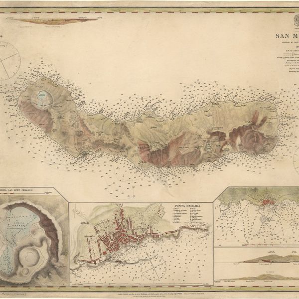
Azores : San Miguel
Cartografia
The islands of Madeira, Porto santo and Dezertas
Cartografia
Mediterranean : Tunis : Fratelli Rocks to Mahedia
Cartografia
Spain & Portugal
Cartografia
Portuguese Islands in the Atlantic Ocean
Cartografia
The Island of Madeira (Portuguese)
Cartografia
Island of Madeira
Cartografia
Map of the wine district of the Alto-Douro
Cartografia
Lisbon = Lisboa
Cartografia
Spain and Portugal
Cartografia
Spain and Portugal
Cartografia
Islands in the Atlantic
Cartografia
West Coast of Africa : Sheet II : Azamor to Sta. Cruz
Cartografia
West Coast of Africa : Sheet IV : Cape Bojador to Cape Blanco
Cartografia
West Coast of Africa : Sheet III : Sta. Cruz to Cape Bojador
Cartografia
West Coast of Africa : Sheet V : Cape Blanco to Cape Verde
Cartografia
Steel's new and correct chart of the coasts of Spain and Portugal : including plans at the principal harbours on an enlarged scale
Cartografia
West Coast of Africa : Sheet XVII : Cape Formosa to Fernando Po
Cartografia
West Coast of Africa : Sheet XI : Cape Palmas to Grand Lahou
Cartografia
West Coast of Africa : Sheet IX : Sherboro Island to Cape Mesurada
Cartografia
West Coast of Africa : Sheet XII : Grand Lahou to Cape Three Points
Cartografia
West Coast of Africa : Sheet XVIII : Fernando Po to Cape Lopez
Cartografia
West Coast of Africa : Sheet X : Cape Mesurada to Cape Palmas
Cartografia
West Coast of Africa : Sheet XIII : Cape Three Points to Barracoe
Cartografia
West Coast of Africa : Sheet XIV : Barracoe to Cape St. Paul
Cartografia
West Coast of Africa : Sheet I : Cape Spartel to Mazighan
Cartografia
A chart of the West Coast of Africa : Sheet VIII : the Isles de Los to Sherboro Island
Cartografia
The Delta of the River Kowara or Quorra, the ancient Niger
Cartografia
West Coast of Africa : Sheet VI : Cape Verde to Cape Roxo including the Gambia
Cartografia
West Coast of Africa : Sheet VII : from Cape Roxo to Isles de Los
Cartografia
Plan of the town and environs of Porto
Cartografia
Madrid
Cartografia
Africa : Sheet II : from the River Gambia to cape Lopez and Annabona including the Bight of Biafra
Cartografia
Portugal