Os cookies.
Este site utiliza cookies para lhe proporcionar uma melhor experiência de utilização.
OK, ACEITO
Sobre
Itens da coleção
Refinar a pesquisa
Coleções digitais
Biblioteca Geral
Mapas Nabais Conde
9
EU
1
Tipo
Cartografia
8
Gravuras e Desenhos
1
Autor
Gibson, John
3
Alagna, J. Giacomo
1
Cole, Benjamin
1
Parker, S.
1
Data
1758-1764
Local de publicação
Londres
Assunto
Portugal
4
Açores
2
Costa
2
Lisboa
2
Mapa
2
Ver mais
Idioma
Inglês
PT
EN
PT
EN
Biblioteca de Fundo Antigo da UC
Almamater
Em destaque
Todos os itens
Sobre
Nesta coleção
Pesquisa avançada
Refinar a pesquisa
Limpar
Coleções digitais
Biblioteca Geral
Mapas Nabais Conde
9
EU
1
Tipo
Cartografia
8
Gravuras e Desenhos
1
Autor
Gibson, John
3
Alagna, J. Giacomo
1
Cole, Benjamin
1
Parker, S.
1
Data
1758-1764
Local de publicação
Londres
Assunto
Portugal
4
Açores
2
Costa
2
Lisboa
2
Mapa
2
Ver mais
Idioma
Inglês
Itens
9
Ver como
Grelha
Lista
Galeria
Ordenar por
Data (de publicação)
Título
Título (descendente)
Data (descendente)
Limite por página
50
100
250
Cartografia
A Map of the River Tale to Lisbon Done from a New Survey
Cartografia
A chart of the sea coasts of Algrave [sic] and Andalusia between cape St. Vincent and the strait of Gibralter and c. Spartel
Gravuras e Desenhos
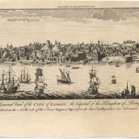
A general view of the city of Lisbon, the capital of the Kingdom of Portugal as it stood on the North side of the river Tagus or Tajo before the late earthquakes, on November 1.st & 8.th 1755
Cartografia
The theatre of war in Portugal with the distances of the fortified towns, from Lisbon
Cartografia
Portugal
Cartografia
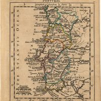
A map of the Kingdom of Portugal
Cartografia
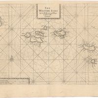
The Western Isles
Cartografia
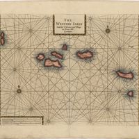
The Western Isles
Cartografia
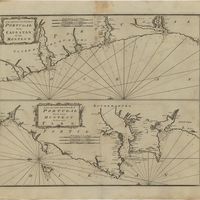
A new and correct chart of the coast of Portugal from Cape Stan to Cape Montego ; A new and correct chart of the coast of Portugal from Cape Montego to Pont de Faro