Os cookies.
Este site utiliza cookies para lhe proporcionar uma melhor experiência de utilização.
OK, ACEITO
Sobre
Itens da coleção
Refinar a pesquisa
Coleções digitais
Biblioteca Geral
154
Mapas Nabais Conde
148
Botânica
87
500 Anos da Biblioteca
4
História da Ciência
3
Ver mais
Tipo
Cartografia
140
Manuscrito
79
Livro Antigo
13
Gravuras e Desenhos
11
Livro Moderno
1
Ver mais
Autor
Thiselton-Dyer, William Turner
18
Walker, J. & C.
17
Stapf, Otto
15
Vidal, Alexander Thomas Emeric
11
Masters, Maxwell Tylden
10
Ver mais
Data
1926-1937
14
1914-1925
14
1797-1810
16
1764-1794
18
1732-1755
15
Ver mais
Local de publicação
Londres
Estrarburgo
3
Leiden
3
Viena
3
Kew
2
Ver mais
Assunto
Mapa
76
Plantas
56
Portugal
43
Classificação
28
Mar Mediterrâneo
28
Ver mais
Idioma
Inglês
181
Francês
33
Português
17
Latim
9
Italiano
1
PT
EN
PT
EN
Biblioteca de Fundo Antigo da UC
Almamater
Em destaque
Todos os itens
Sobre
Nesta coleção
Pesquisa avançada
Refinar a pesquisa
Limpar
Coleções digitais
Biblioteca Geral
154
Mapas Nabais Conde
148
Botânica
87
500 Anos da Biblioteca
4
História da Ciência
3
Ver mais
Tipo
Cartografia
140
Manuscrito
79
Livro Antigo
13
Gravuras e Desenhos
11
Livro Moderno
1
Ver mais
Autor
Thiselton-Dyer, William Turner
18
Walker, J. & C.
17
Stapf, Otto
15
Vidal, Alexander Thomas Emeric
11
Masters, Maxwell Tylden
10
Ver mais
Data
1926-1937
14
1914-1925
14
1797-1810
16
1764-1794
18
1732-1755
15
Ver mais
Local de publicação
Londres
Estrarburgo
3
Leiden
3
Viena
3
Kew
2
Ver mais
Assunto
Mapa
76
Plantas
56
Portugal
43
Classificação
28
Mar Mediterrâneo
28
Ver mais
Idioma
Inglês
181
Francês
33
Português
17
Latim
9
Italiano
1
Itens
245
Ver como
Galeria
Lista
Grelha
Ordenar por
Título (descendente)
Título
Data (de publicação)
Data (descendente)
Páginas
1
2
3
Limite por página
50
100
250
Cartografia
The Western Isles
Cartografia
The Western Isles
Cartografia
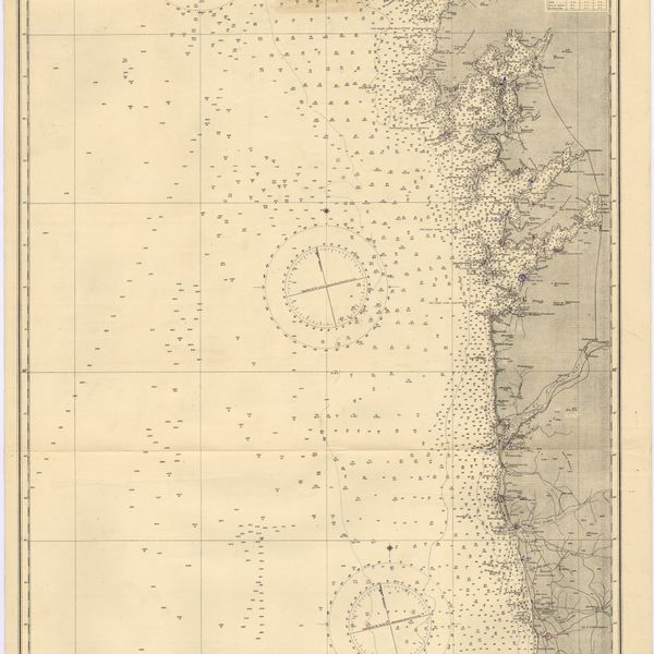
West coasts of Spain and Portugal : Cabo Villanno to Oporto : from the spanish and portuguese government charts to 1916 : with corrections and additions to 1921
Cartografia
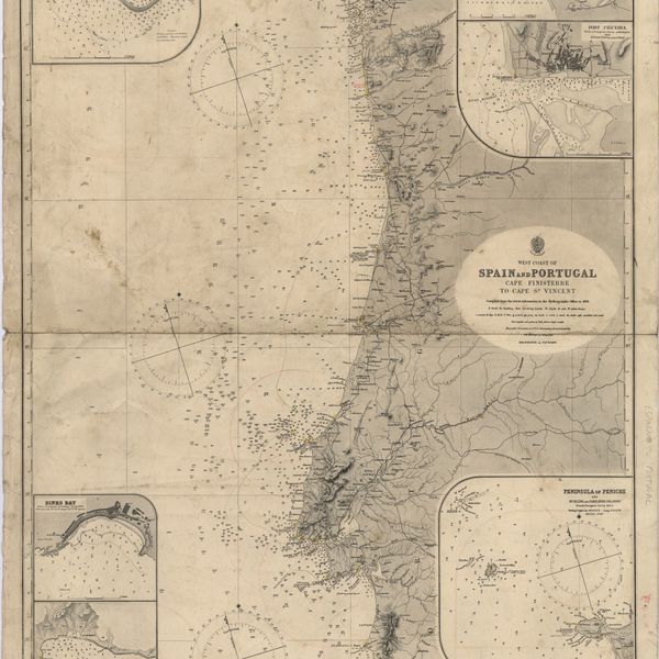
West coast of Spain and Portugal : Cape Finisterre to Cape St. Vincent : compiled from the latest information in the Hidrographic Office to 1881
Cartografia
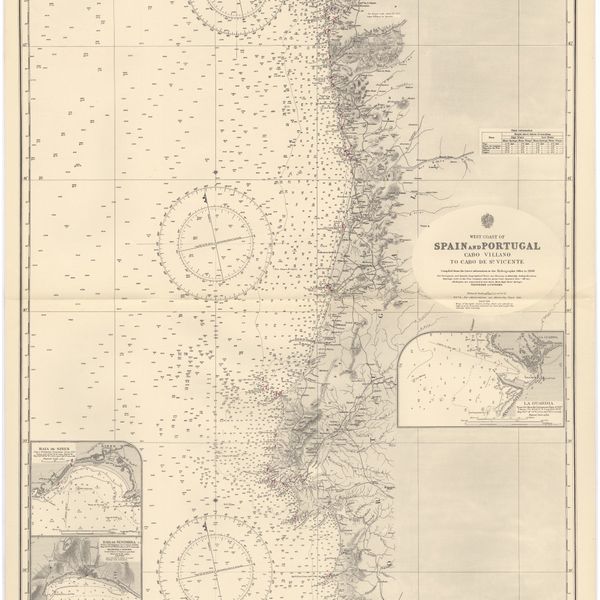
West coast of Spain and Portugal : Cabo Villano to Cabo de S.º Vicente : compiled from the latest information in the Hidrographic Office to 1958
Cartografia
West Coast of Africa : Sheet XVIII : Fernando Po to Cape Lopez
Cartografia
The West Coast of Africa : Sheet XVII from Banda Point to St. Paul de Loanda including the Congo
Cartografia
West Coast of Africa : Sheet XVII : Cape Formosa to Fernando Po
Cartografia
West Coast of Africa : Sheet XIV : Barracoe to Cape St. Paul
Cartografia
West Coast of Africa : Sheet XII : Grand Lahou to Cape Three Points
Cartografia
West Coast of Africa : Sheet XI : Cape Palmas to Grand Lahou
Cartografia
West Coast of Africa : Sheet VII : from Cape Roxo to Isles de Los
Cartografia
West Coast of Africa : Sheet VI : Cape Verde to Cape Roxo including the Gambia
Cartografia
West Coast of Africa : Sheet IX : Sherboro Island to Cape Mesurada
Gravuras e Desenhos
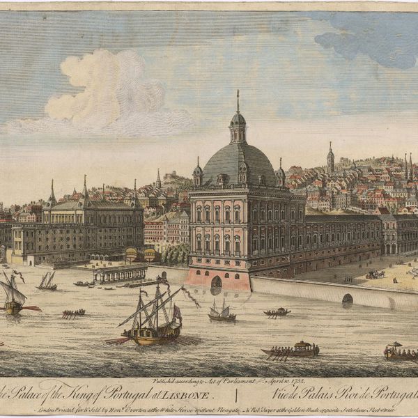
A view of the Palace of the King of Portugal at Lisbone = Vüe de Palais Roi de Portugale à Lisbon
Cartografia
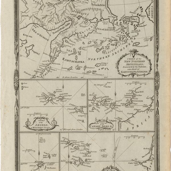
Various charts of islands &c., in the Atlantic & Pacific Oceans
Cartografia
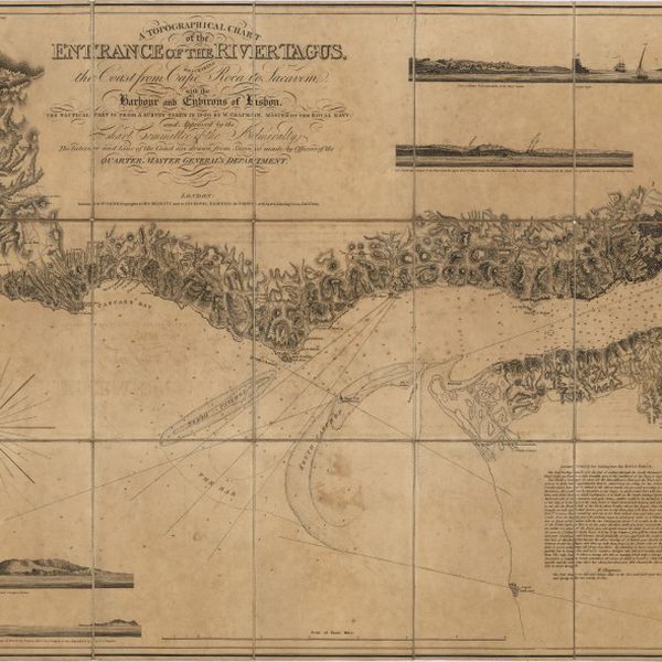
A topographical chart of the entrance of the river Tagus, describing the coast from Cape Roca to Sacavem ; with the harbour and environs of Lisbon. The nautical part is from a survey taken in 1806 by W. Chapman, Master of the Royal Navy; and approved by the Chart Committee of the Admiralty. The interior and line of the coast are drawn from survays made by officers of the Quarter Master General's Department
Cartografia
The theatre of war in Portugal with the distances of the fortified towns, from Lisbon
Livro Antigo
Taboadas de reduçam com amplas explicaçoens na lingoa portugueza, para facilmente conhecer a diferença de latitude e apartamento que se ganha em qualquer derrota, e para resolver outros muitos problemas dos mais necessarios na prática da navegaçam
Cartografia
Strait of Gibraltar : from the spanish government charts of 1936 : with corrections to 1953
Cartografia
Steel's new and correct chart of the coasts of Spain and Portugal : including plans at the principal harbours on an enlarged scale
Cartografia
Spaine newly described with many adictions, both in the attires of the people & the setuations of their cheifest cityes
Cartografia
Spain and Portugal. A map of the mouth of the River Tagus or harbour of the city of Lisbon
Cartografia
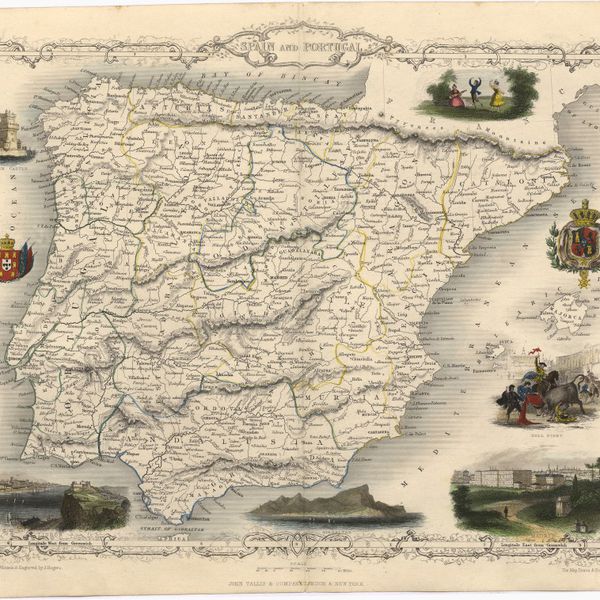
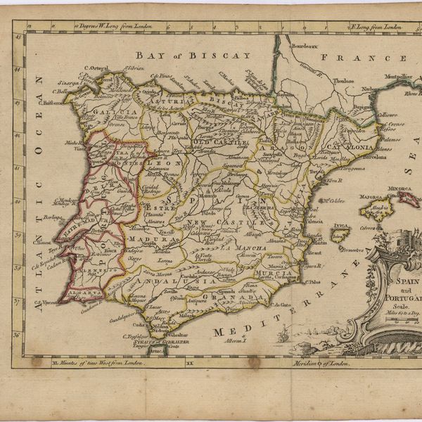
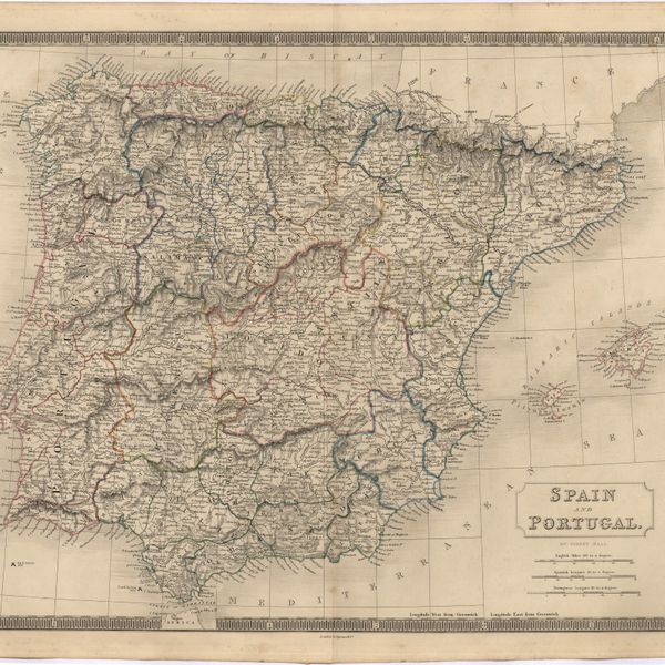
Spain and Portugal
Cartografia
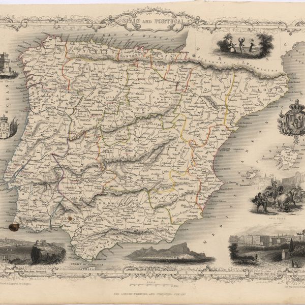
Spain and Portugal
Cartografia
Spain and Portugal
Cartografia
Spain and Portugal
Cartografia
Spain and Portugal
Cartografia
Spain and Portugal
Cartografia
Spain : West Coast : Ria de Vigo : from the spanish government chart of 1912
Cartografia
Spain : South Coast : Pta. del Acebuche to Pta. de la Chullera including Gibraltar Bay : from the spanish government charts of 1872-1914
Cartografia
Spain : North Coast : Foz to Camariñas : from the spanish government charts of 1915 to 1920 : with additions and corrections to 1935
Cartografia
Spain & Portugal
Gravuras e Desenhos
Se Velha, or old Cathedral : Coimbra
Gravuras e Desenhos
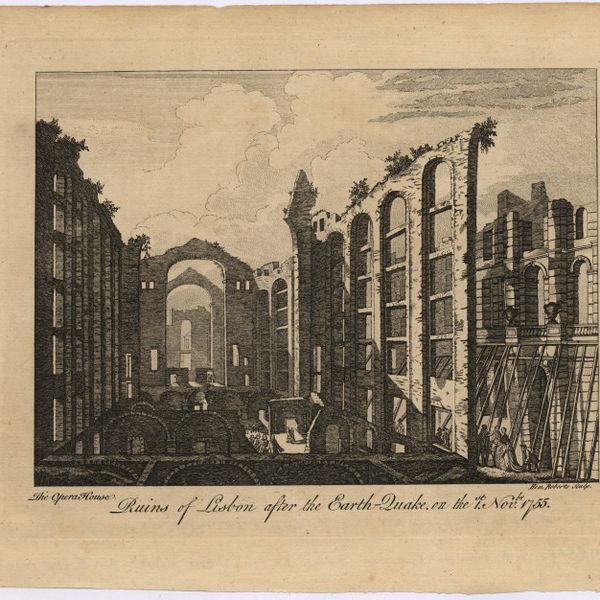
Ruins of Lisbon after the Earth-Quake on the 1st. Nov.br 1755 : The Opera House
Cartografia
Portuguese Islands in the Atlantic Ocean
Cartografia
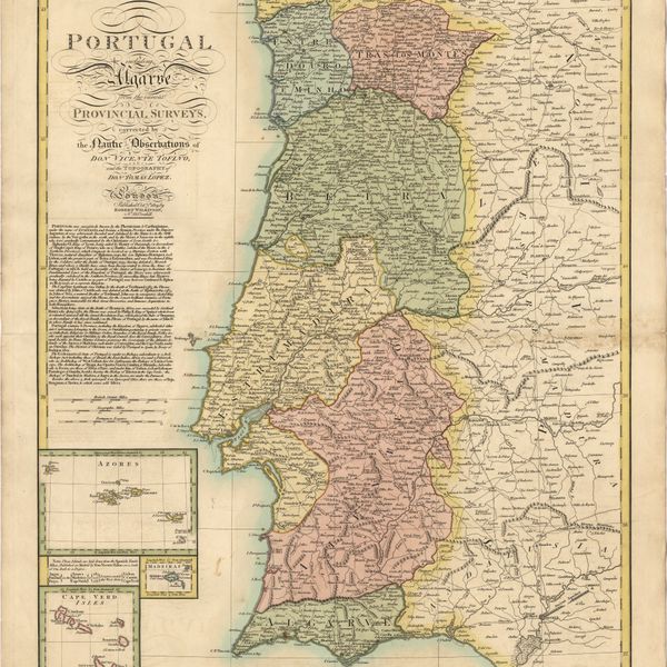
Portugal including Algarve
Cartografia
Portugal : West Coast : entrance of the River Tagus with the Harbour of Lisbon (Lisboa) : compiled from various Portuguese Government surveys to 1879 : with corrections to 1945
Cartografia
Portugal : Nº 4
Cartografia
Portugal : Berlenga to Cabo Espichel including the approaches to Rio Tejo : compiled from portuguese government charts to 1935 : with additions and corrections to 1956
Cartografia
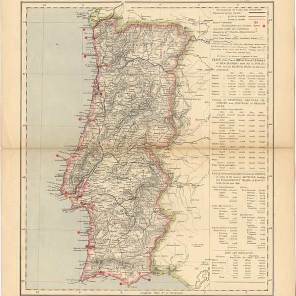
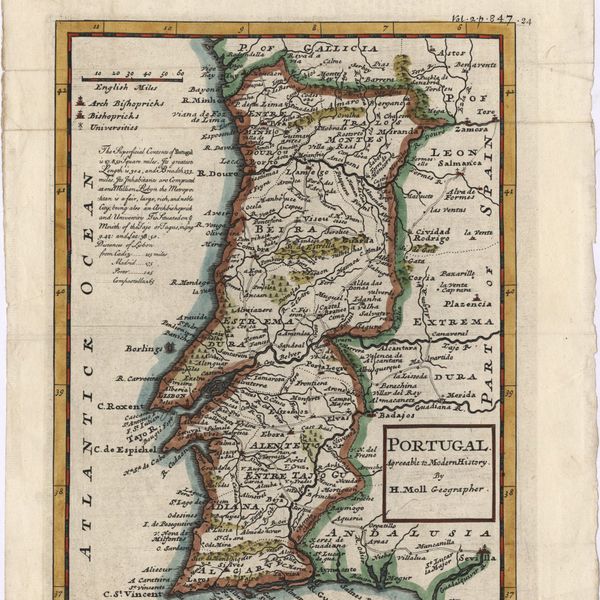
Portugal : agreeable to modern history
Cartografia
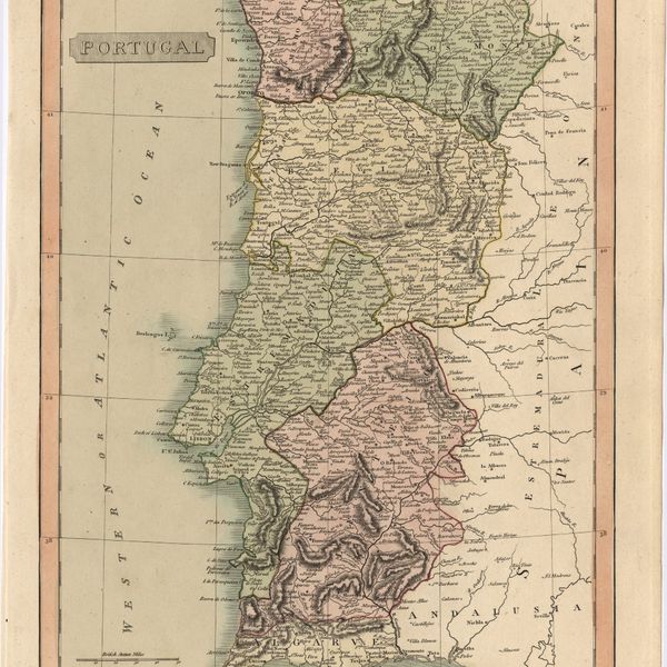
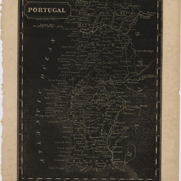
Portugal
Cartografia
Portugal
Cartografia
Portugal
Cartografia
Portugal
Cartografia
Portugal
Cartografia
Portugal
Cartografia
Portsmouth to Canary Islands (Islas Canarias) and the Azores (Açôres) : compiled from the latest information in the hydrographic Department, 1954
Cartografia
Plan of the town and environs of Porto
Cartografia
A plan of the city of Lisbon with the Harbour, Forts, Depth of Water and Country adjacent : for the Lond. Mag.
Cartografia
Physical Map of the Island of Madeira
Cartografia
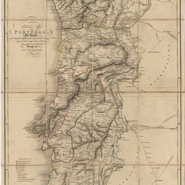
A new military map of Portugal : the roads from the Carta militar published by the french in Lisbon, the rivers and montains, from the best authorities
Cartografia
A new military map of Portugal : the roads from the Carta Militar published by the french in Lisbon : the rivers and mountains from the last Authorities
Cartografia
A new military map of Portugal : the roads from the Carta Militar published by the french in Lisbon : the rivers and mountains from the last Authorities
Cartografia
A new map of the kingdoms of Spain and Portugal with their principals divisions.
Cartografia
A new map of the Kingdom of Portugal divided into its provinces
Cartografia
A new map of Spain and Portugal : exhibiting the chains of mountains with their passes, the principal & cross roads, with other details requisite for the intelligence of Military Operations
Cartografia
A new map of Spain and Portugal : exhibiting the chains of mountains with their passes, the principal & cross roads, with other details requisite for the intelligence of Military Operations
Cartografia
A new map of present Spain & Portugal : shewing their principal divisions, cheif cities, townes, rivers, mountains & c. : Dedicated to His Highness William Duke of Gloucester
Cartografia
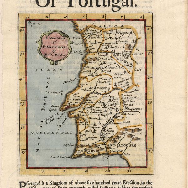
A new map of Portugal
Cartografia
A new map of Iberia Europaea alias Celtiberia, or Ancient Spain : shewing its principal divisions, cheif cities, townes, rivers, mountains & c[?]. Dedicated to His Highness William Duke of Gloucester
Cartografia
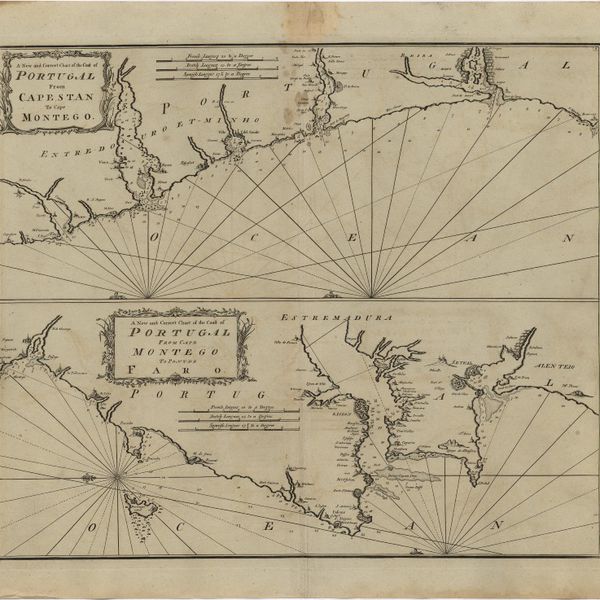
A new and correct chart of the coast of Portugal from Cape Stan to Cape Montego ; A new and correct chart of the coast of Portugal from Cape Montego to Pont de Faro
Cartografia
A new and accurate map of Spain and Portugal : drawn from the best Authorities
Cartografia
A new and accurate map of Portugal : composed from the latest improvem.ts and adjusted by the most authentic astron. observats.
Livro Antigo
The mourning bride : a tragedy
Cartografia
A Military sketch of the country between Lisbon and Vimiero occupied by the British Army under the command of Lieutenant General Viscount Wellington
Livro Antigo
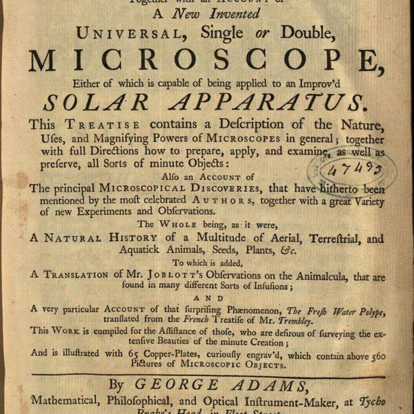
Micrographia illustrata, or, The knowledge of the microscope explain'd together with an account of a New Invented Universal, single or double, Microscope, either of which is capable of being applied to an Improv'd Solar Apparatus. This Treatise contains a Description of the Nature, Uses, and Magnifysing Powers of Microscopes in general; together with full Directions how to prepare, apply, and examine, as well as preserve, all Sorts of minute Objects also an account of The principal Microcopical Discoveries, that have hirherto been mentioned by the most celebrated Authors, togeher with a great Variety of new Experiments and Observations. The whole being, as it were, A Natural History of a Multitude of Aerial, Terrestrial, and Aquatick Animals, Seeds, Plants, Etc. To which is added, A Translation of Mr. Joblott's Observations on the Animalcula, that are found in many different Sorts of Infusions and a very particular Account of the surprising Phaenomenon, The Fresh Water Polype, translated from the French Treatise of Mr. Trembley. This Work is compiled for the Assistance of those, who are desirous of surveyng the extensive Beauties of the minute Creation and is illustreted with 65 Copper-plates, curiously engrav'd, wich contain above 560 Pictures of Microscopic Objets
Cartografia
Mediterranean Sea : Tunisia : East Coast : Kélibia to Tripoli : principally from french and italian Gouvernment charts to 1954
Cartografia
Mediterranean Sea : Tunisia : East Coast : approaches to Sfax : from the french Gouvernment charts to 1952 : with corrections to 1953
Cartografia
Mediterranean Sea : plans of the Coast of Libya : Rada and Porto di Tripoli : from the italian Gouvernment chart of 1930
Cartografia
Mediterranean Sea : Marocco : Bahia de Ceuta : from the Spanish Gouvernment Chart of 1926 : with corrections to 1956
Cartografia
Mediterranean Sea : Libya : Ras Ashdir to Sirte : from the italian Gouvernment charts of 1931-32
Cartografia
Mediterranean Sea : Europe Gibraltar to Alicante : Africa Cape Spartel to Cape Ferrat : from spanish and french government charts to 1877
Cartografia
Mediterranean Sea : Egypt : Damietta to El Arish
Cartografia
Mediterranean Sea : Egypt : approaches to Port Said ; Port Said
Cartografia
Mediterranean Sea : Egypt : Alexandria to Port Saïd
Cartografia
Mediterranean Sea : Egypt : Alexandria Harbour
Cartografia
Mediterranean Sea : Algeria : Port d'Alger : from the french government chart of 1911 : with corrections to 1938
Cartografia
Mediterranean Sea : Algeria : approaches to Alger : from the french government charts to 1932 : with corrections to 1950
Cartografia
Mediterranean Sea : Algérie : C. Ferrat to C. Bougaroni : from the french government surveys of 1868-74 : the coast of Spain from spanish authorities
Cartografia
Mediterranean : Tunisia : North Coast : Lac de Bizerte and Entrance : from french government charts to 1948 : with corrections to 1957
Cartografia
Mediterranean : Tunisia : Baie de Tunis : from the french Gouvernment charts of 1893 : with corrections to 1953
Cartografia
Mediterranean : Tunis : Fratelli Rocks to Mahedia
Cartografia
Mediterranean : Libya : Porto di Tripoli
Cartografia
Mediterranean : Israel : Bay of Acre ; Acre Anchorage ; Haifa Harbour
Cartografia
Mediterranean : Gibraltar : surveyed by Capt. R. M. Southern R. N. and officers of H. M. Surveying ship "Challenger" : 1947-1948
Cartografia
Mediterranean : Coast of Palestine : Tyre to El Arish
Cartografia
Mediterranean : Algérie : C. Ivi to Alger : from the french government charts of 1867-1870 : with additions and corrections to 1951
Cartografia
Mediterranean : Algeric : approaches to Bone : from french government chart 1889 : with corrections from the french government chart 1929
Cartografia
Mediterranean : Algeria : Tunis : C. Bougaroni to Fratelli Rocks including Galita Channel
Cartografia
Mediterranean : Algeria : Ports d'Oran and Mers-el-Kébir : from the french government chart of 1876 : with corrections to 1953
Cartografia
Mediterranean : Algeria : Algiers to C. Bougaroni : surveyed by Captain E. Mouchez of the french Navy 1867-9 : with corrections from the french gouvernment charts 1925-1926
Cartografia
Mediterranean : Africa : C. Tres Forcas to C. Ivi : surveyed by Captain E. Mouchez of the french Navy 1870-73
Cartografia
Mappa ou carta geographica dos reinos de Portugal e Algarve
Cartografia
Mappa ou carta geographica dos reinos de Portugal e Algarve
Cartografia
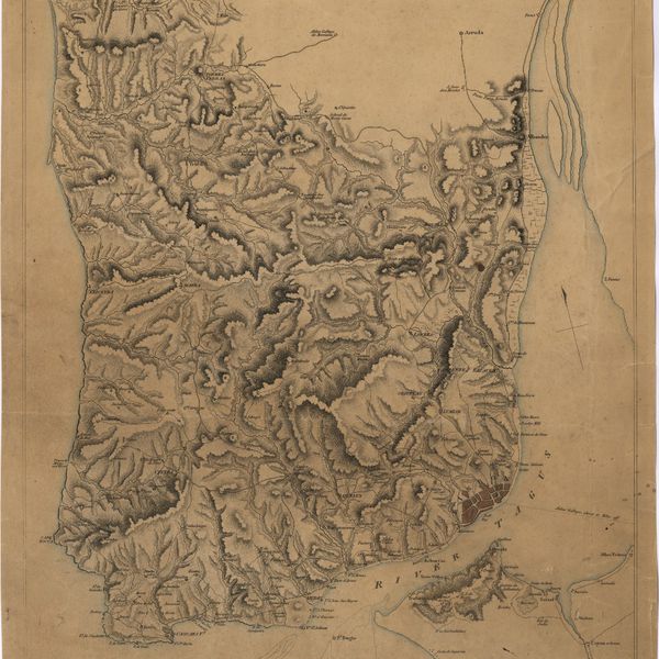
Map of the wine district of the Alto-Douro
Cartografia
A Map of the River Tale to Lisbon Done from a New Survey
Cartografia
A map of the Kingdom of Portugal
Cartografia
Map of South America : For the Ver. Dr. Robertson's History of America
Cartografia
Map of Portugal