
Biblioteca Geral Digital
Coleção digital
Biblioteca Geral Digital
Nesta coleção

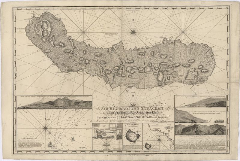
Chart of the Island of St. Michael
Chart of the Island of St. Michael
Sobre o item
- Autor
- Read, W. Harding (cartógrafo)
- Stephenson, John, fl. 1786-1800 (gravador)
- Publicação
- London : Published as the Act Directs by William Heather, 1808
- Descrição Material
- 1 mapa : p&b ; 63x92 cm
- Assunto
- Ilha de São Miguel -- mapa -- 1808
- Classificação
- CDU: 912 (469.9) "18"
- Registo SIIB/UC
- http://webopac.sib.uc.pt/record=b2723243~S74*por
- Cota
- NC-1435
- Dados Geográficos
- [ca. 1:75 000]
- Acesso
- open access
- Formato electrónico
- Imagem
- Creative Commons
- https://creativecommons.org/licenses/by/4.0
- Coleção Digital
- Biblioteca Geral Digital
- Mapas Nabais Conde
- Data de publicação ou produção
- 1808
- Local de publicação
- Londres
- Localização
- ucbg
- Idioma
- Inglês
- Tipo
- Cartografia
- Notas
- A margem inferior contém insertos os seguintes mapas: "A View of the City of Ponta Delgada taken from the Anchorage, sbewing and Marks, as survyed June 10 th. 1806" - Escala ca 1:11000, determinada com o valor calculado 3,40 cm correspondente a "200 Fathoms" ingleses . - "The Mole e Castle of St. Braz" - Escala ca 1:3200, determinada com o valor calculado 2,90 cm correspondente a "50 Fathoms" ingleses . - "Plan of the Bason" - Escala ca 1:4700, determinada com o valor calculado 3,90 cm correspondente a "100 English Fathoms" . - "A Survey of Villa Franca with the adjacent Island" - Escala ca 1:9900, determinada com o valor calculado 1,85 cm correspondente a "100 Fathoms" ingleses.
